
Collected from the R.H. Brown
The principal objective of the PACS TEPPS cruise was to understand the physical reasons behind the differences in the pattern of precipitation over the tropical eastern Pacific ITCZ derived from satellite IR versus microwave data. Since both IR and microwave brightness temperatures are directly related to the vertical structure of precipitation and only indirectly related to rainfall, the project's focus was on observation of the three-dimensional structure of reflectivity and Doppler velocity in order to address simultaneously the vertical distribution of hydrometeors and the surface rainfall. In addition, the three-dimensional radar data provides contextual information which aids in subsetting the surface, upper air sounding, and and vertically pointing data into periods which are representative of synoptic conditions versus periods that are influenced by local convection. Within the time periods influenced by local convection, the radar data permits further subdivision of the ship-based data into storm inflow versus storm outflow subsets.
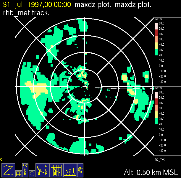
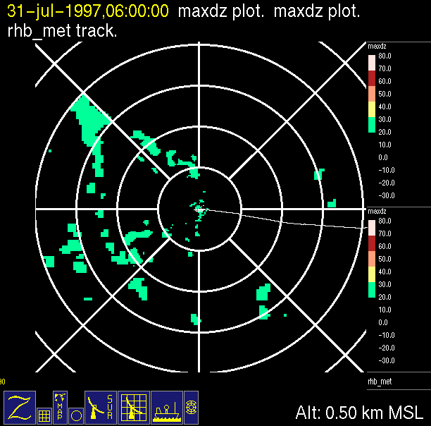
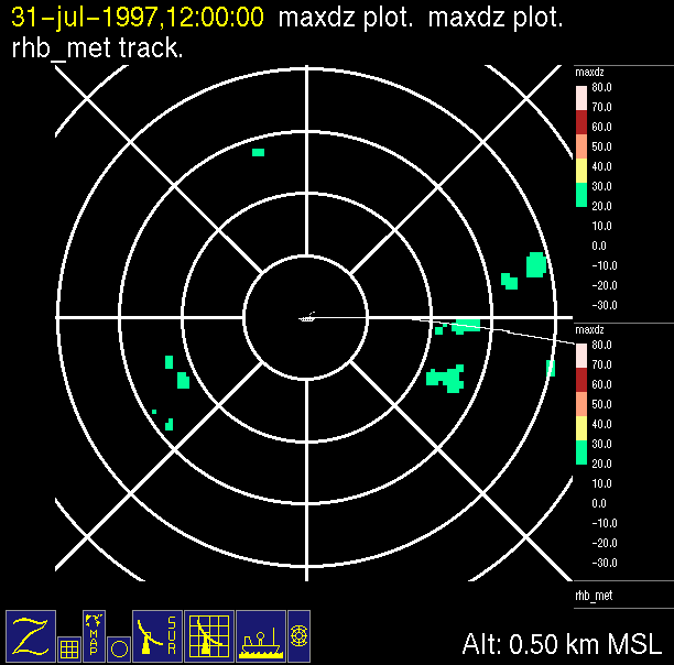
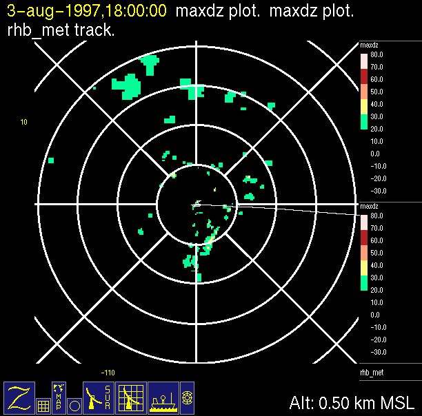
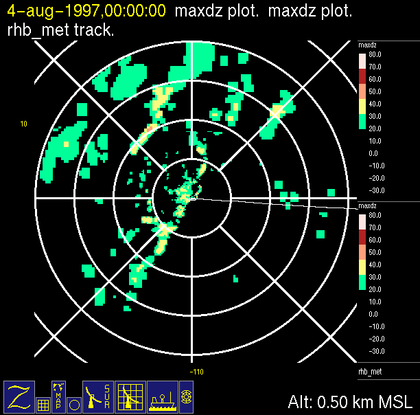
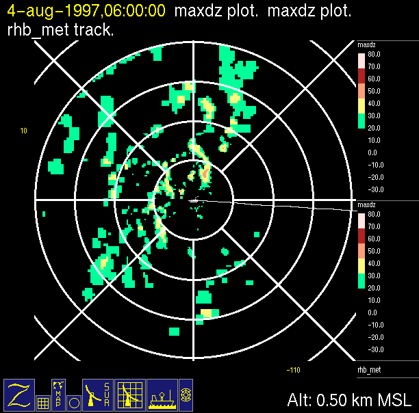
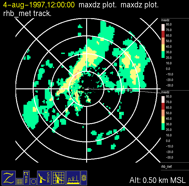
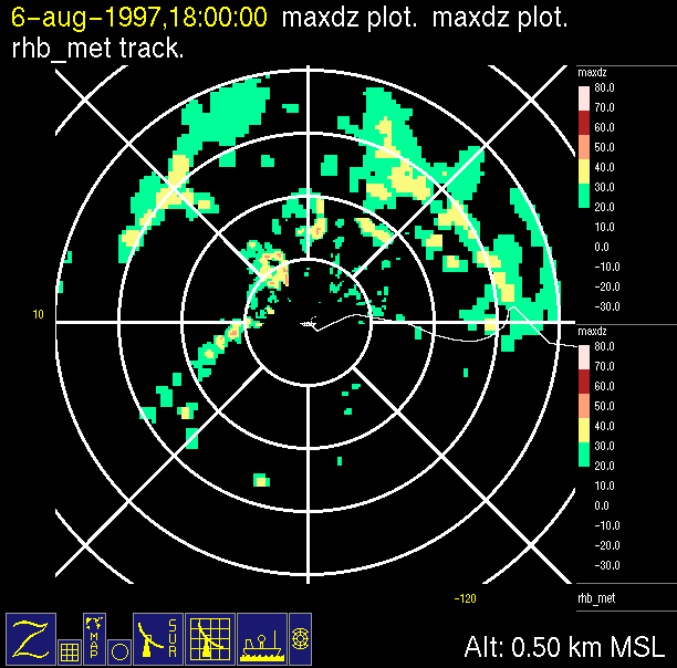
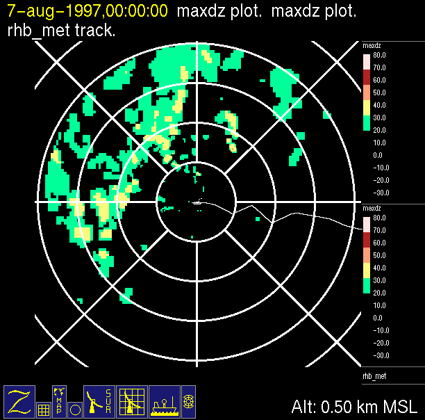
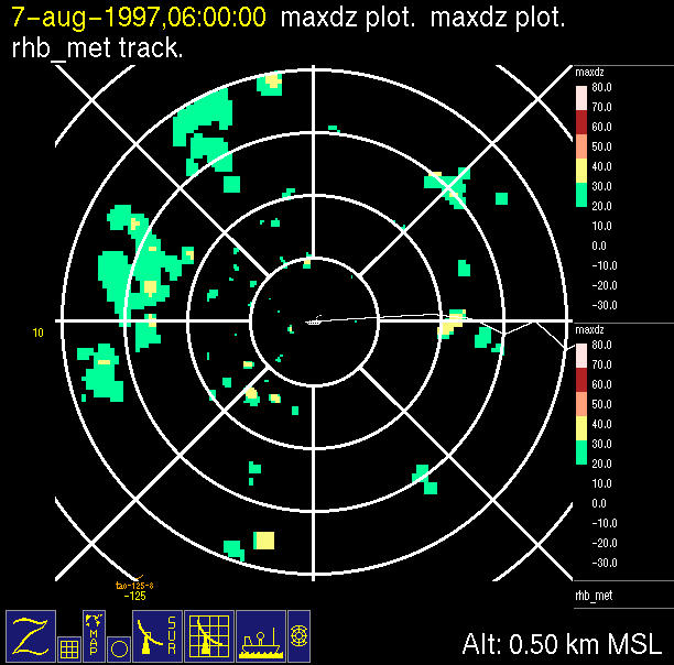
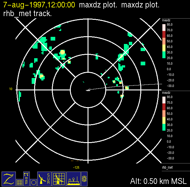
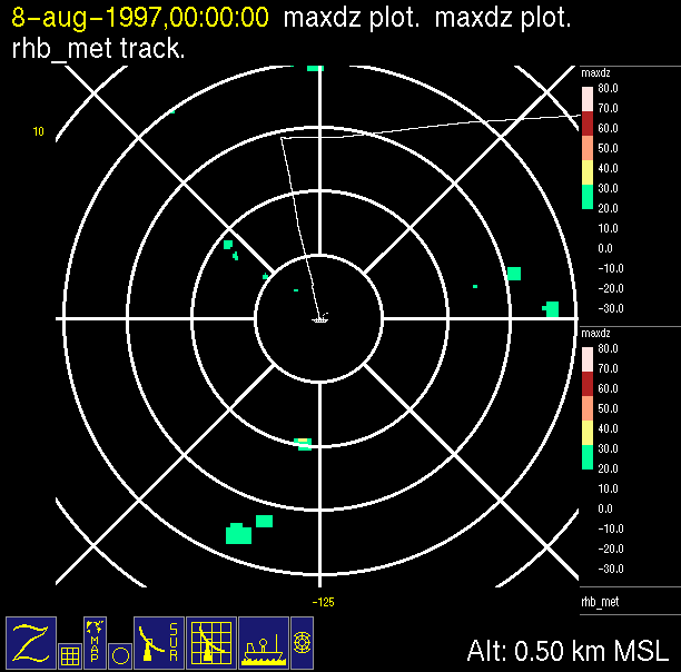
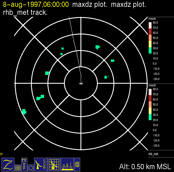
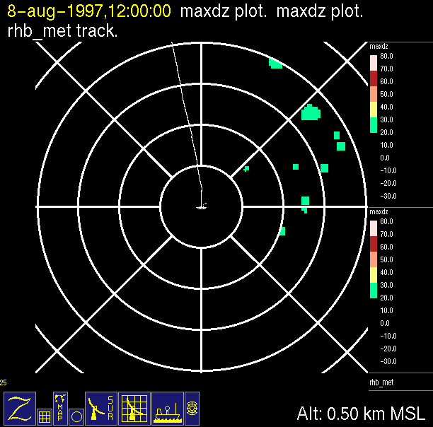
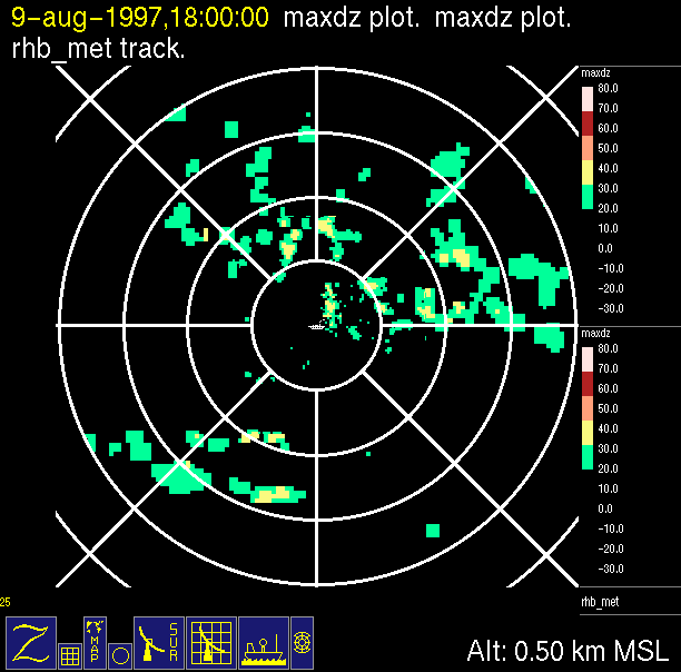
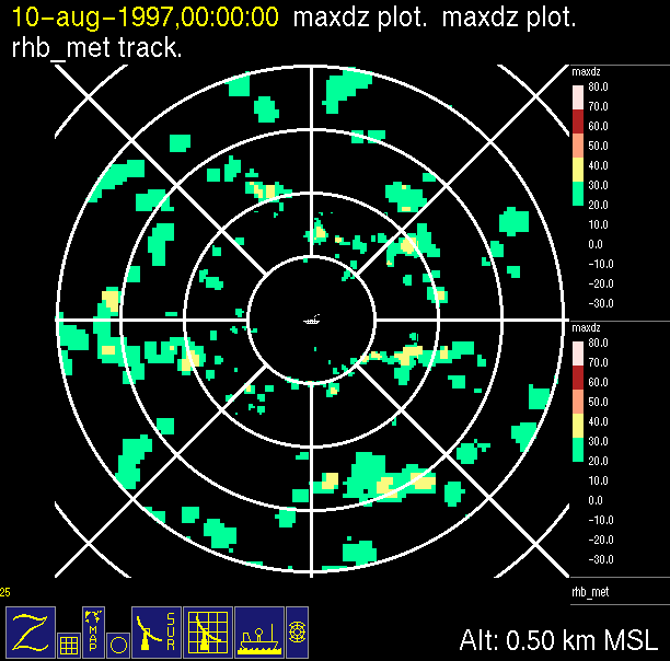
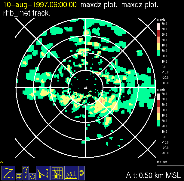
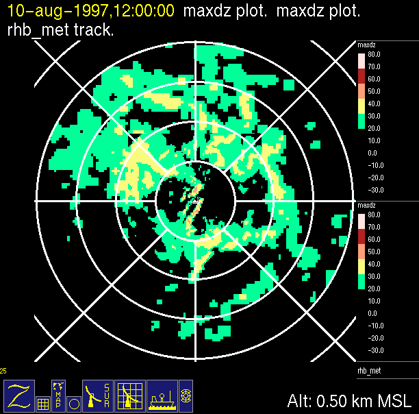
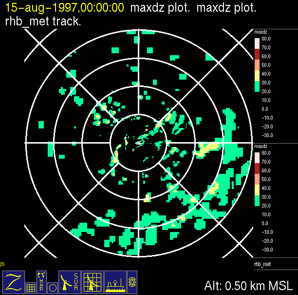
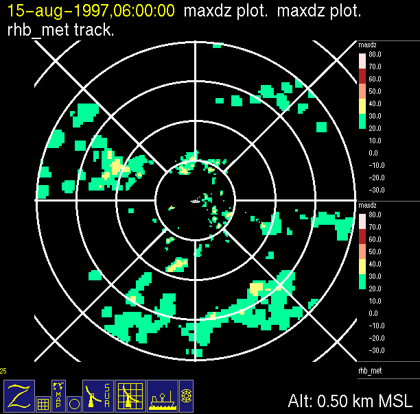
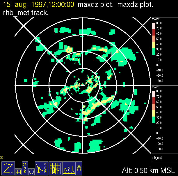
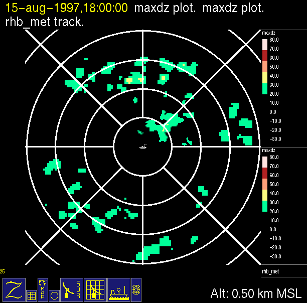
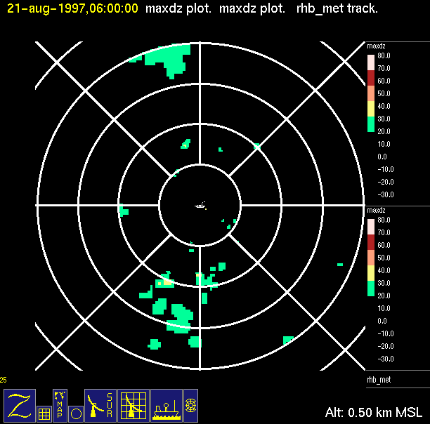
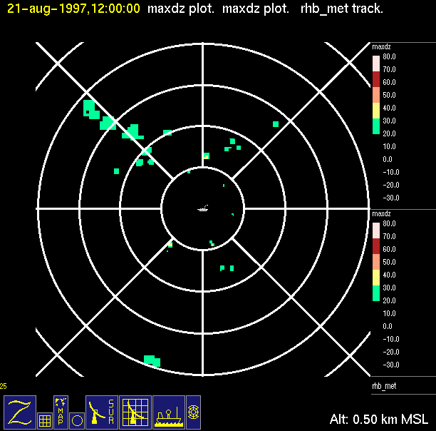
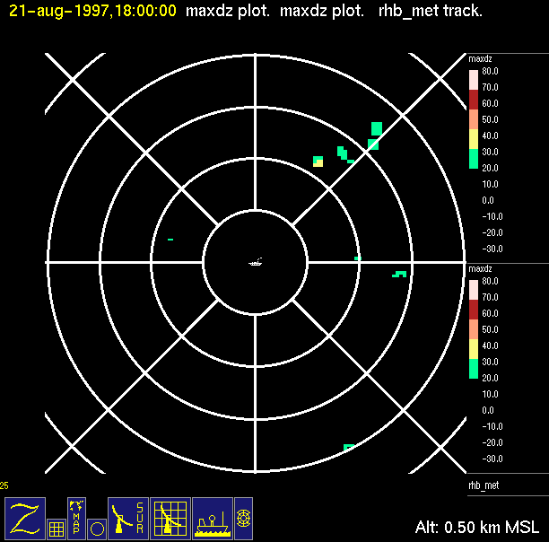
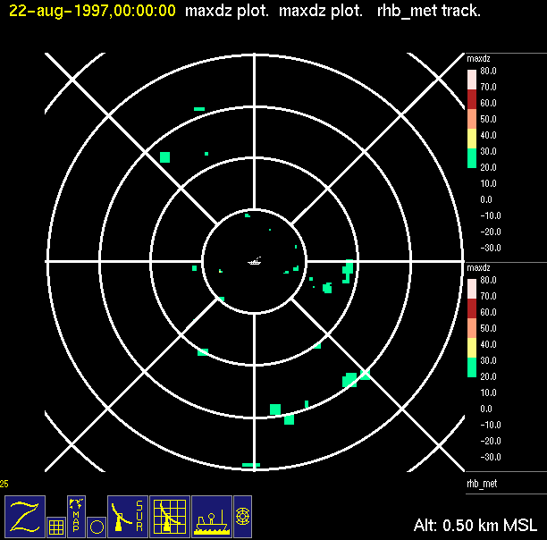
The ITCZ radar scan strategy had two main components: surveillance of the larger scale region within 240 km of the ship and collection of high resoution three-dimensional volume data within 100 km. Two three-dimensional volume scans and one surveillance scan were repeated every 15 minutes. This type of scan was used for the duration of the cruise while operating in or near the ITCZ.
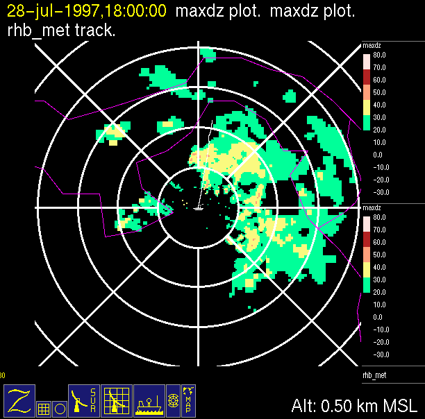
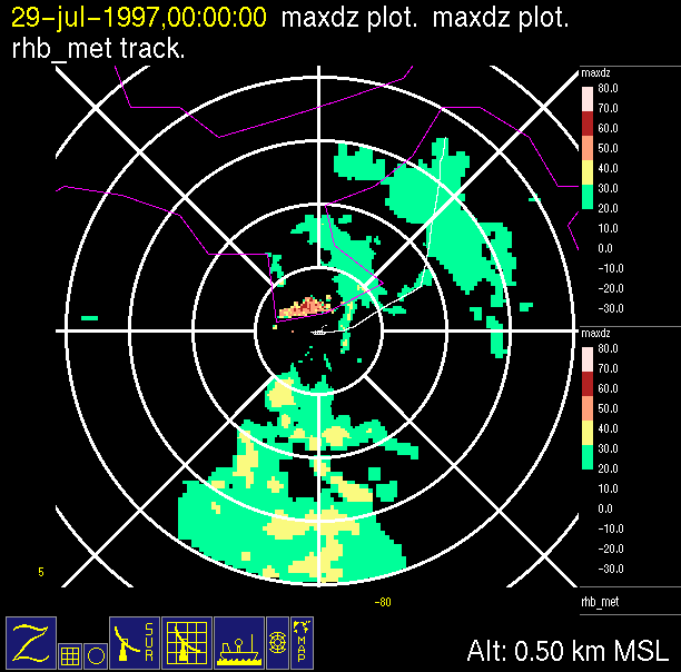
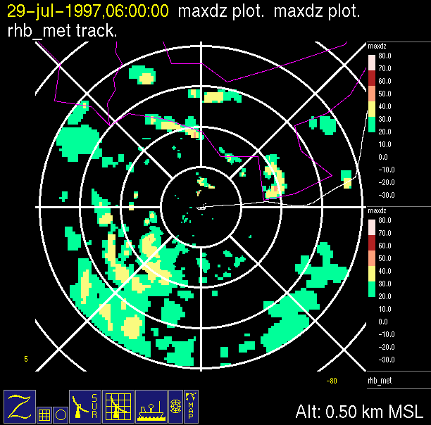
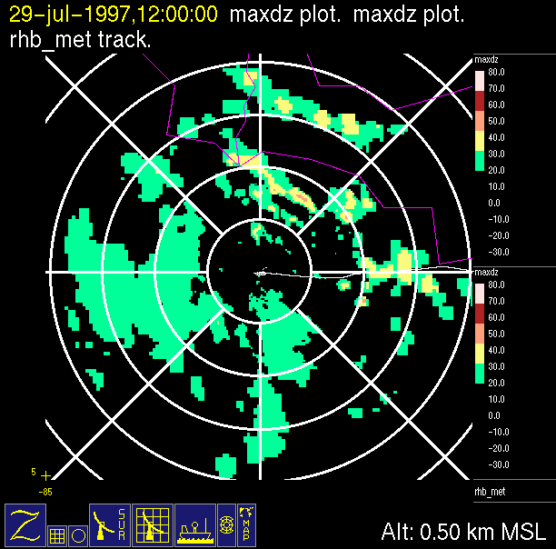
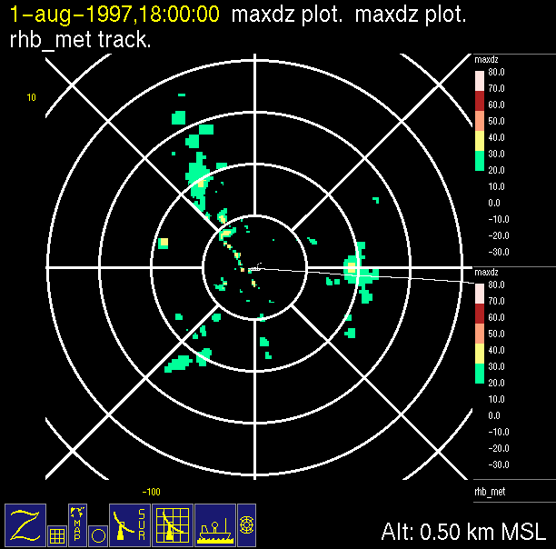
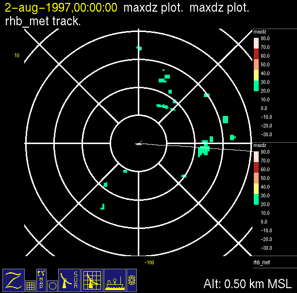
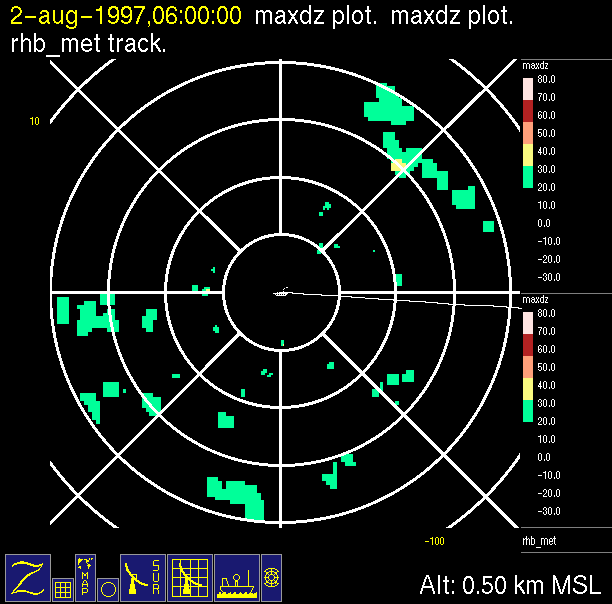
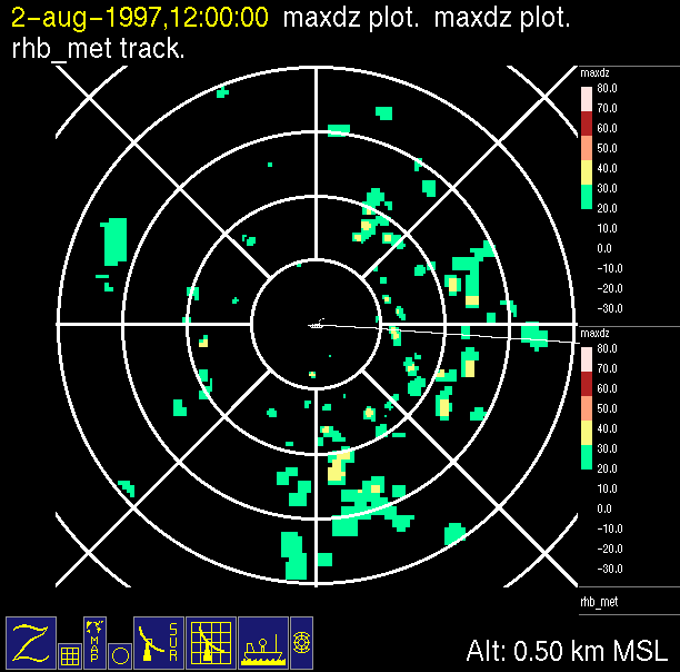
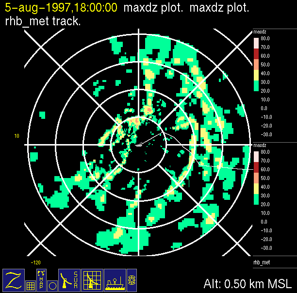
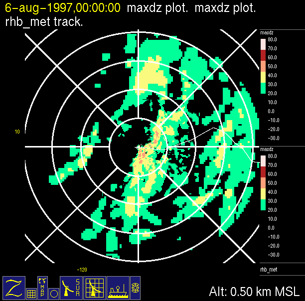
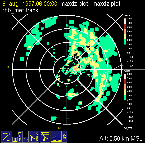
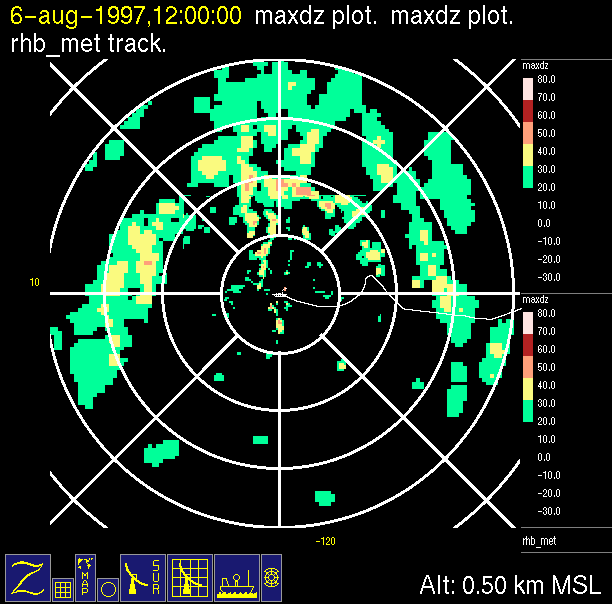
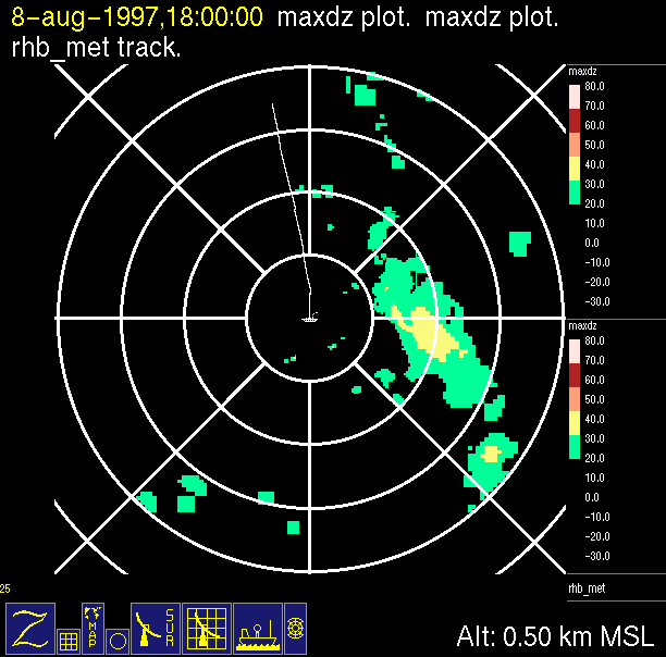
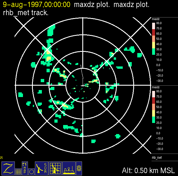
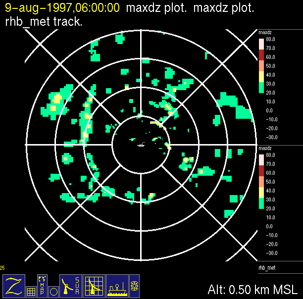
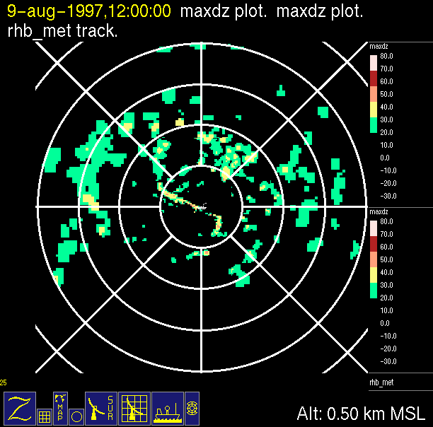
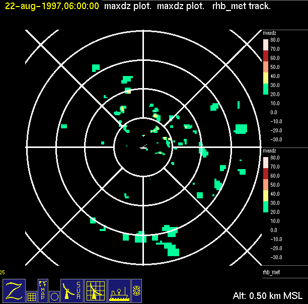
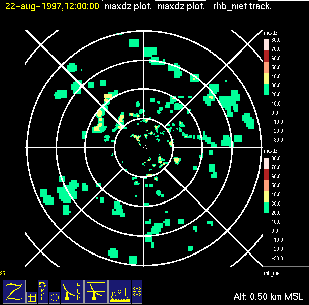
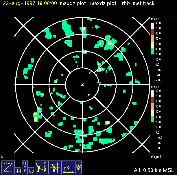
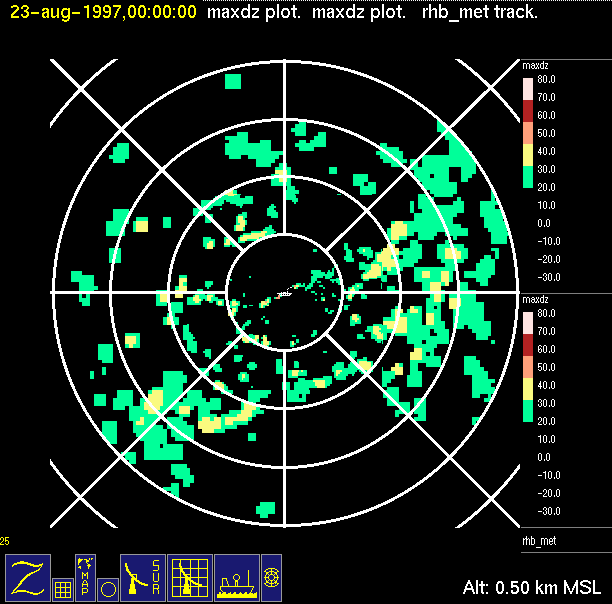
The hourly browse images contain four windows:
-Large scale context (top left) contains IR data when available and
radar reflectivity data color-coded in 10 dB increments.
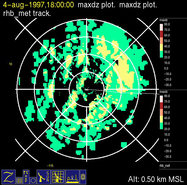
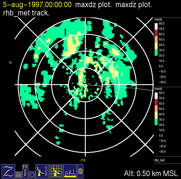
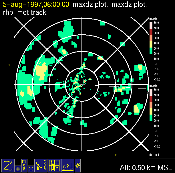
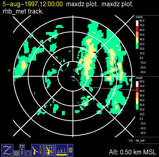
-Close up of radar data (bottom left) contains low level horizontal
cross-section of radar reflectivity color-coded in X dB
increments. Red line with small ship on end indicates ship
track. White line indicates where vertical cross-section is taken.
-Vertical cross-section of reflectivity (top right) showing vertical
structure of radar echo.
-Vertical cross-section of radial velocity (bottom right) showing
vertical structure of radial wind pattern within radar echo.

INSTRUCTIONS FOR USE:
1.To access ANIMATED LOOPS of reduced-size radar images for a particular day, click on the date and a separate window will be opened and begin loading the loop. *Note that each day may take up to ten minutes to load (dependent on workstation).
2.To access full-size INDIVIDUAL HOURLY IMAGES for a particular date; follow the link to a calendar of ITCZ days.
| Panama Canal to ITCZ: July 28, 1997 | |||
 |
|||
| 0000 UTC, no data | 0600 UTC, no data | 1200 UTC, no data | 1800 UTC, 7.55N 79.68W | Panama Canal to ITCZ: July 29, 1997 |
 |
 |
 |
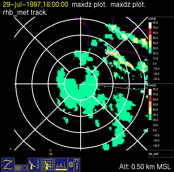 |
| 0000 UTC, 7.08N 80.55W | 0600 UTC, 7.03N 81.78W | 1200 UTC, 7.07N 82.78W | 1800 UTC, 7.20N 84.00W | Panama Canal to ITCZ: July 30, 1997 |
 |
 |
 |
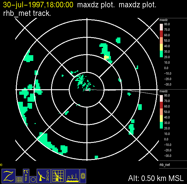 |
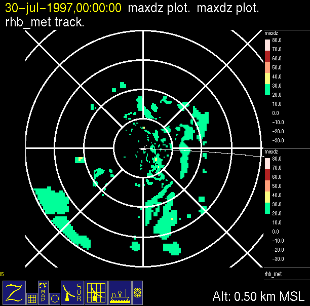
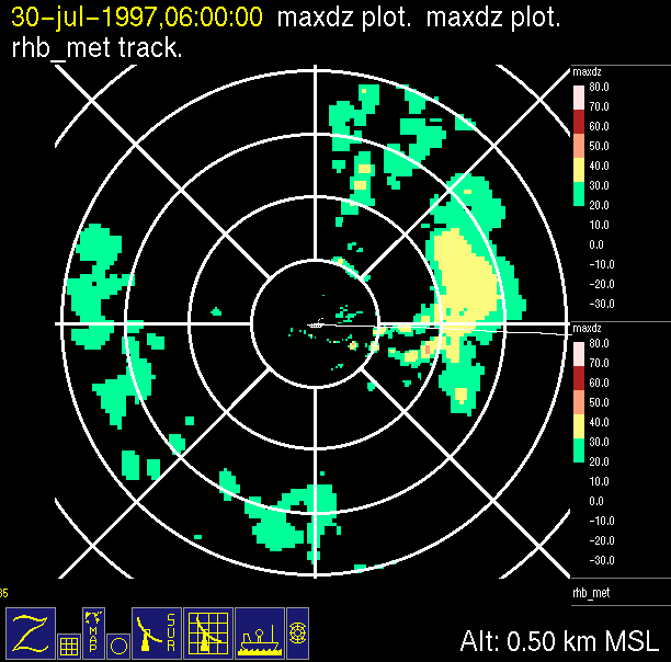
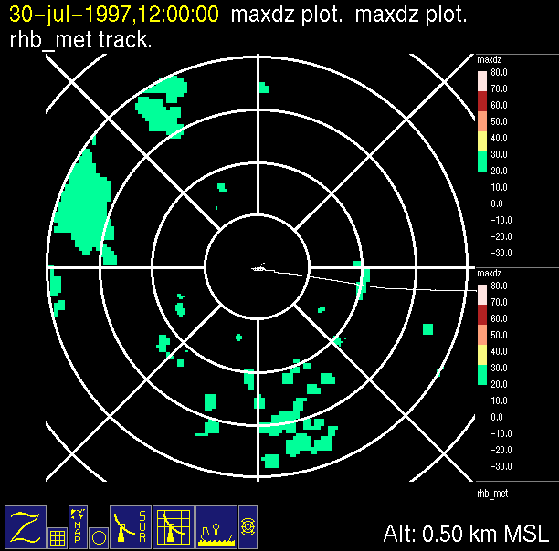
| 0000 UTC, 7.27N 85.25W | 0600 UTC, 7.30N 86.47W | 1200 UTC, 7.50N 87.67W | 1800 UTC, 7.48N 88.85W | Panama Canal to ITCZ: July 31, 1997 |
 |
 |
 |
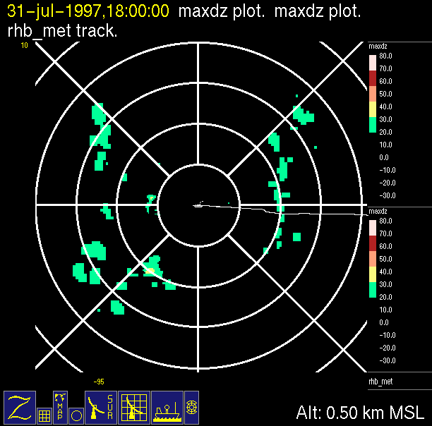 |
| 0000 UTC, 7.55N 90.08W | 0600 UTC, 7.73N 91.20W | 1200 UTC, 7.78N 92.42W | 1800 UTC, 7.88N 93.68W | Panama Canal to ITCZ: August 1, 1997 |
 |
 |
 |
 |
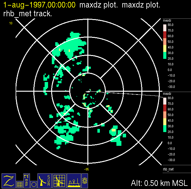
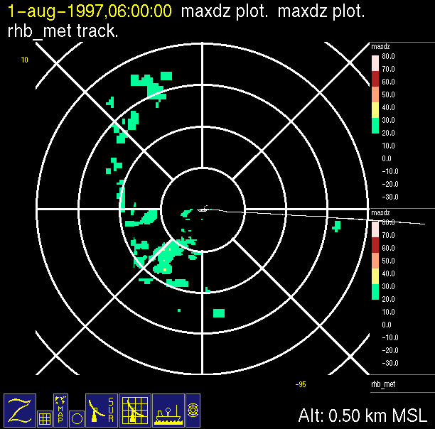
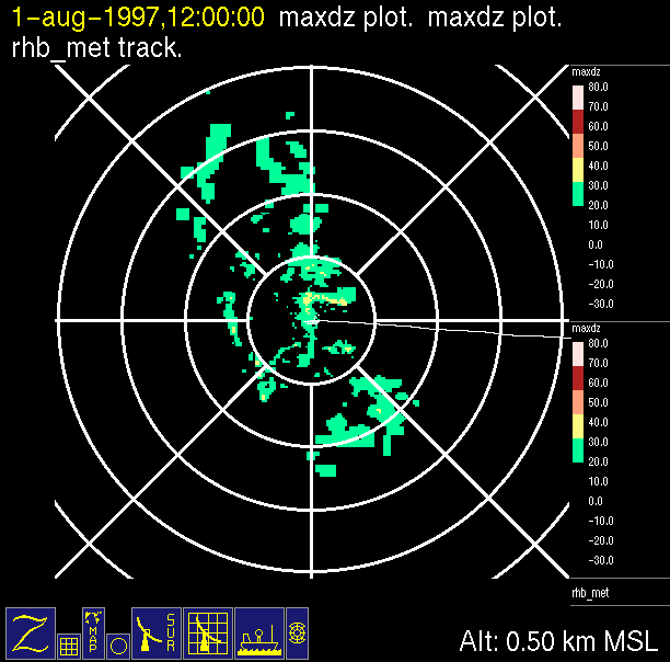
| 0000 UTC, 8.00N 94.98W | 0600 UTC, 8.07N 96.30W | 1200 UTC, 8.17N 97.63W | 1800 UTC, 8.25N 98.93W | Near Hurricane Guillermo: August 2, 1997 |
 |
 |
 |
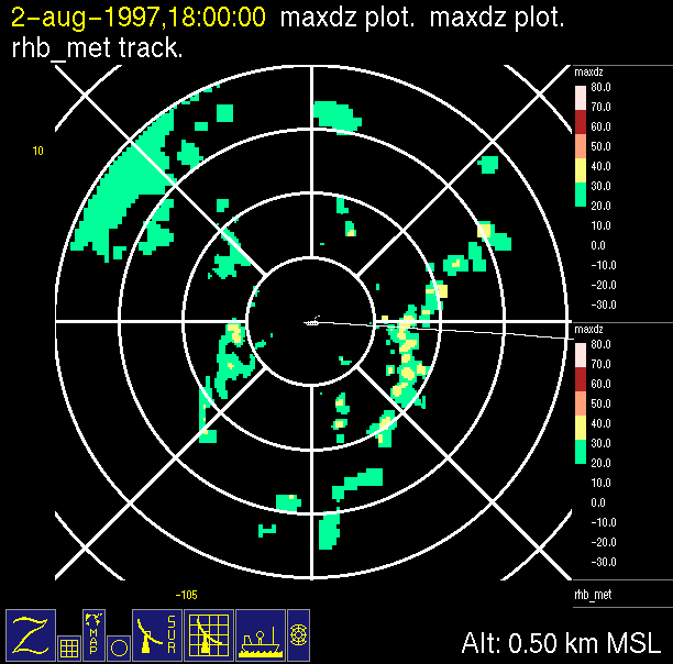 |
| 0000 UTC, 8.33N 100.20W | 0600 UTC, 8.40N 101.45W | 1200 UTC, 8.50N 102.73W | 1800 UTC, 8.58N 103.95W | Near Hurricane Guillermo: August 3, 1997 |
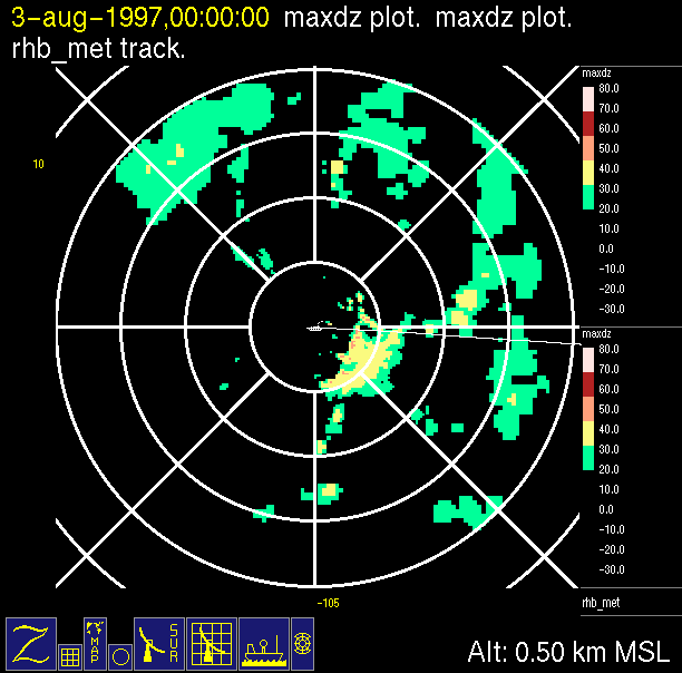 |
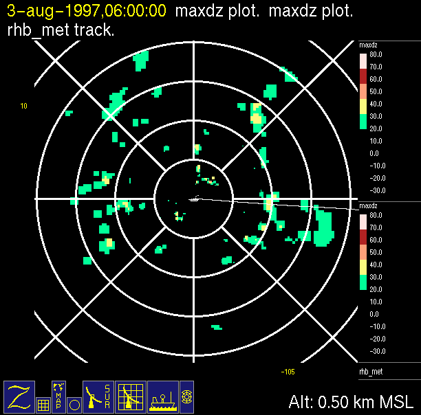 |
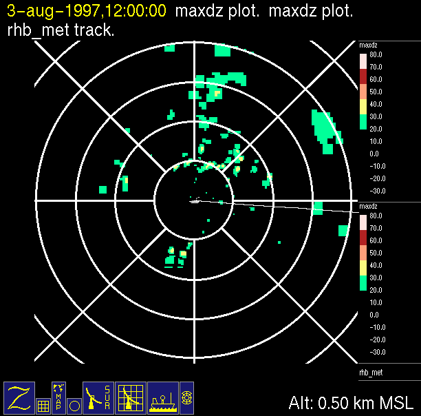 |
 |
| 0000 UTC, 8.65N 105.13W | 0600 UTC, 8.73N 106.33W | 1200 UTC, 8.15N 107.55W | 1800 UTC, 8.92N 108.80W | Near Hurricane Guillermo: August 4, 1997 |
 |
 |
 |
 |
| 0000 UTC, 8.98N 110.08W | 0600 UTC, 9.08N 111.40W | 1200 UTC, 9.13N 112.67W | 1800 UTC, 9.25N 113.88W | Near Hurricane Guillermo: August 5, 1997 |
 |
 |
 |
 |
| 0000 UTC, 9.30N 114.92W | 0600 UTC, 9.38N 116.15W | 1200 UTC, 9.82N 117.12W | 1800 UTC, 9.85N 117.98W | Near Hurricane Guillermo: August 6, 1997 |
 |
 |
 |
 |
| 0000 UTC, 9.72N 118.95W | 0600 UTC, 9.90N 119.70W | 1200 UTC, 9.92N 120.43W | 1800 UTC, 9.93N 121.37W | Near Hurricane Guillermo: August 7, 1997 |
 |
 |
 |
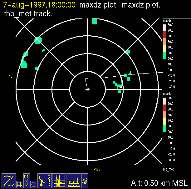 |
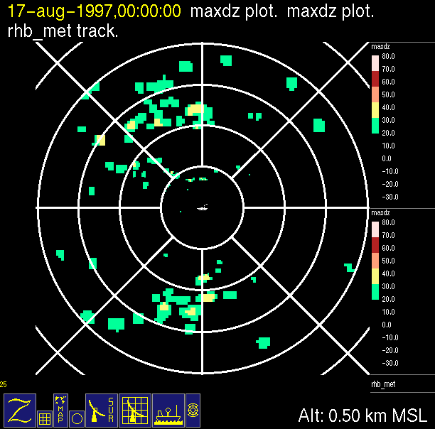
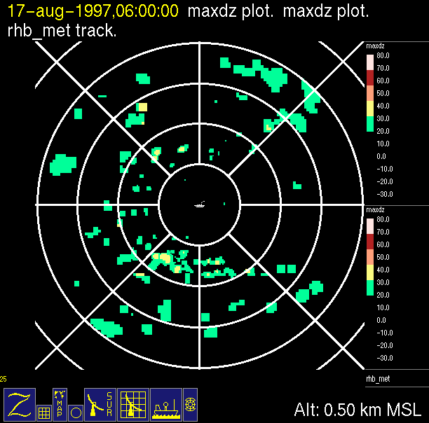
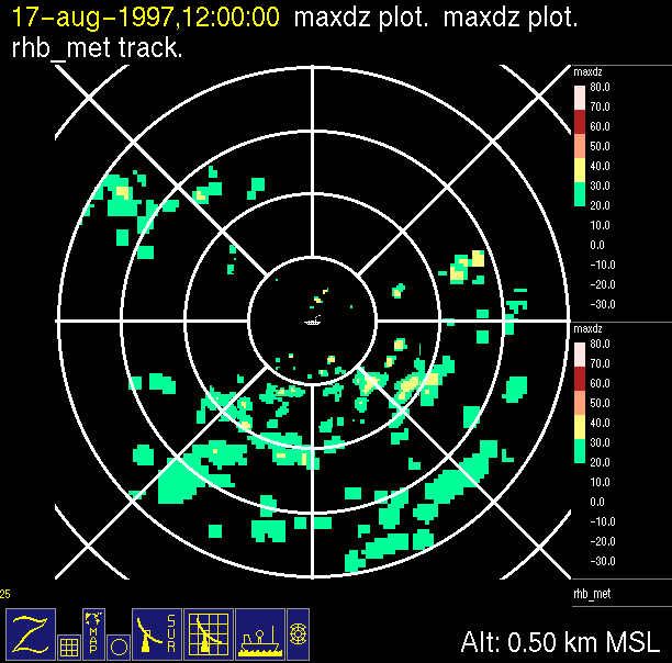
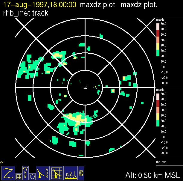
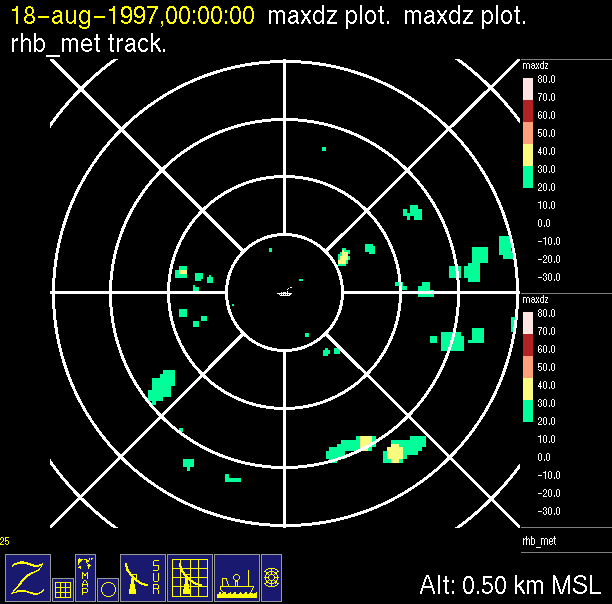
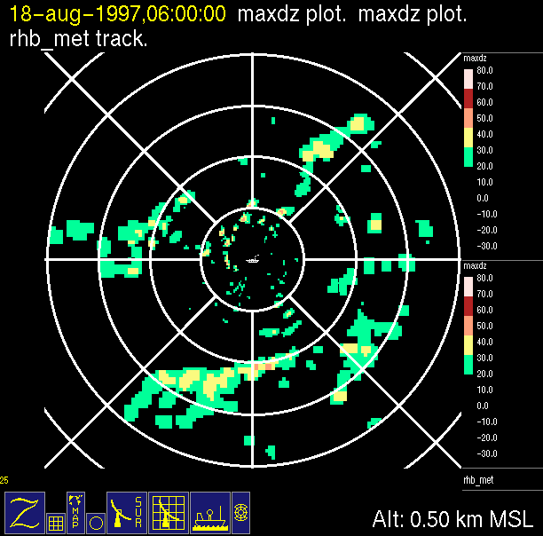
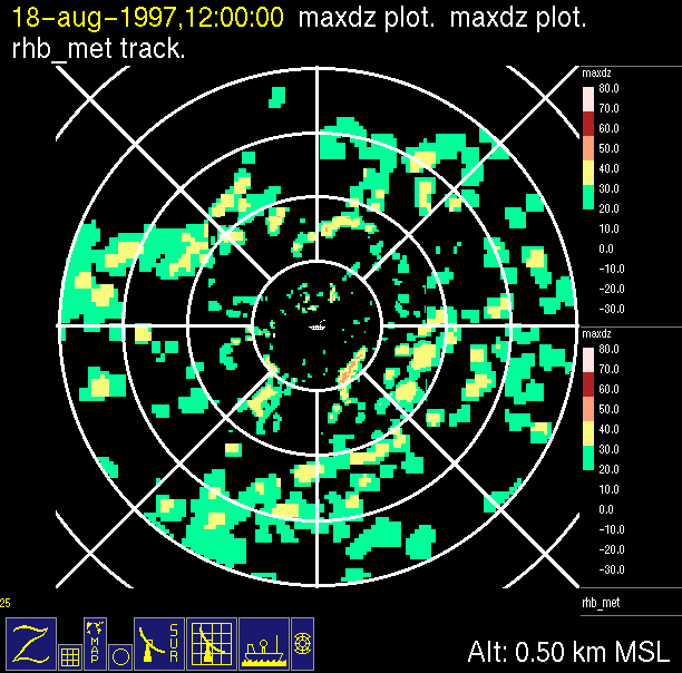
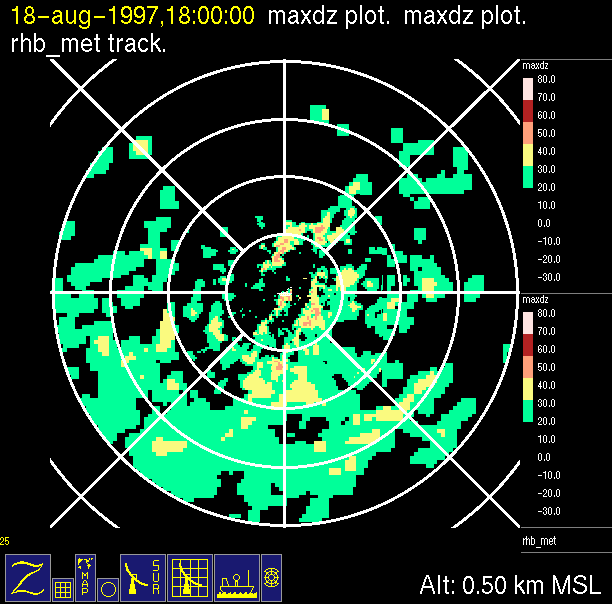
| 0000 UTC, 10.17N 122.33W | 0600 UTC, 10.10N 123.47W | 1200 UTC, 10.00N 124.67W | 1800 UTC, 10.63N 125.32W | Onstation: August 8, 1997, lat. 7.75N, long. 125W |
 |
 |
 |
 |
| 0000 UTC | 0600 UTC | 1200 UTC | 1800 UTC | Onstation: August 9, 1997, lat. 7.75N, long. 125W |
 |
 |
 |
 |
| 0000 UTC | 0600 UTC | 1200 UTC | 1800 UTC | Onstation: August 10, 1997, lat. 7.75N, long. 125W |
 |
 |
 |
 |
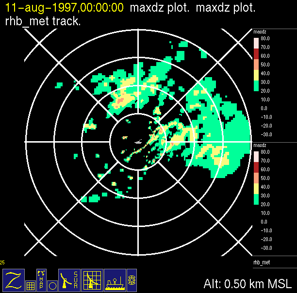
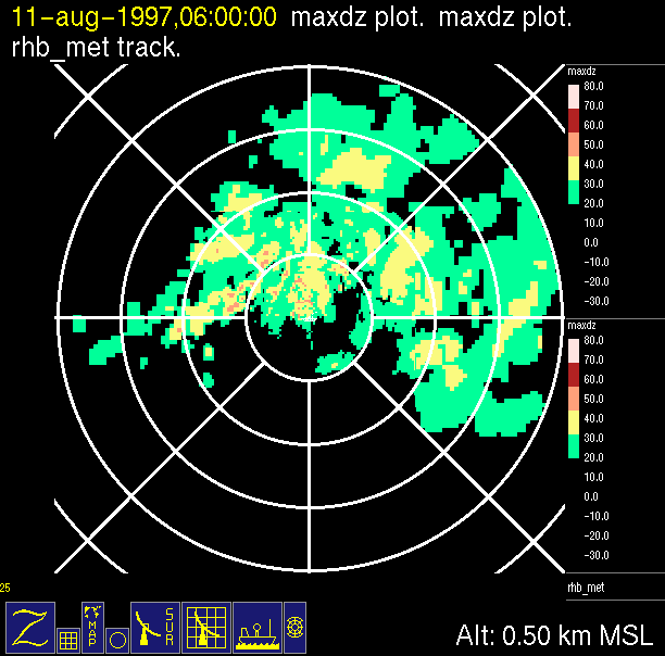
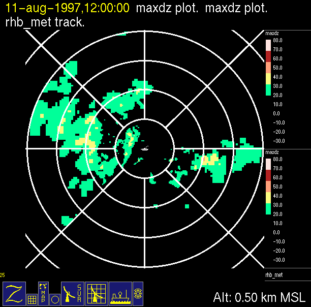
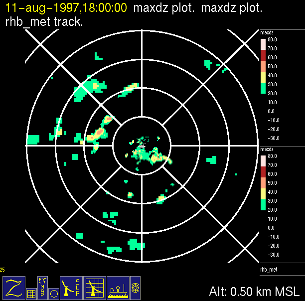
| 0000 UTC | 0600 UTC | 1200 UTC | 1800 UTC | Onstation: August 11, 1997, lat. 7.75N, long. 125W |
 |
 |
 |
 |
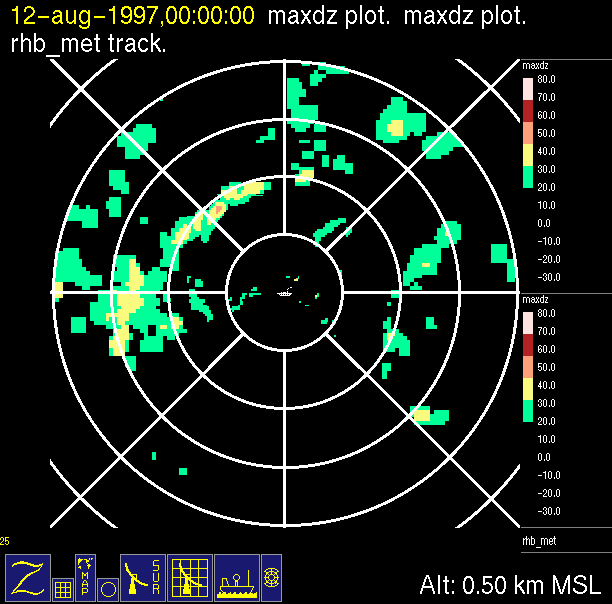
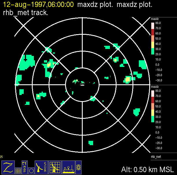
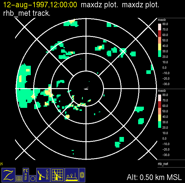
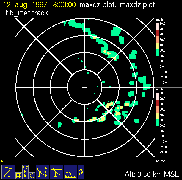
| 0000 UTC | 0600 UTC | 1200 UTC | 1800 UTC | Onstation: August 12, 1997, lat. 7.75N, long. 125W |
 |
 |
 |
 |
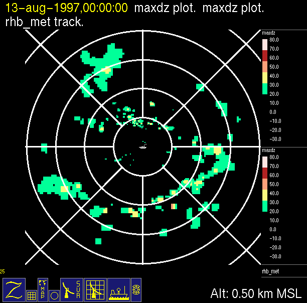
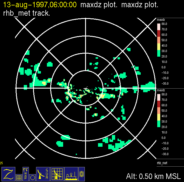
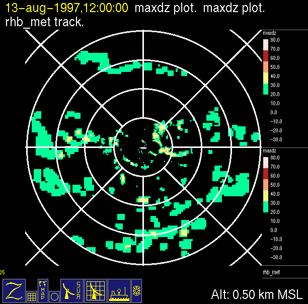
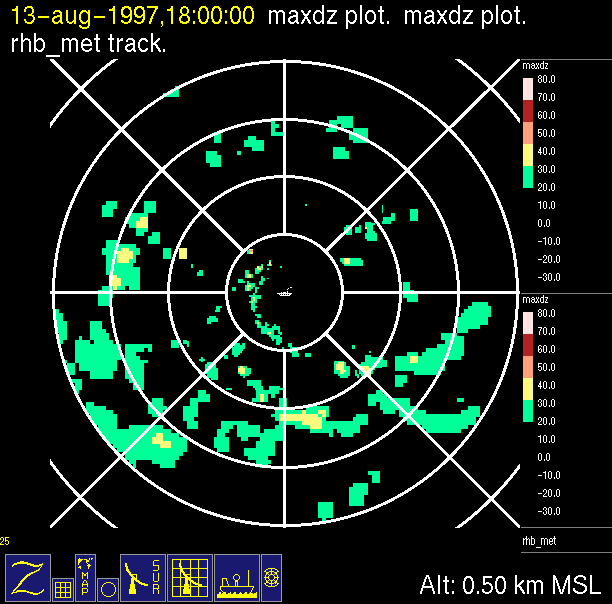
| 0000 UTC | 0600 UTC | 1200 UTC | 1800 UTC | Onstation: August 13, 1997, lat. 7.75N, long. 125W |
 |
 |
 |
 |
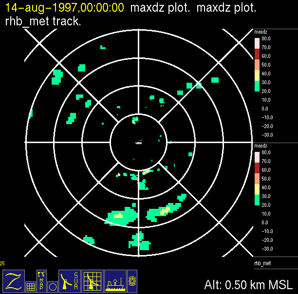
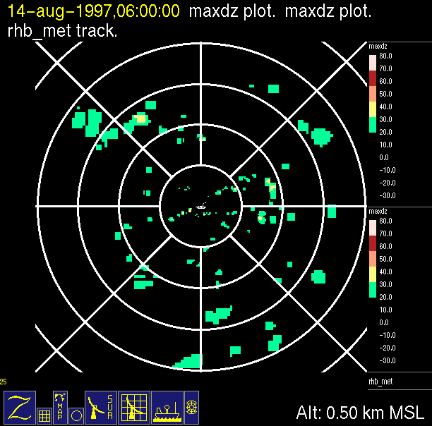
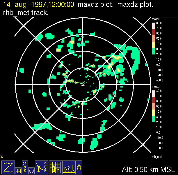
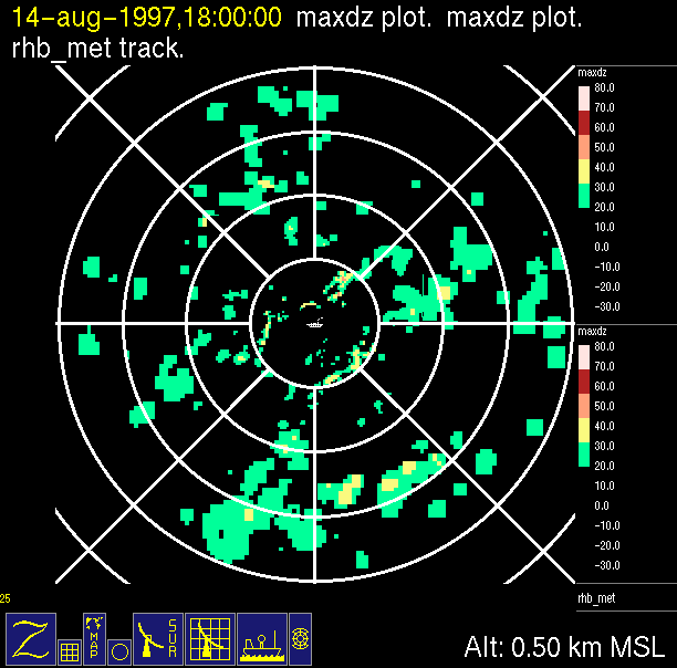
| 0000 UTC | 0600 UTC | 1200 UTC | 1800 UTC | Onstation: August 14, 1997, lat. 7.75N, long. 125W |
 |
 |
 |
 |
| 0000 UTC | 0600 UTC | 1200 UTC | 1800 UTC | Onstation: August 15, 1997, lat. 7.75N, long. 125W |
 |
 |
 |
 |
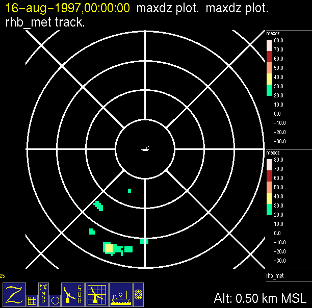
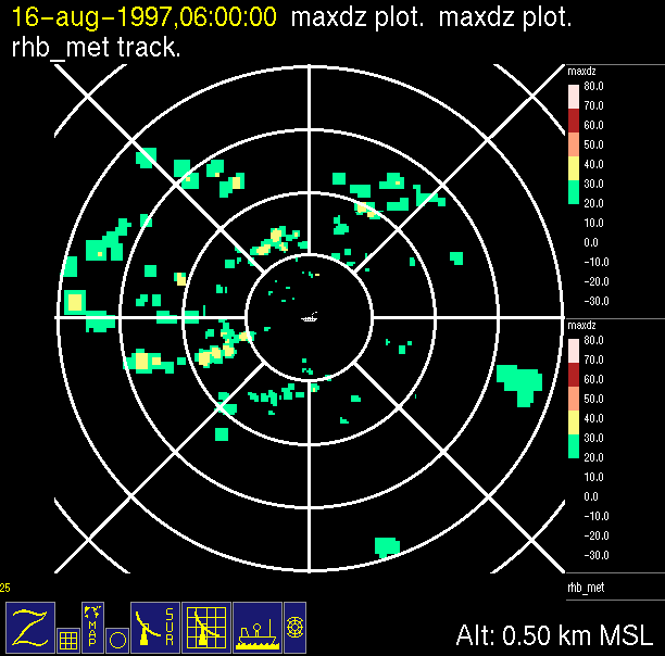
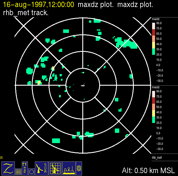
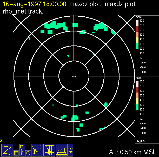
| 0000 UTC | 0600 UTC | 1200 UTC | 1800 UTC | Onstation: August 16, 1997, lat. 7.75N, long. 125W |
 |
 |
 |
 |
| 0000 UTC | 0600 UTC | 1200 UTC | 1800 UTC | Onstation: August 17, 1997, lat. 7.75N, long. 125W |
 |
 |
 |
 |
| 0000 UTC | 0600 UTC | 1200 UTC | 1800 UTC | Onstation: August 18, 1997, lat. 7.75N, long. 125W |
 |
 |
 |
 |
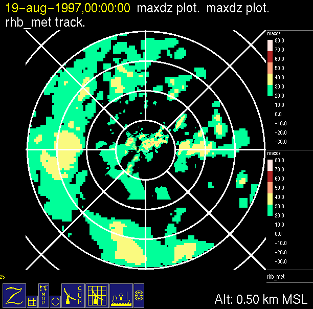
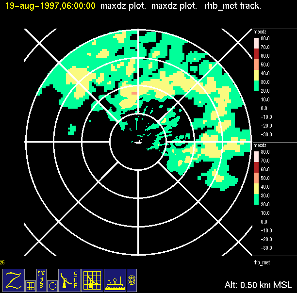
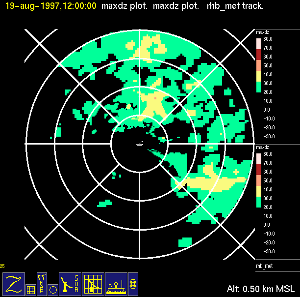
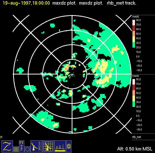
| 0000 UTC | 0600 UTC | 1200 UTC | 1800 UTC | Onstation: August 19, 1997, lat. 7.75N, long. 125W |
 |
 |
 |
 |
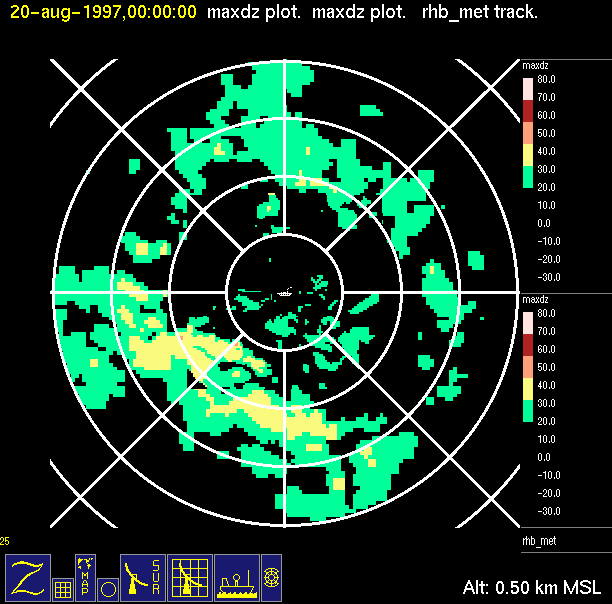
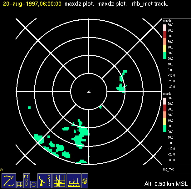
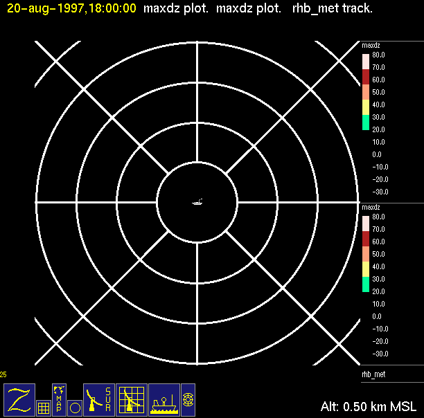
| 0000 UTC | 0600 UTC | 1200 UTC | 1800 UTC | Onstation: August 20, 1997, lat. 7.75N, long. 125W |
 |
 |
 |
 |
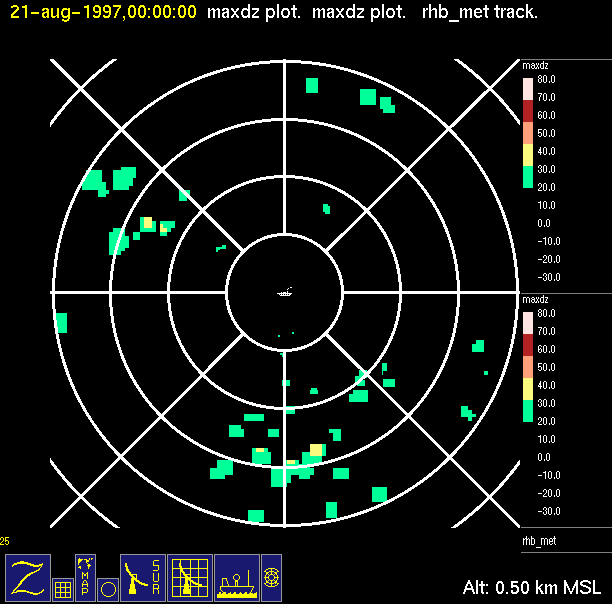
| 0000 UTC | 0600 UTC | 1200 UTC | 1800 UTC | Onstation: August 21, 1997, lat. 7.75N, long. 125W |
 |
 |
 |
 |
| 0000 UTC | 0600 UTC | 1200 UTC | 1800 UTC | Onstation: August 22, 1997, lat. 7.75N, long. 125W |
 |
 |
 |
 |
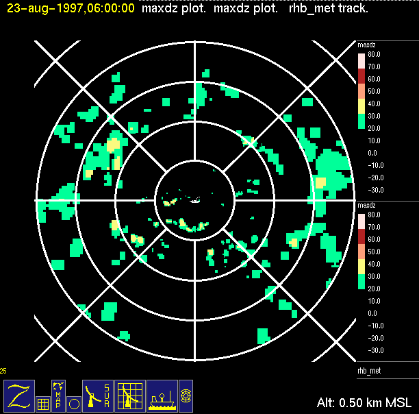
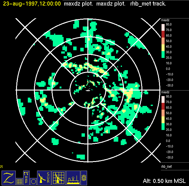
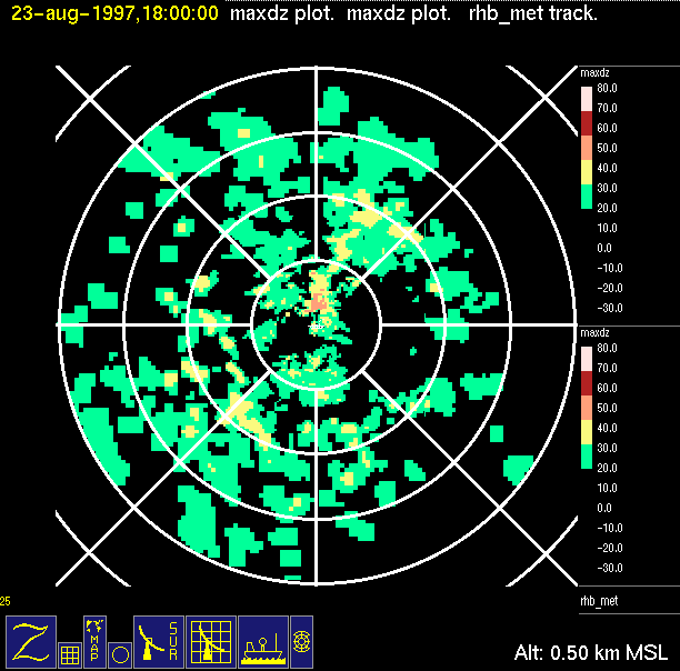
| 0000 UTC | 0600 UTC | 1200 UTC | 1800 UTC | Onstation: August 23, 1997, lat. 7.75N, long. 125W |
 |
 |
 |
 |
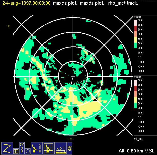
| 0000 UTC | 0600 UTC | 1200 UTC | 1800 UTC | ITCZ Transit: August 24, 1997 |
 |
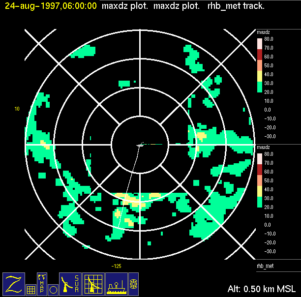 |
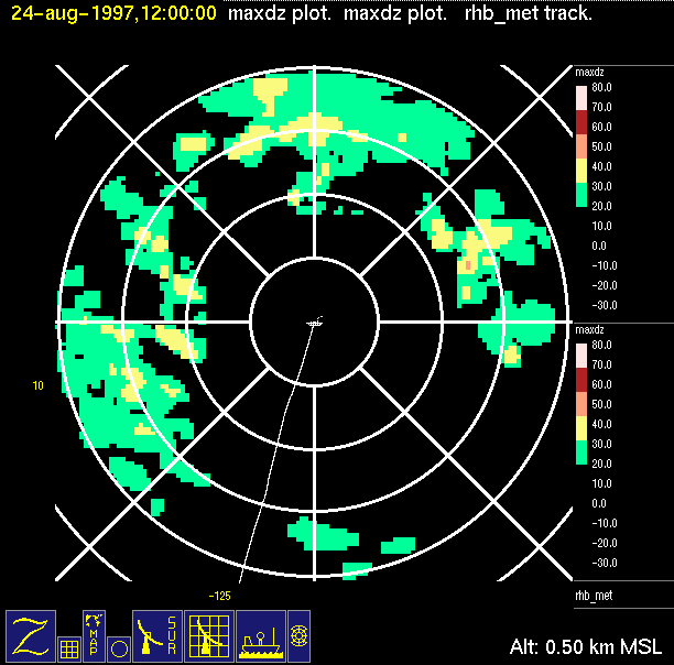 |
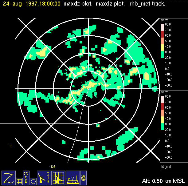 |
| 0000 UTC, 8.18N 124.88W | 0600 UTC, 9.35N 124.58W | 1200 UTC, 10.55N 124.22W | 1800 UTC, 11.77N 123.90W | ITCZ Transit: August 25, 1997 |
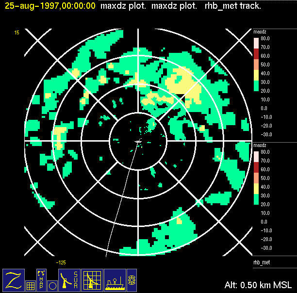 |
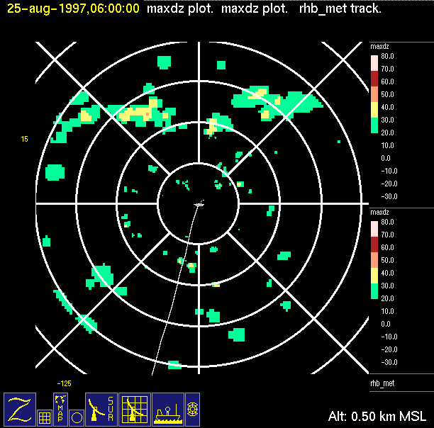 |
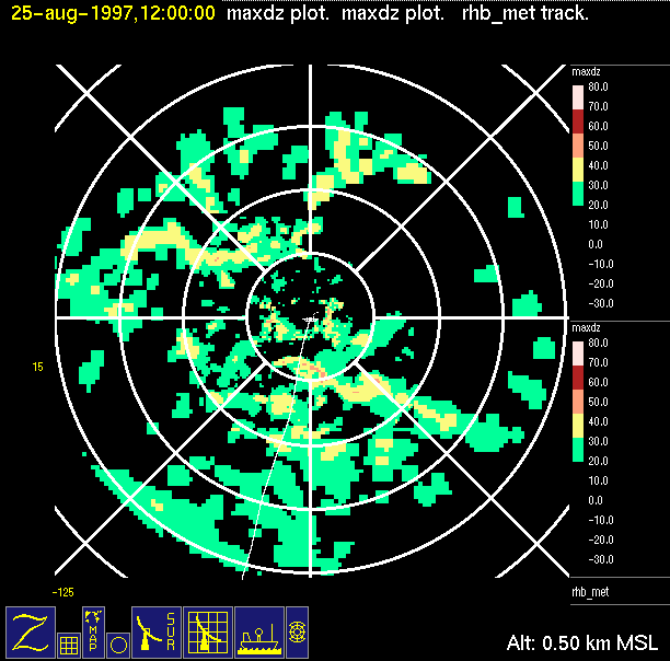 |
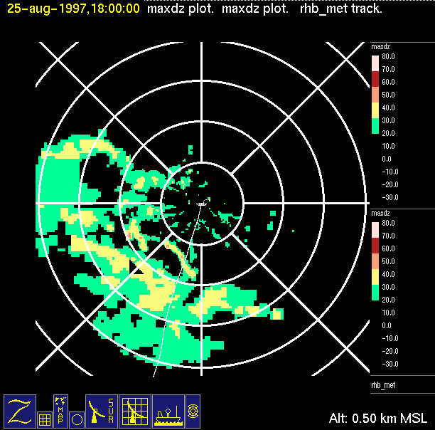 |
| 0000 UTC, 12.97N 123.55W | 0600 UTC, 14.17N 123.25W | 1200 UTC, 15.45N 122.90W | 1800 UTC, 16.40N 122.63W |
Made by: Bob