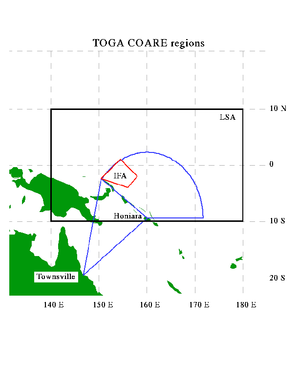
 Map of TOGA COARE
regions. Locations of Honiara, Guadacanal, Solomon Islands and
Townsville, Australia are indicated. The rectangle from 10 deg S to
10 deg N and 140 deg E to 180 deg E is the Large Scale Array (LSA)
where TOGA COARE observations were concentrated. The pie-shaped
region anchored at Honiara and the triangular area extending across
the Solomon Sea toward Townsville mark the aircraft operations area
(blue lines). The red quadrilateral centered near 2 deg S, 156 deg E is
the Intensive Flux Array (IFA).
Map of TOGA COARE
regions. Locations of Honiara, Guadacanal, Solomon Islands and
Townsville, Australia are indicated. The rectangle from 10 deg S to
10 deg N and 140 deg E to 180 deg E is the Large Scale Array (LSA)
where TOGA COARE observations were concentrated. The pie-shaped
region anchored at Honiara and the triangular area extending across
the Solomon Sea toward Townsville mark the aircraft operations area
(blue lines). The red quadrilateral centered near 2 deg S, 156 deg E is
the Intensive Flux Array (IFA).