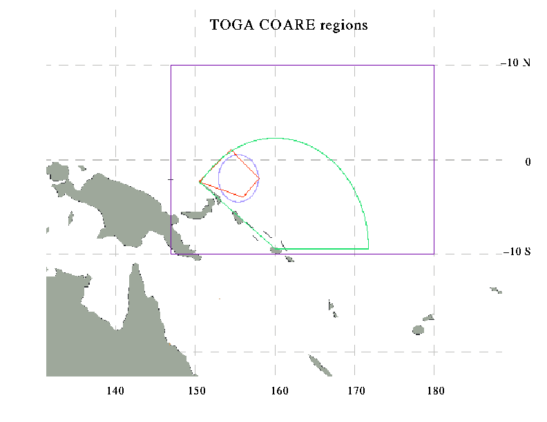
For the purpose of compiling statistics of satellite cloud cluster occurrence, the TOGA COARE region was considered to consist of three nested regions. These regions are shown on a map and are described below:
This was the region of most concentrated observations taken on islands, ships, and buoys. It is shown by the quadrilateral enclosing the point 2 deg S and 156 deg E, which was the central buoy location in the array. For the purpose of identifying the satellite cloud clusters, the elliptical region was used as a proxy for the actual IFA. The data in the time-size plot panel identified as "IFA" clusters includes cloud clusters whose centroids were located within the ellipse.
This region is a partial circle radiating out from Honiara. The outer boundary of the circle was approximately the 3-hour flight distance for the turboprop aircraft stationed at Honiara.
This region encompasses the whole region (147-180E, 10S-10N) regarded as the TOGA COARE domain.