Quantitative Intercomparison of TRMM PR and
KPOL Radar Observations
S. Bolen
and V. Chandrasekar Department
of Electrical Engineering, Colorado State University
Simultaneous space and ground-based measurements were collected from the Tropical
Rainfall Measuring Mission (TRMM) Precipitation Radar (PR) and the WSR-93S radar
located at Kwajalein Island - also referred to as the KPOL radar. Data was collected
from five different time periods over nine different spatial areas.
Direct inter-comparisons between space and ground based samples can be a daunting
task. Differences in viewing aspects between space and earth point observations,
propagation frequencies, resolution volume size and time synchronization mismatch
between space and ground-based measurements can contribute, in a significant way,
to direct point-by-point inter-comparison errors. This problem is further exasperated
by geometric distortions induced upon the space-based observations caused by the
movements and attitude perturbations of the spacecraft itself.
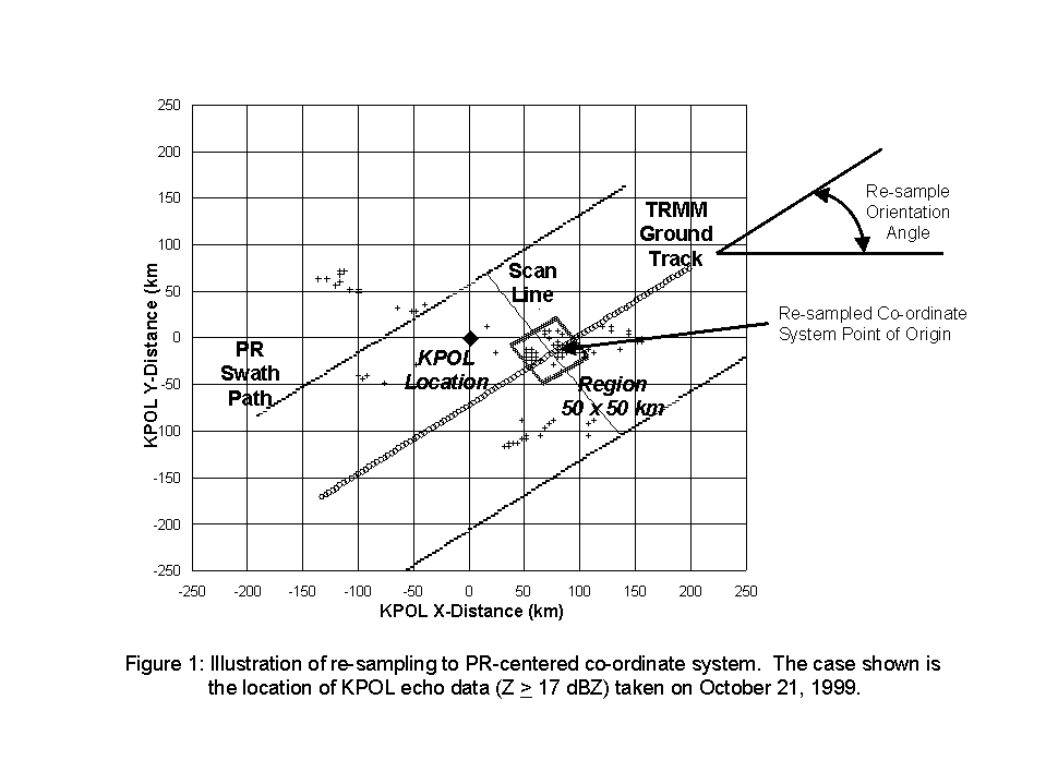
To minimize errors, ground and PR data were collected during simultaneous intervals
not exceeding 2-3 minutes in time difference. Both sets of data were re-mapped
to a PR-centered Cartesian coordinate system, using a non spherical earth model
(WGS-84 model), with the origin located at the intersection of the TRMM ground
track and scan that passes through the center of the storm area located within
a 50 x 50 km window - as depicted in the example shown in Figure 1.
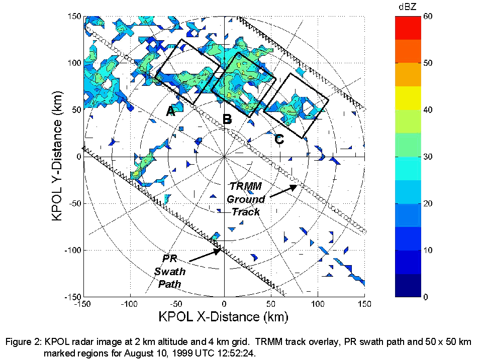
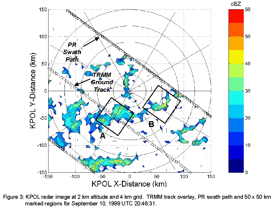
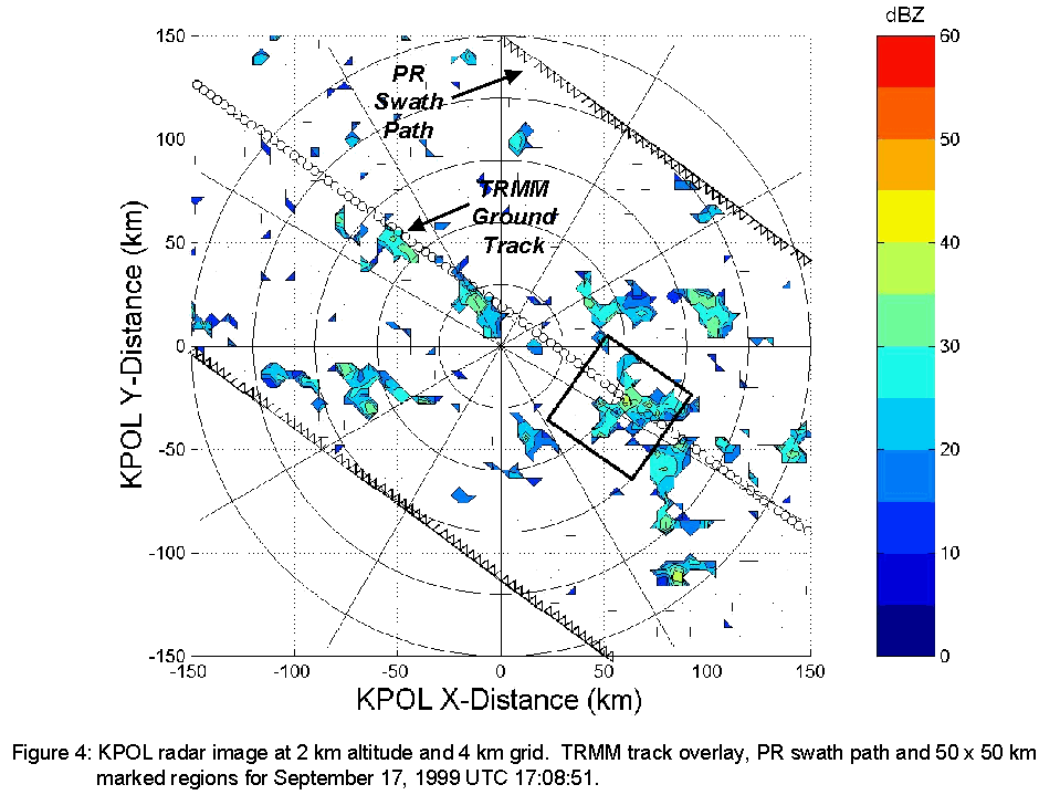
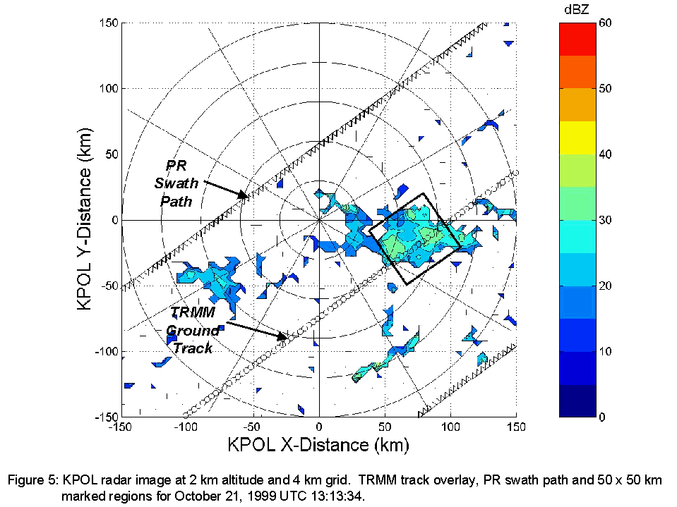
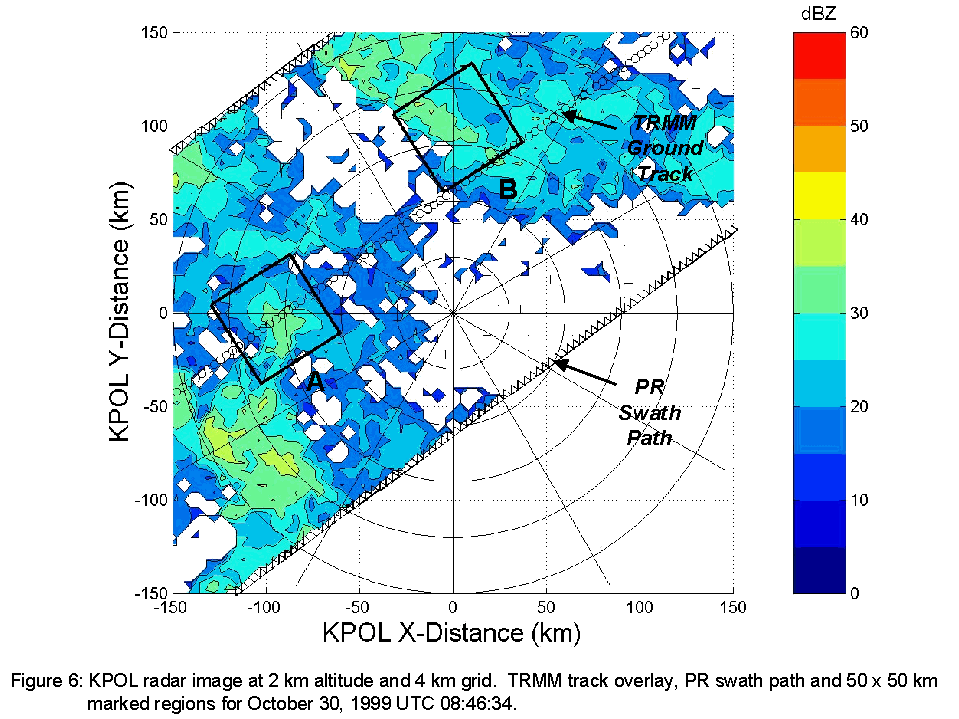
The horizontal images of KPOL data for each of the study cases are shown in Figures
2-6. The radar images are taken at the 2 km horizontal altitude and show the TRMM
track overlay, PR swath path, scan line and 50 x 50 km study regions with KPOL
location at the center of the image.
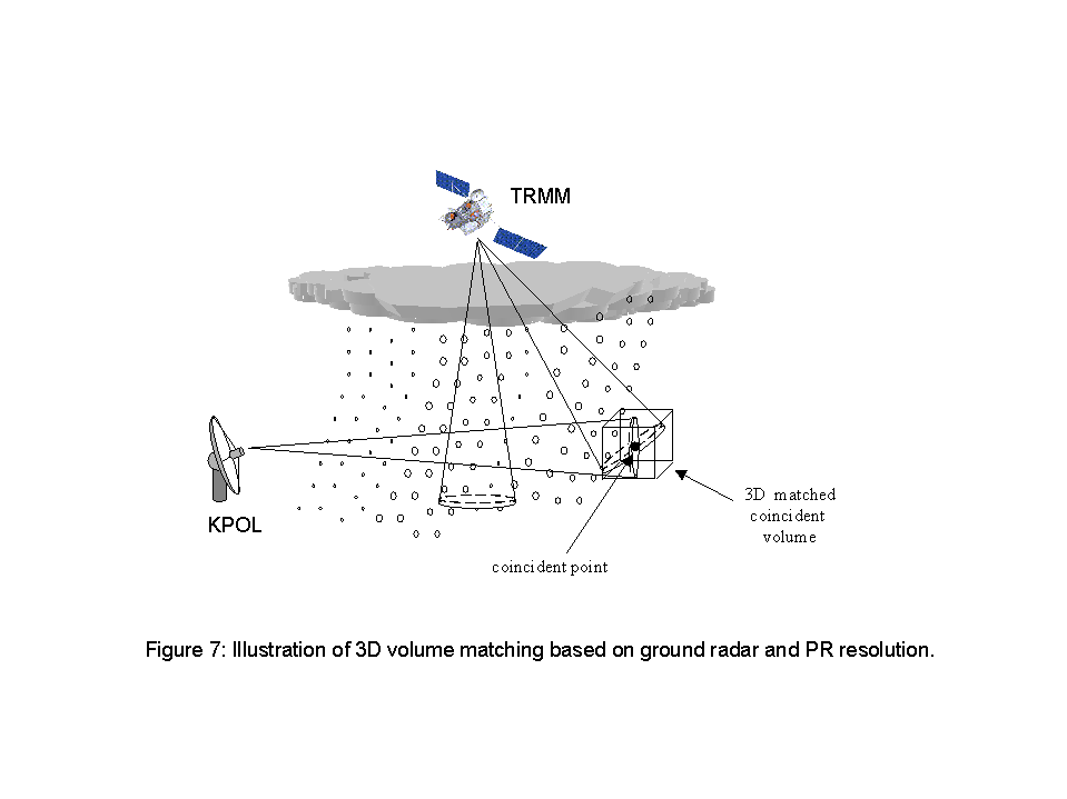
Ground and PR data were interpolated to 0.5 km grids in the horizontal and 0.25
km in the vertical at altitudes ranging from 0.5 to 15.0 km. The (x,y) coordinates
of each PR beam are then found and each beam is linearly averaged at the specified
(x,y) coordinate in the vertical and horizontal directions. Vertical limits are
taken as the maximum vertical resolution between either the PR or ground radar
vertical resolution at that point calculated according to the resolution geometry.
Thus, a three dimensional volume, with dimensions in the horizontal plane equal
to the PR horizontal resolution and height equal to the resolution of the PR or
ground radar at that point, is constructed at each PR (x,y) beam location. Similarly,
ground radar reflectivity is also linearly averaged in the same three-dimensional
volume. This ensures that observations are taken from similar co-located volumes.
The geometry is illustrated in Figure 7.
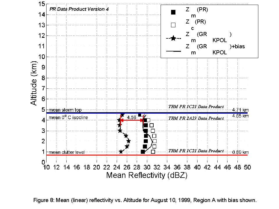
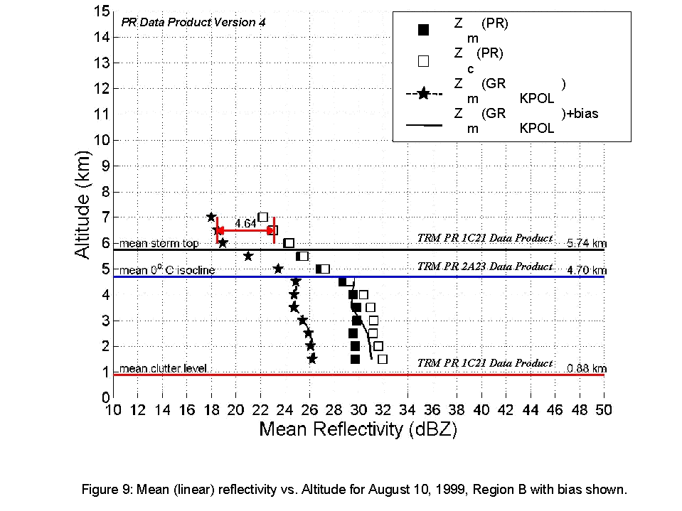
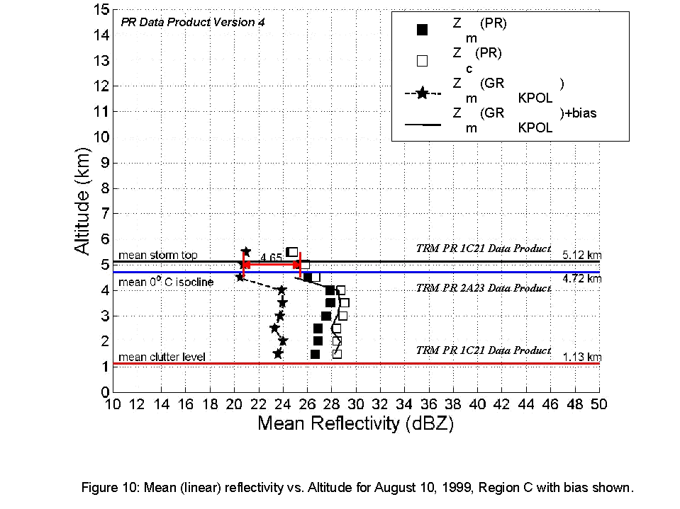
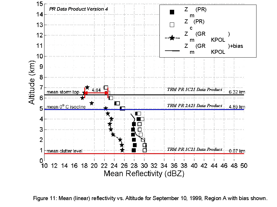
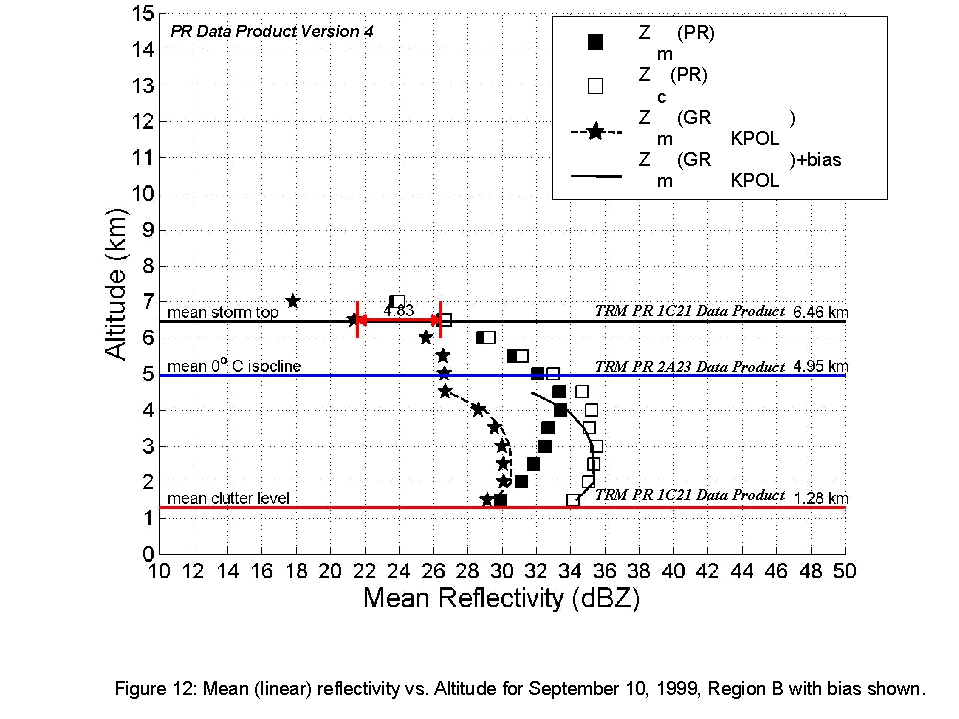
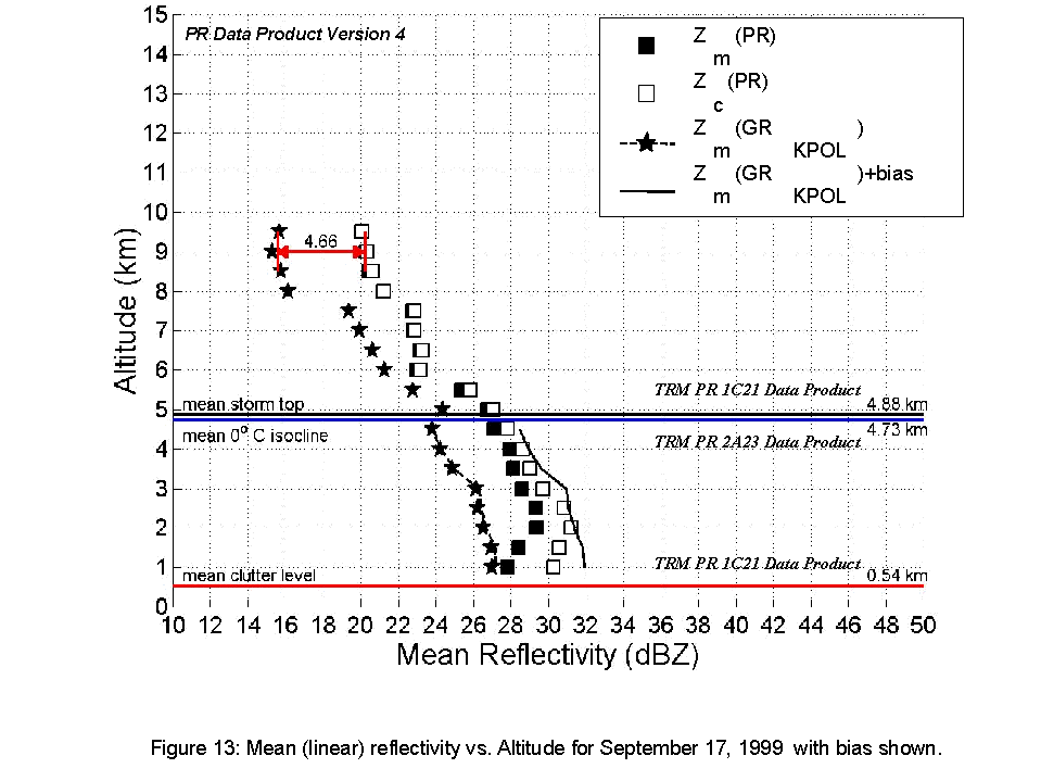
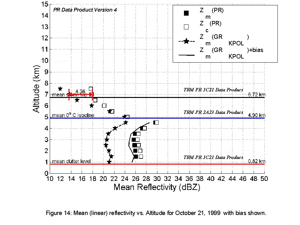
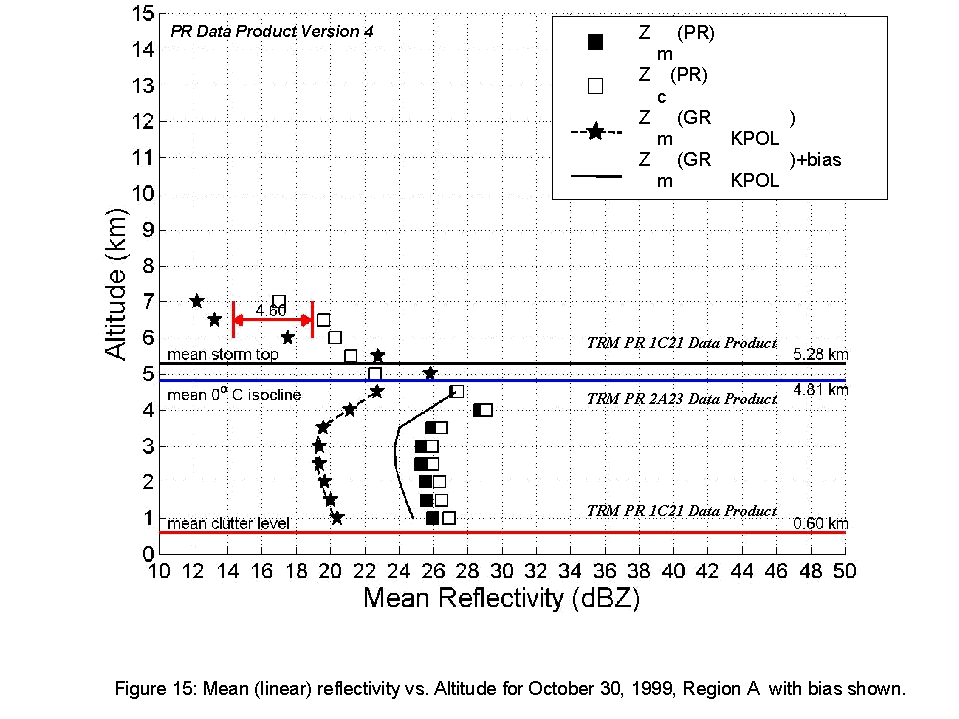
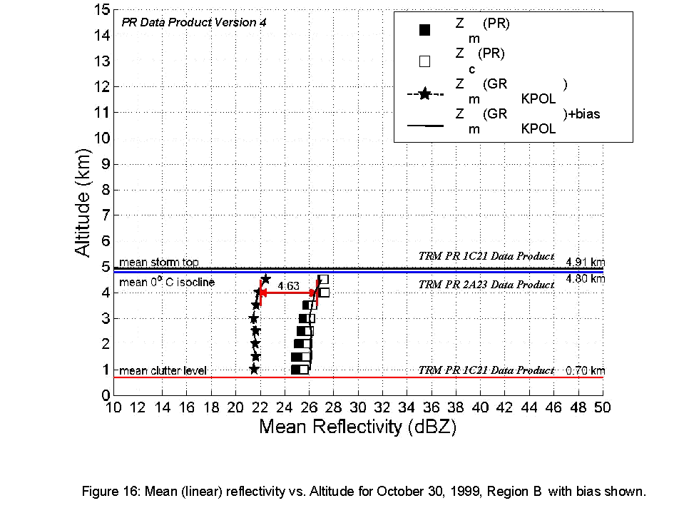
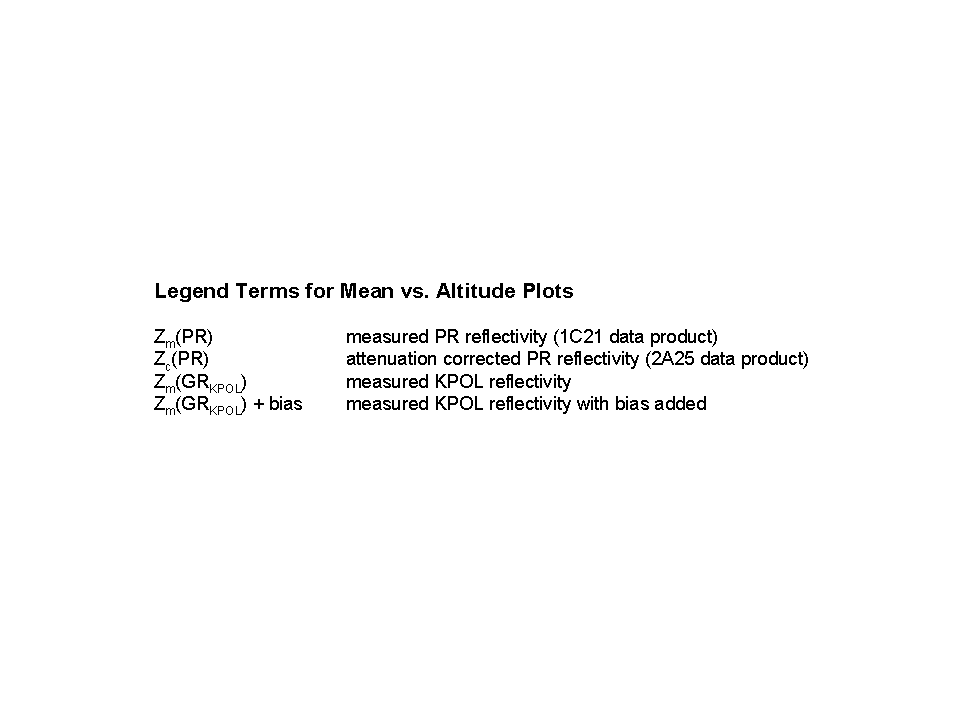
After volume matching, the average reflectivity (in linear scale) vs. altitude
was determined for each of the nine different regions and the plots are shown
in Figures 8-16. The difference between PR and KPOL was determined from the plots
at altitude and reflectivity levels were it was assumed that there was insignificant
attenuation in PR measurements. (PR reflectivity version 4 data was used in the
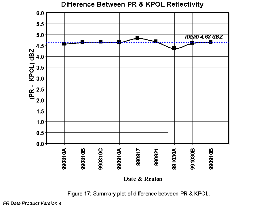
comparison). A summary of the difference between PR and KPOL observations is shown
in Figure 17.