Mission Summary: 07/26/99
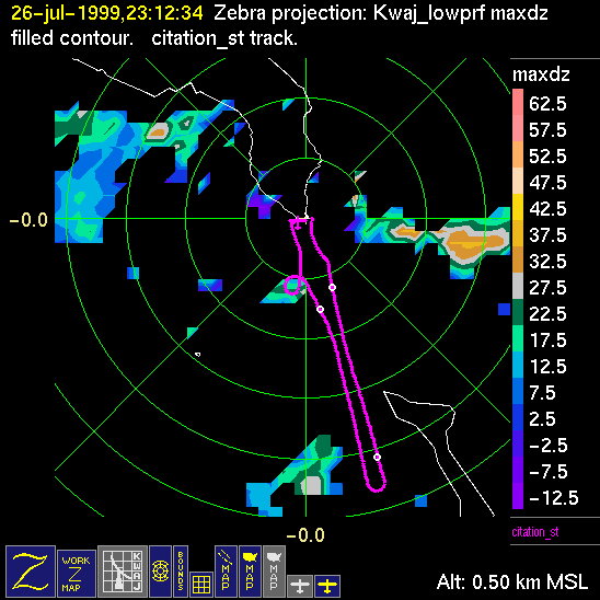
Mission summaries consist of Scientists's discussions of the flights and Radar Images overlayed with flight tracks. Separate discussions (written by the Aircraft Mission Coordinator and the chief airborne mission scientist on each aircraft participating in the mission) may be read by clicking on the "Scientists' Discussion" link shown below. Also shown below are the aircraft flight tracks (see color key below) superimposed on a series of radar echo patterns obtained by the Kwajalein S-band radar during flights. In some cases, horizontal maps of radar echo are accompanied by a vertical cross section of the radar reflectivity: indicated by light blue lines on the horizontal maps and displayed directly below them. The geography of the Kwajalein Atoll is outlined in white. The area covered by the radar is almost all open ocean. Range rings are at 10 nm intervals. The NOAA ship Ronald H. Brown is located ~22 nm (40 km) south of the Kwajalein radar. The overlapping white circles show the dual-Doppler radar lobes for the combined Kwajalein and ship radars. The red circle is a no-fly zone.
| Aircraft | Time of Takeoff (UTC) | Time of Landing (UTC) |
| Citation | 2235 | 2308 |
| Color-Key to Radar Image Overlays: | ||
| - Citation Flight Track | ||
 |
Scientific contact: Professor Sandra Yuter, Project Science Coordinator