Mission Summary: 08/30b/99
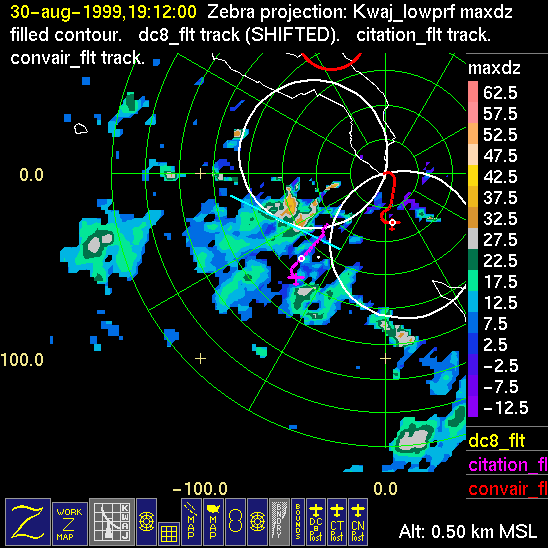
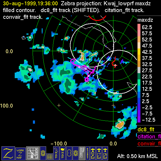
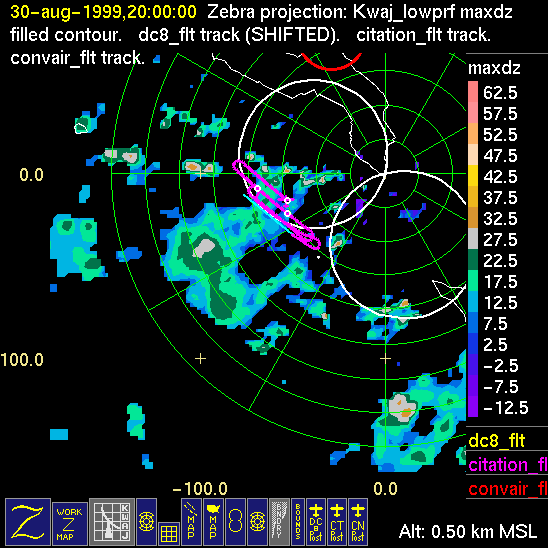
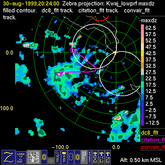
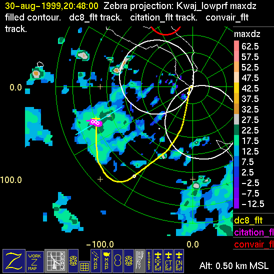
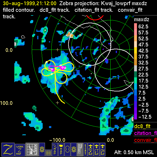
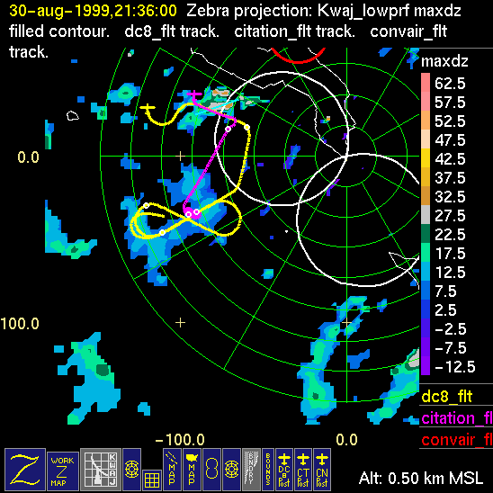
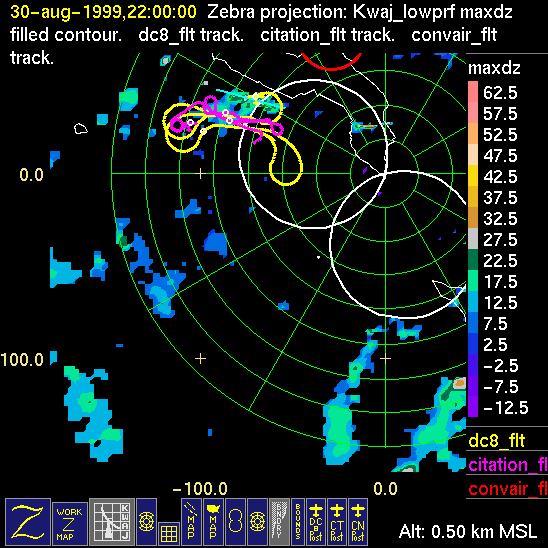
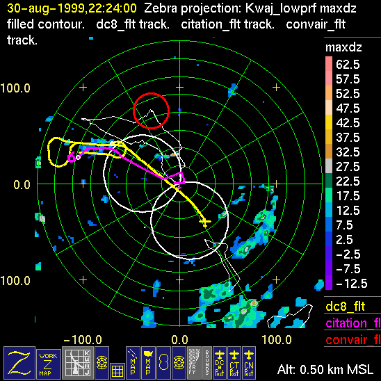
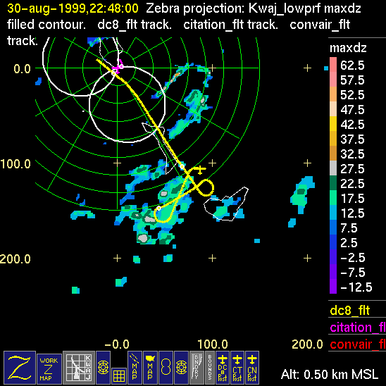
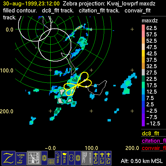
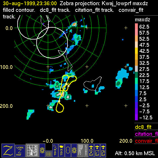
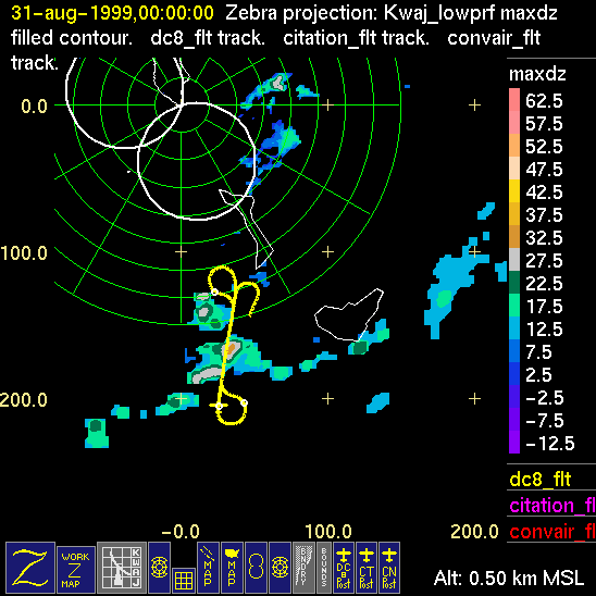
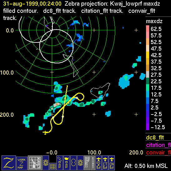
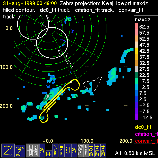
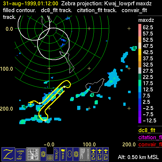
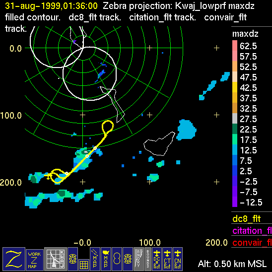
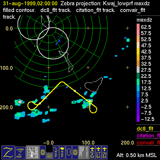
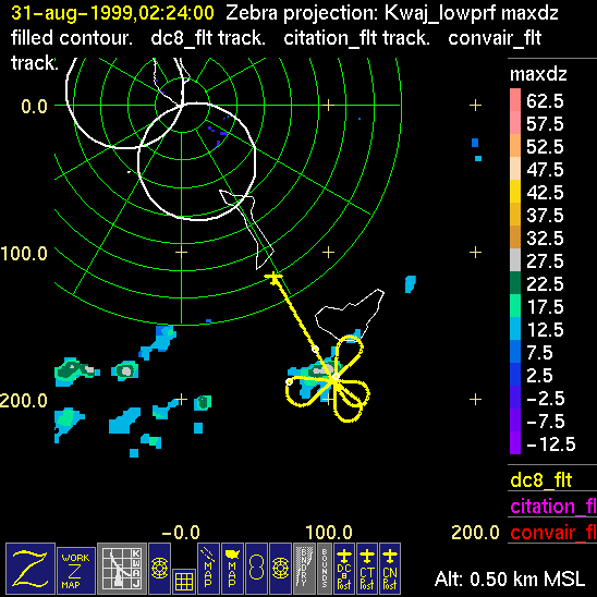
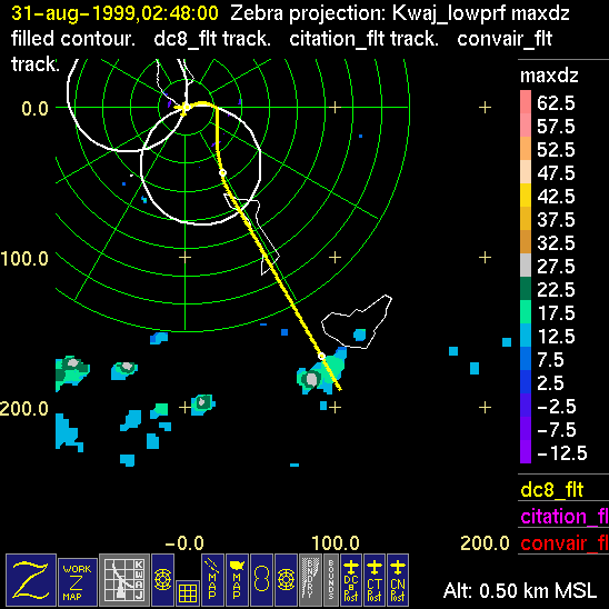
Mission summaries consist of Scientists' discussions of the flights and Radar Images overlayed with flight tracks. Separate discussions (written by the Aircraft Mission Coordinator and the chief airborne mission scientist on each aircraft participating in the mission) may be read by clicking on the "Scientists' Discussion" link shown below. Also shown below are the aircraft flight tracks (see color key below) superimposed on a series of radar echo patterns obtained by the Kwajalein S-band radar during flights. Echo along radials 296-297 deg. is non-meteorological. The geography of the Kwajalein Atoll is outlined in white. The area covered by the radar is almost all open ocean. Range rings are at 10 nm intervals. The NOAA ship Ronald H. Brown is located ~22 nm (40 km) southwest of the Kwajalein radar. The overlapping white circles show the dual-Doppler radar lobes for the combined Kwajalein and ship radars. The red circle is a no-fly zone.
| Aircraft | Time of Takeoff (UTC) | Time of Landing (UTC) |
| Convair | 1903 | 1921 |
| DC-8 | 2028 Aug 30 | 0239 Aug 31 |
| Citation | 1857 | 2220 |
| Color-Key to Radar Image Overlays: | ||
| - Convair Flight Track | ||
| - Citation Flight Track | ||
| - DC-8 Flight Track | ||
| Scientists' Discussion | ||
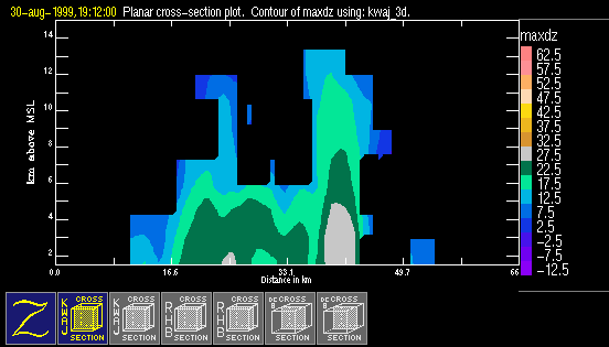
| Click here for a loop of the radar images shown below | ||
 |
 |
 |
 |
 |
 |
 |
 |
 |
 |
 |
 |
 |
 |
 |
 |
 |
|
 |
 |
 |
 |
 |
 |
 |
 |
 |
 |
 |
|
Scientific contact: Professor Sandra Yuter, Project Science Coordinator