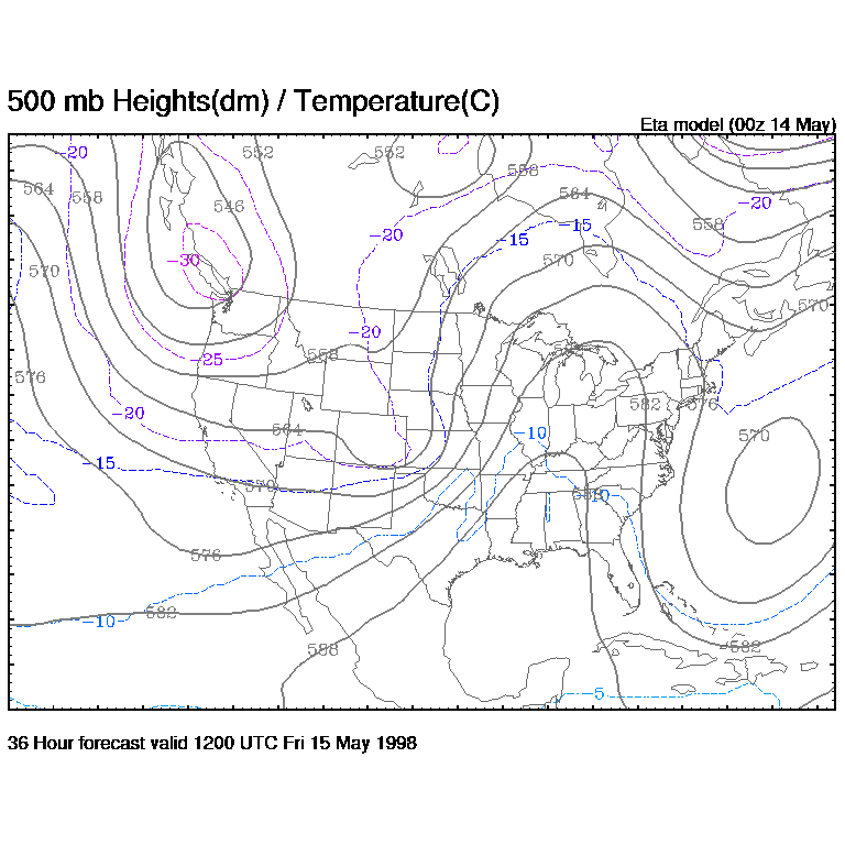
1. Using arrows, draw and label the Pressure Gradient Force (PGF), the Coriolis Force (CF), and tne actual wind (V) on the above 500 mb map. Draw these arrows for Seattle, Los Angeles, Oklahoma City, Minneapolis, Chicago, Washington D.C., and Miami. Be sure and make the length of each arrow proportional to the strength of the force (or wind speed). The closer the contours, the longer the PGF, CF, and V arrows should be. Remember to label your arrows!
Note: It is easiest to first draw in the wind keeping in mind that the wind is parallel to the contours and highs are to the right. Next draw perpindicular arrows on it that correspond to the balanced PGF and CF.