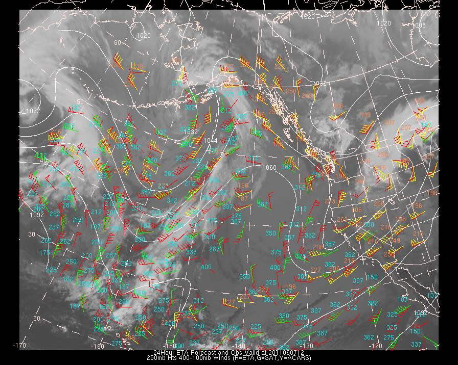
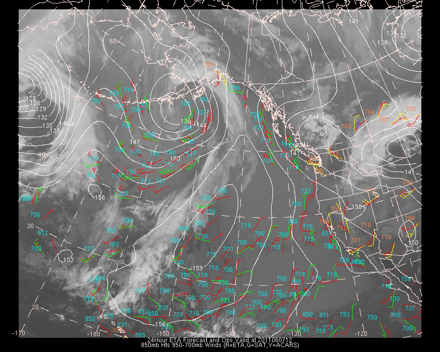
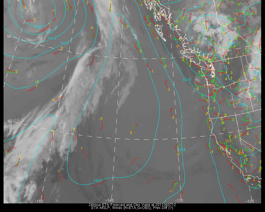
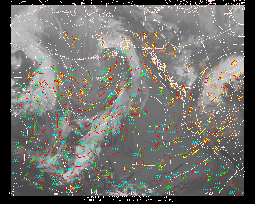
| MODEL | Upper Level Plots (centered at 250mb) | Mid-Level Plots (centered at 500mb) | Low-Level Plots (centered at 850mb) | Surface Plots | Surface Plots (close up view) |
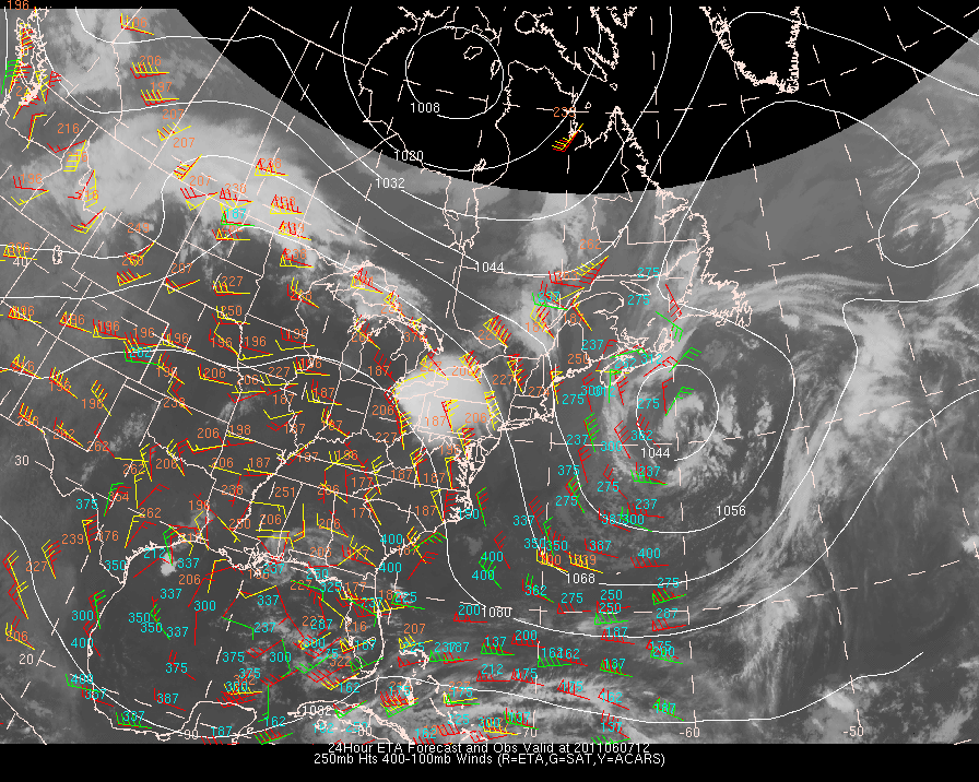
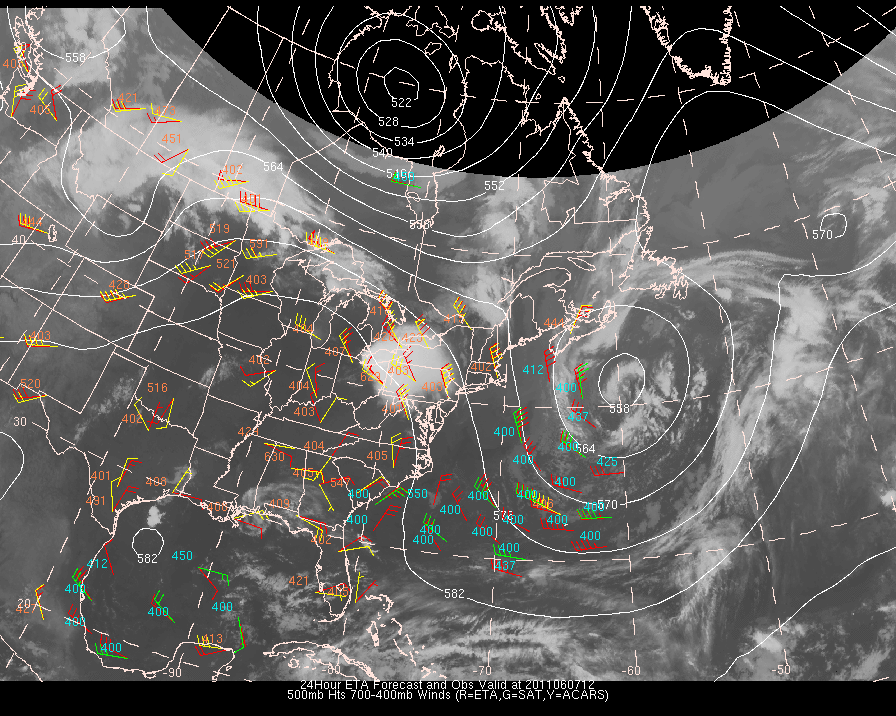
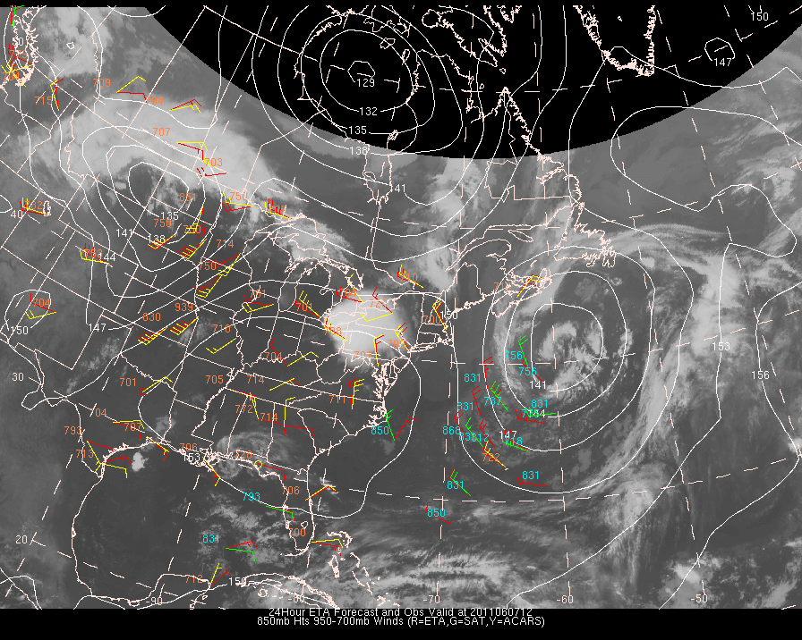
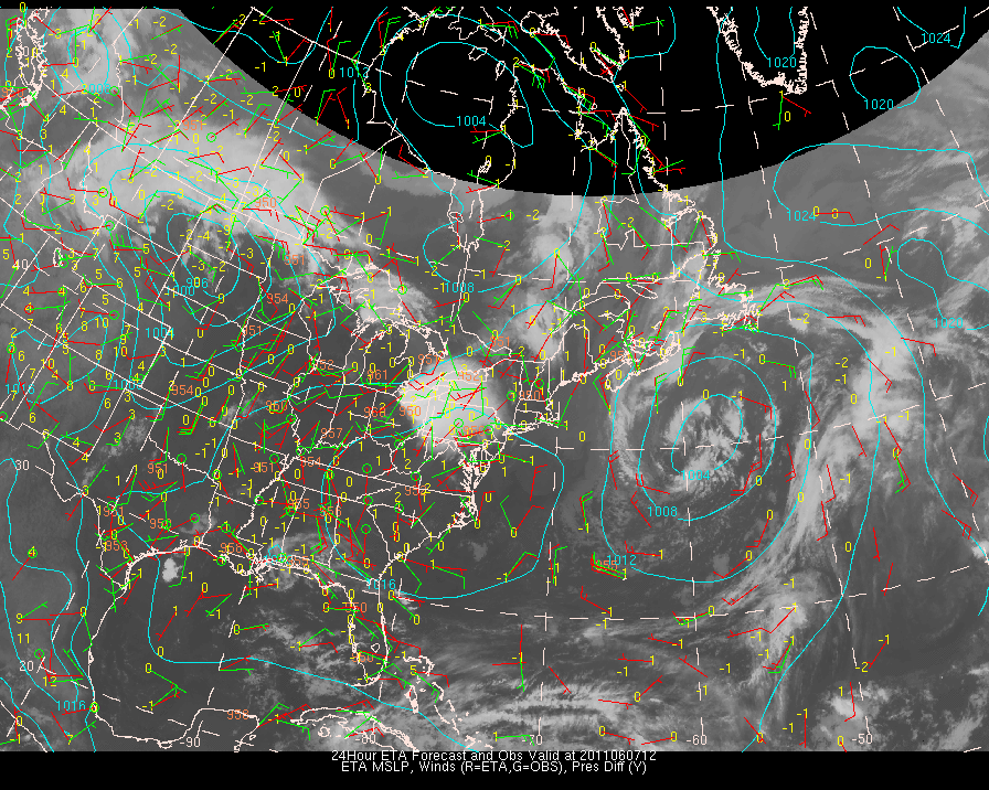
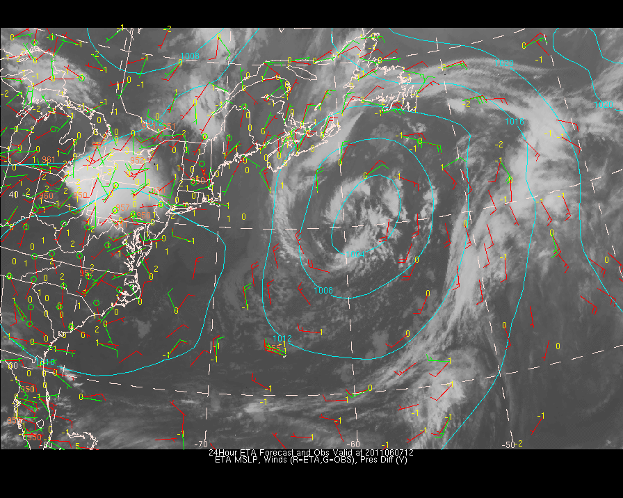
| ETA | ETA | ETA | ETA | ETA | ETA |
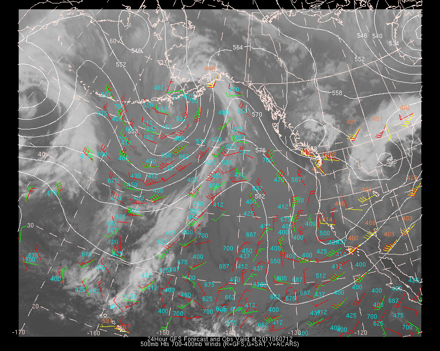
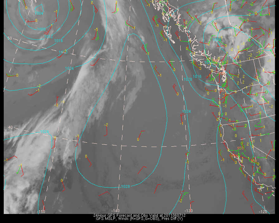
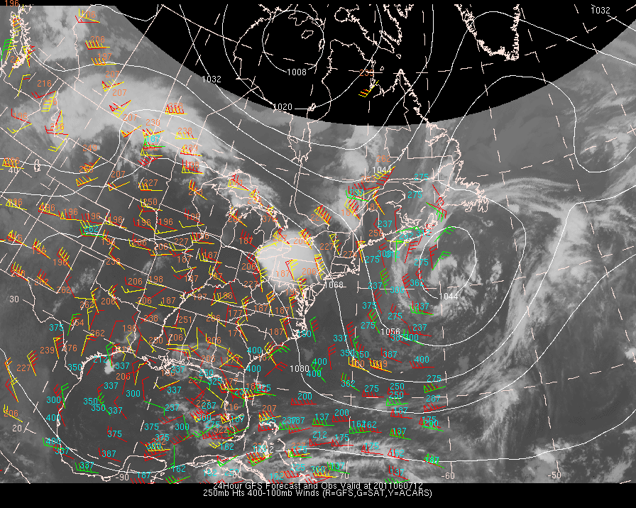
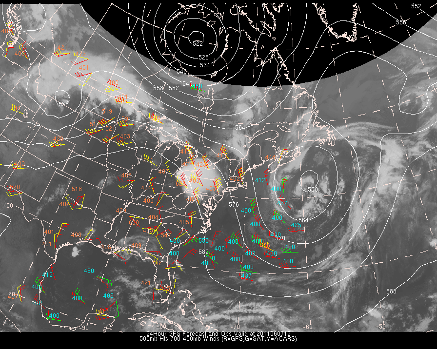
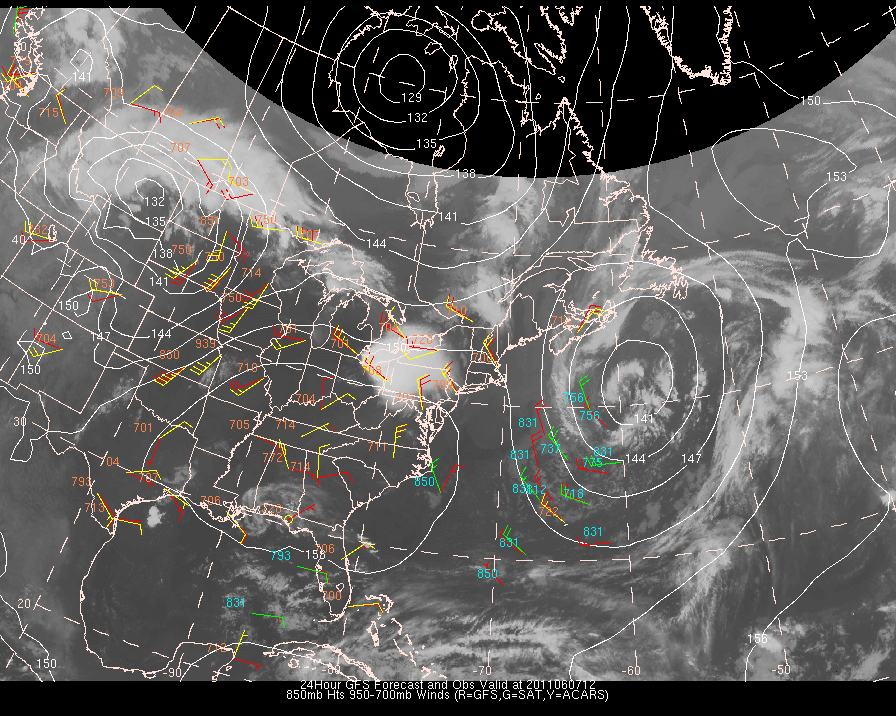
| GFS | GFS | GFS | GFS | GFS | GFS |
| NOGAPS | NOGAPS | NOGAPS | NOGAPS | NOGAPS | NOGAPS |
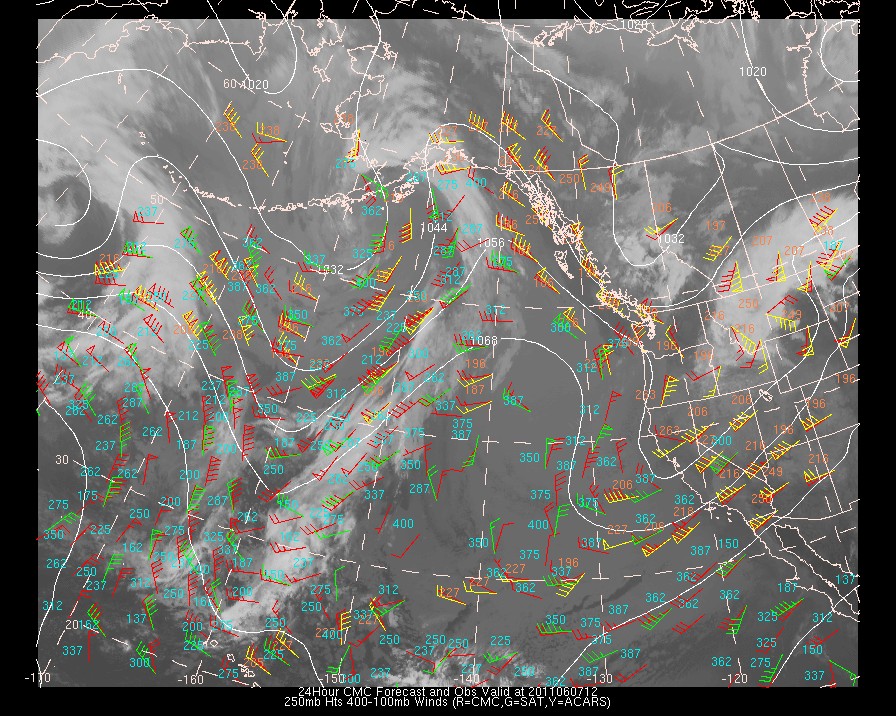
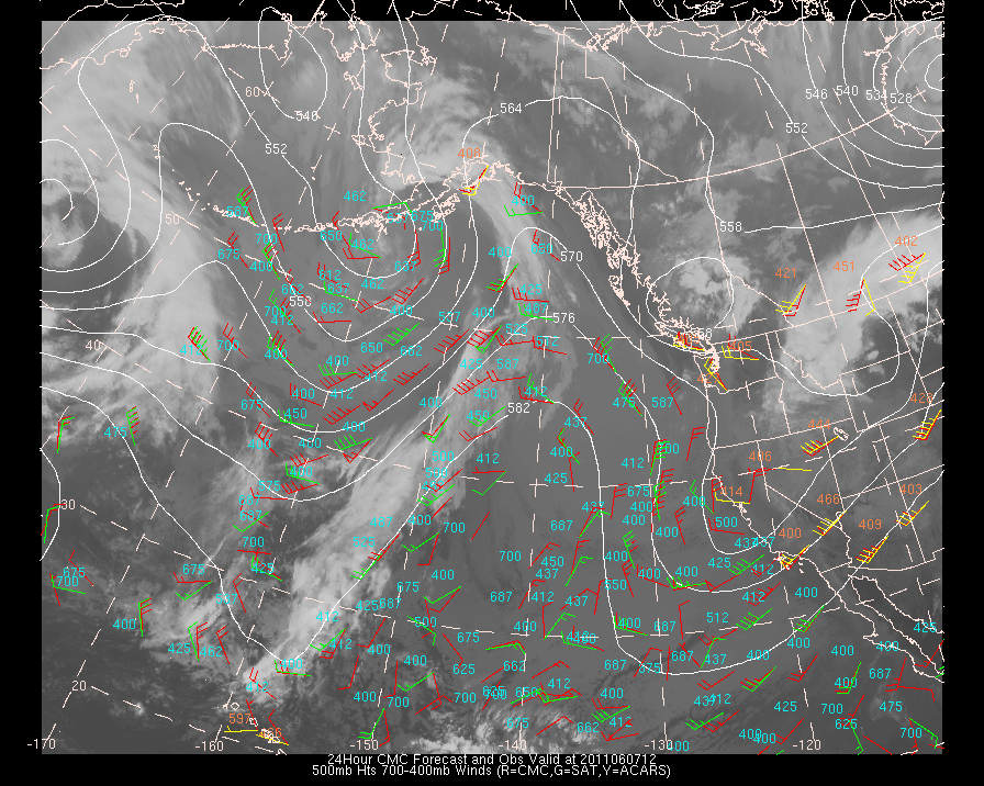
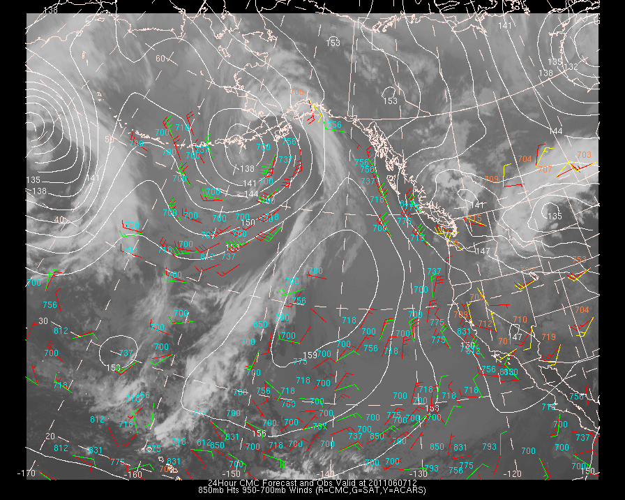
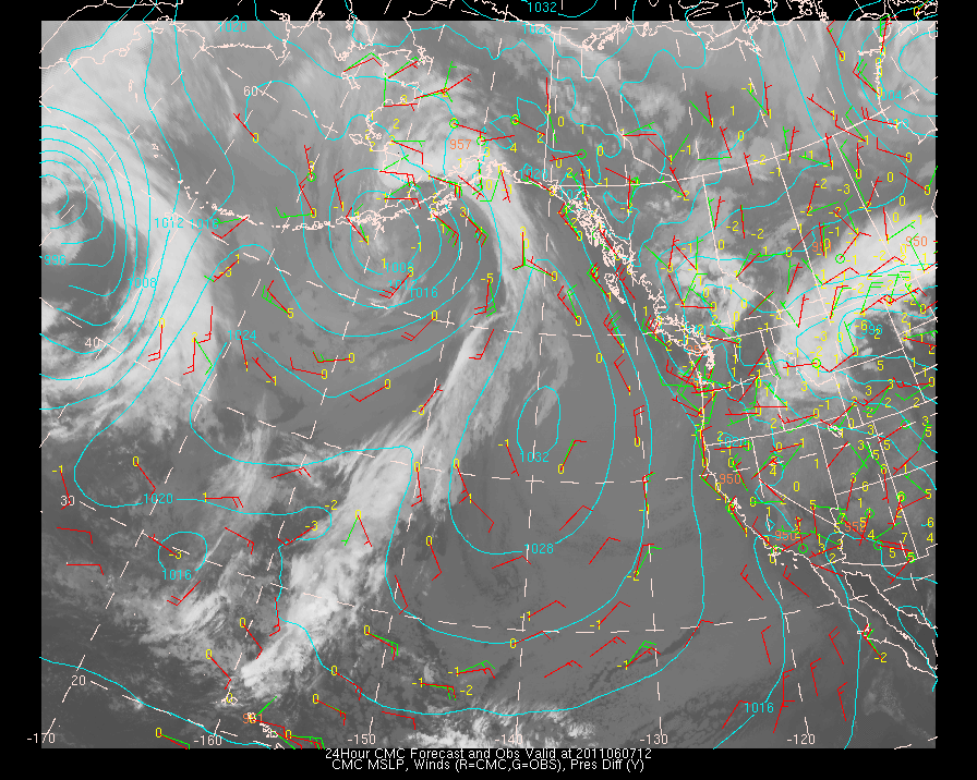
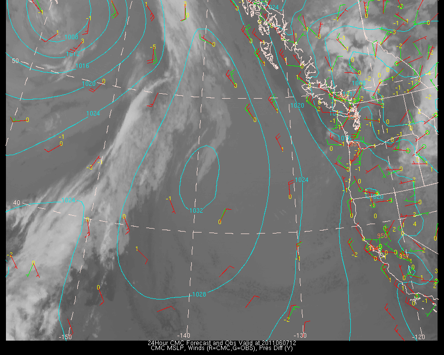
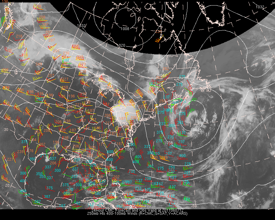
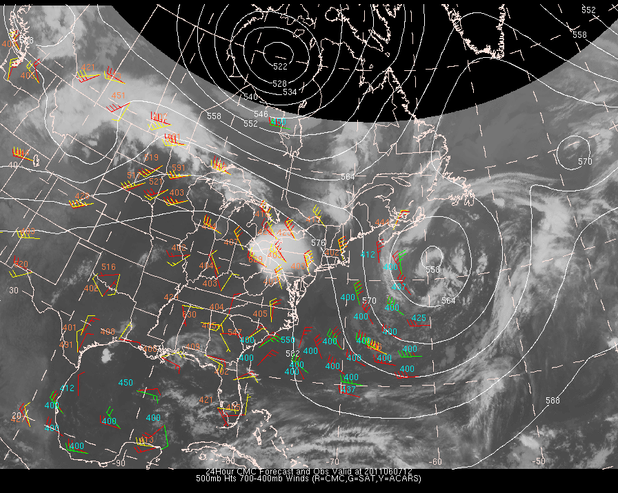
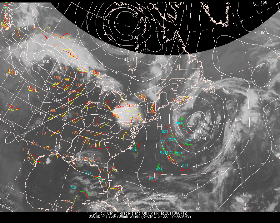
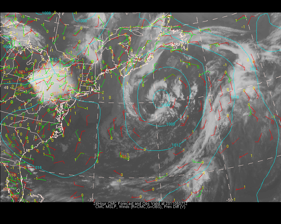
| CMC | CMC | CMC | CMC | CMC | CMC |
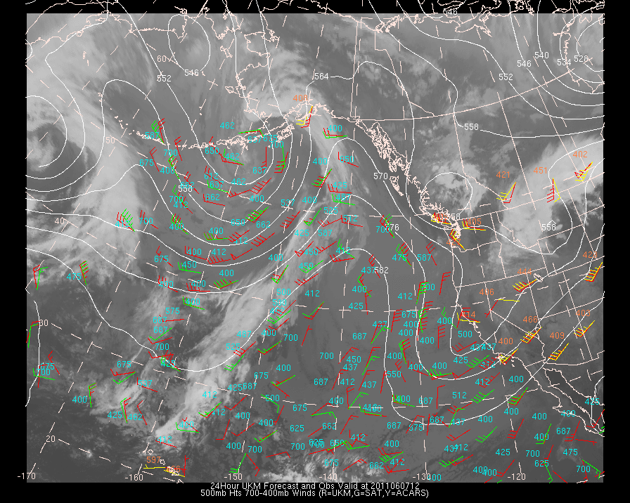
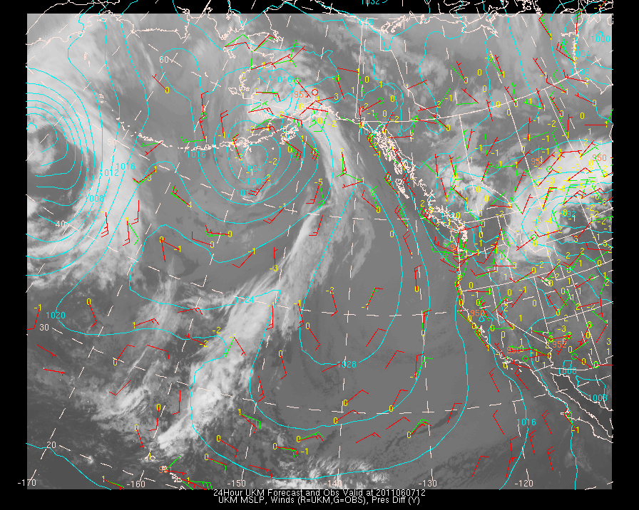
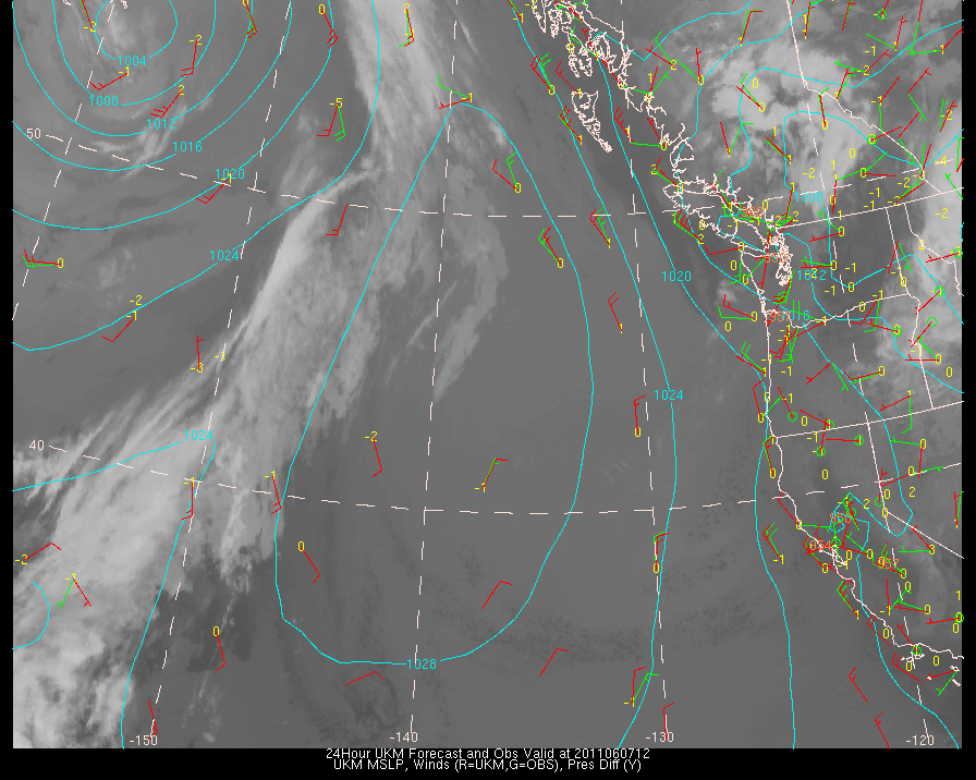
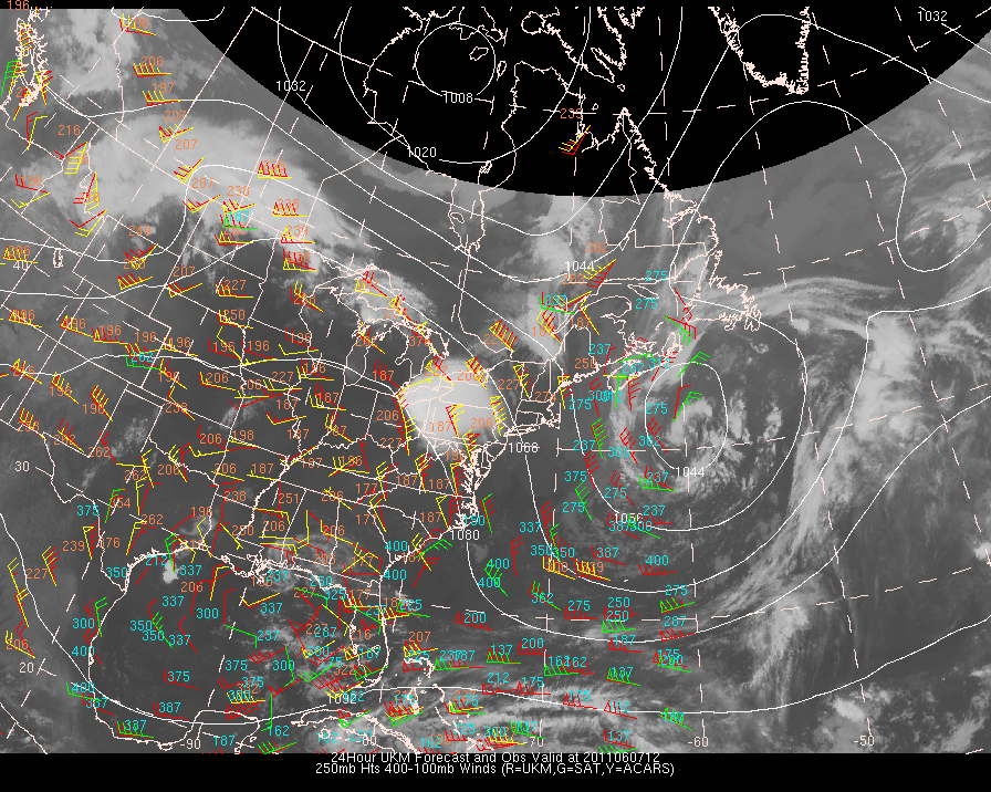
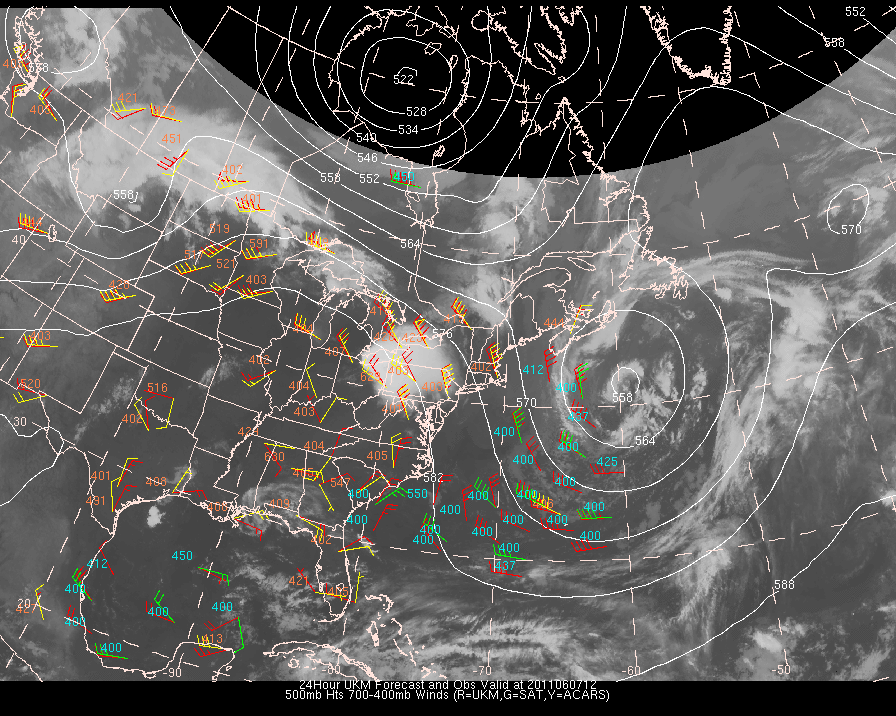
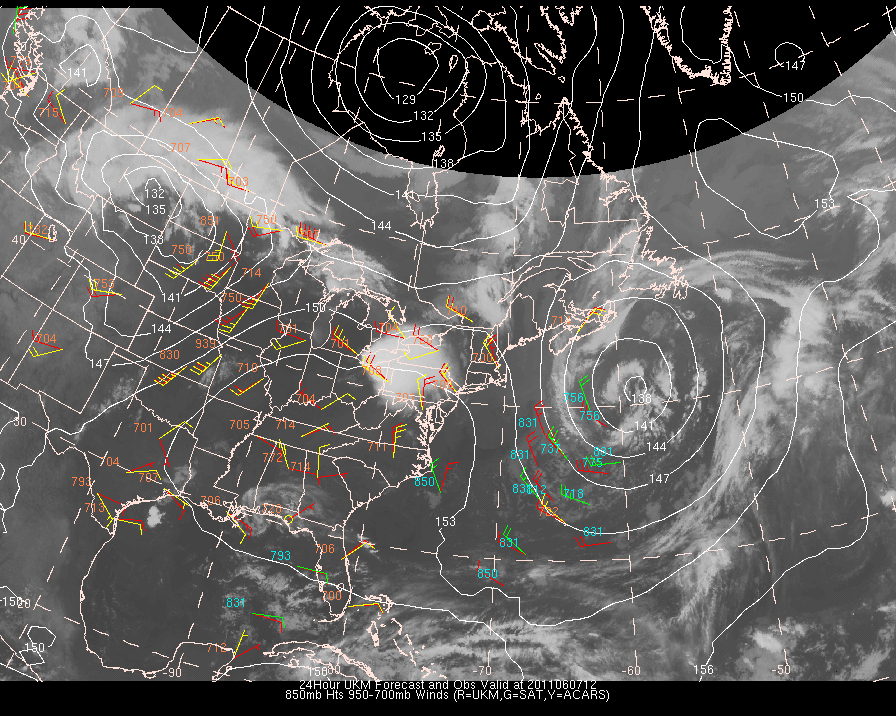
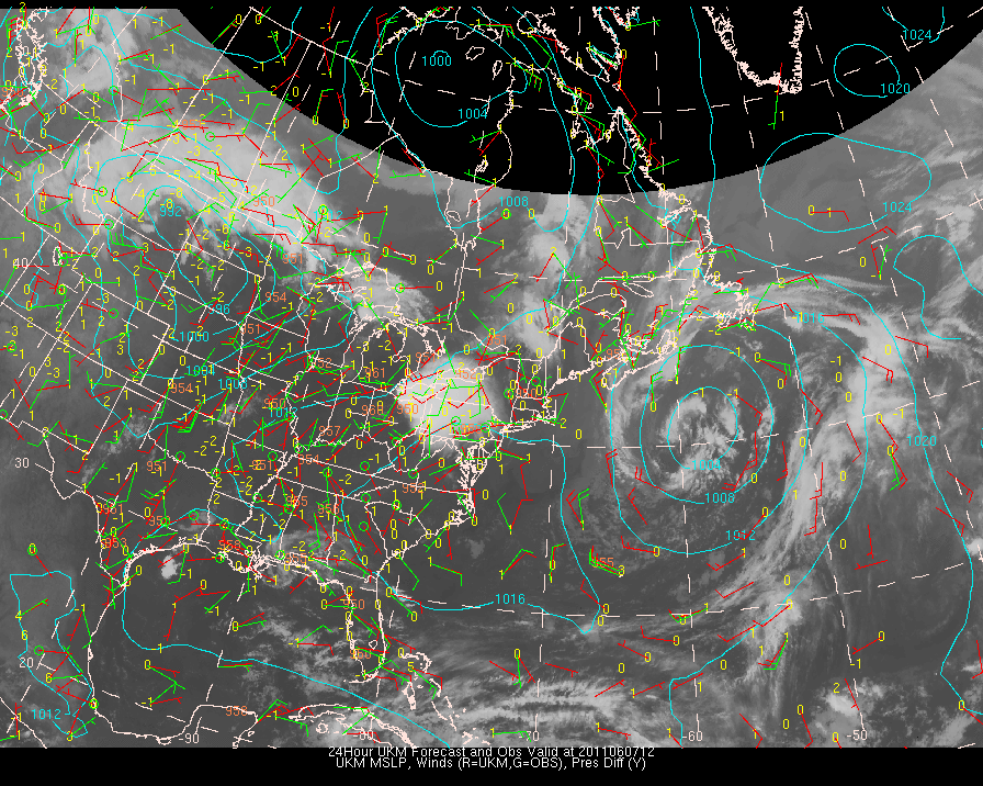
| UKMO | UKMO | UKMO | UKMO | UKMO | UKMO |
To see the individual data assets and their associated statistics click the links below:
| MODEL | Upper Level Plots (centered at 250 mb) | Mid-level Plots (centered at 500mb) | Low-Level Plots (centered at 850mb) | Surface Plots | Surface Plots (close up view) |
| ETA | ETA -- EAST | ETA -- EAST | ETA -- EAST | ETA -- EAST | ETA -- EAST |
| GFS | GFS -- EAST | GFS -- EAST | GFS -- EAST | GFS -- EAST | GFS -- EAST |
| NOGAPS | NOGAPS -- EAST | NOGAPS -- EAST | NOGAPS -- EAST | NOGAPS -- EAST | NOGAPS -- EAST |
| CMC | CMC -- EAST | CMC -- EAST | CMC -- EAST | CMC -- EAST | CMC -- EAST |
| UKMO | UKMO -- EAST | UKMO -- EAST | UKMO -- EAST | UKMO -- EAST | UKMO -- EAST |
Other Plots for West Coast
Temperature Comparisons between model and ACARS and/or Upper Air
Vector Differences between model and ACARS and/or Cloud track/water vapor winds
Statistics comparing each data source and each model
Previous
Model Run:
2011060600
Click Here
Back
to NWP Initialization/Forecast Evaluation Home
If you have comments or suggestions, email me at mcmurdie@atmos.washington.edu
This page created with Netscape Navigator Gold.