    
|
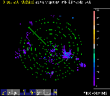
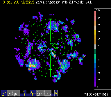
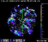
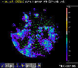
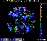
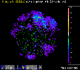
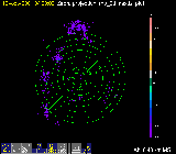
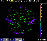
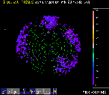
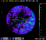
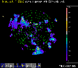
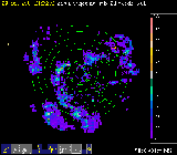
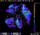
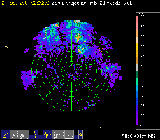
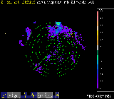
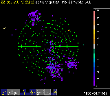
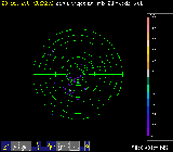
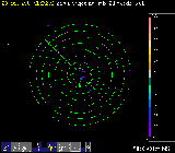
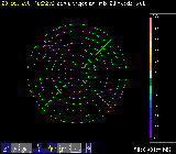
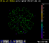
Shown below are four C-band radar reflectivity images per day. The reflectivity data are integrated between 0.4 and 1.2 km altitude. The data in the table were selected to characterize the drizzling periods, if drizzle occurred during that day. Range rings in each image are at three kilometer intervals. The "top" of the image is North, and the time is in UTC, which is approximately 6 hours ahead of local time.
Click on each thumbnail image to view a larger version. Click on the date to view a loop of radar images for that day - one image per hour.
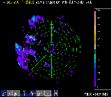
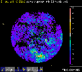
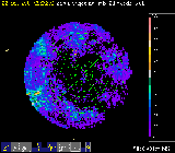
Below is a 5-minute resolution radar loop obtained during a day with particularly well sampled drizzle. The grid spacing is 10 kilometers in these images.
| 5 Minute Time Resolution Loop: | Oct 19, 2001 |
| October 12, 2001 | |||
| No Data Available | No Data Available | No Data Available |  |
| 2300 UTC | |||
| October 13, 2001 | |||
 |
 |
 |
 |
| 0000 UTC | 0100 UTC | 0200 UTC | 0300 UTC |
| October 14, 2001 | |||
 |
 |
 |
 |
| 0100 UTC | 0900 UTC | 1300 UTC | 1700 UTC |
| October 15, 2001 | |||
 |
 |
 |
 |
| 0000 UTC | 0400 UTC | 1200 UTC | 1800 UTC |
| October 16, 2001 | |||
 |
 |
 |
 |
| 1100 UTC | 1300 UTC | 1600 UTC | 1900 UTC |
| October 17, 2001 | |||
 |
 |
 |
 |
| 0900 UTC | 1300 UTC | 1800 UTC | 2300 UTC |
| October 18, 2001 | |||
 |
 |
 |
 |
| 1000 UTC | 1500 UTC | 1700 UTC | 2300 UTC |
| October 19, 2001 | |||
 |
 |
 |
 |
| 0000 UTC | 0500 UTC | 1000 UTC | 1600 UTC |
| October 20, 2001 | |||
 |
 |
 |
 |
| 1000 UTC | 1200 UTC | 2100 UTC | 2300 UTC |
| October 21, 2001 | |||
 |
 |
 |
 |
| 0200 UTC | 0700 UTC | 1500 UTC | 2100 UTC |
| October 22, 2001 | |||
 |
 |
 |
 |
| 0700 UTC | 0900 UTC | 1100 UTC | 1300 UTC |
| October 23, 2001 | |||
 |
 |
 |
 |
| 0000 UTC | 0600 UTC | 1200 UTC | 1800 UTC |
| October 24, 2001 | |||
 |
 |
 |
 |
| 0000 UTC | 0600 UTC | 1200 UTC | 1800 UTC |
| October 25, 2001 | |||
 |
No Data Available | No Data Available | No Data Available |
| 0000 UTC | |||