    
|
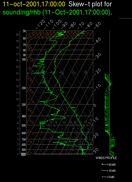
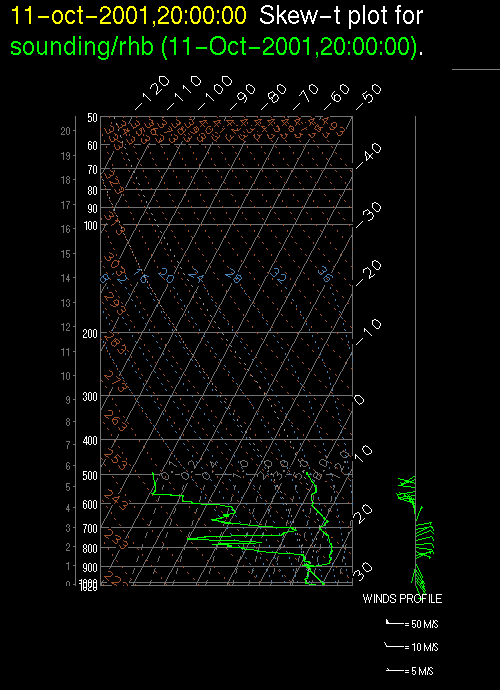
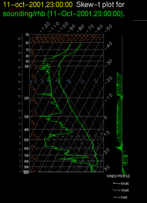
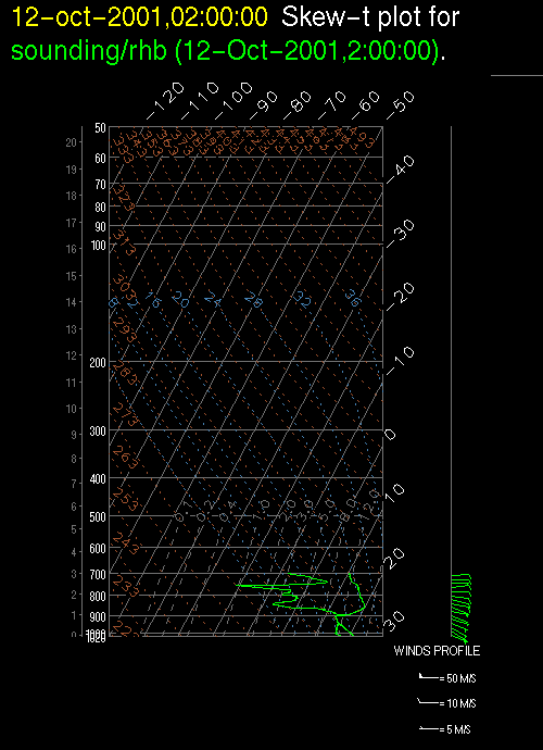
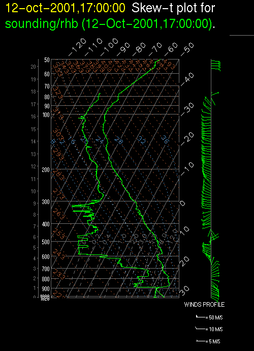
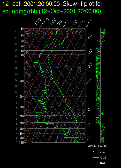
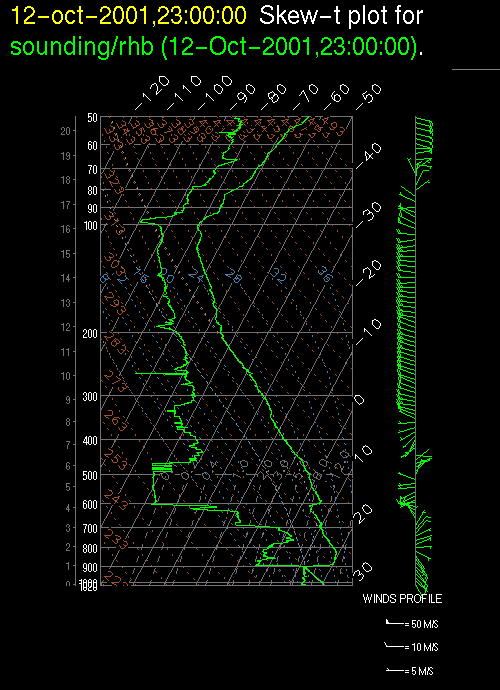
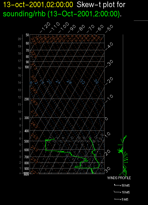
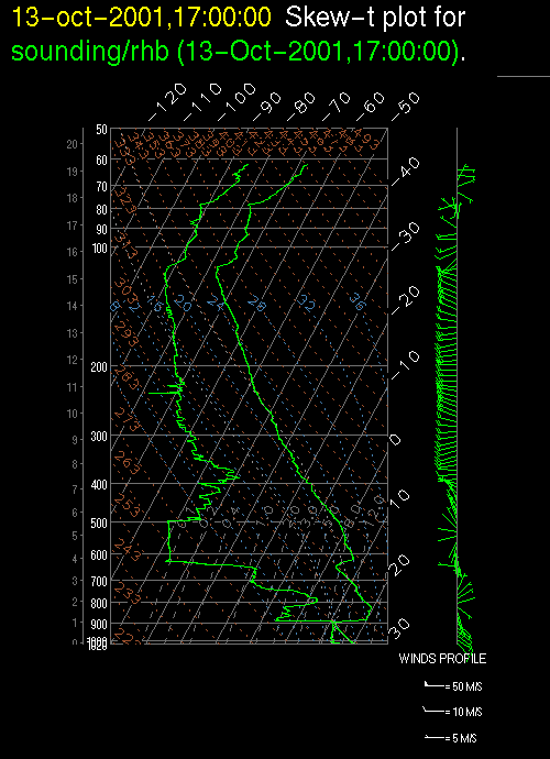
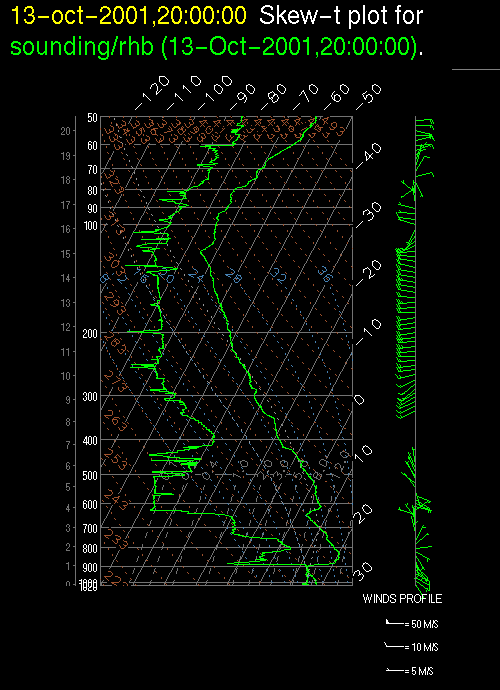
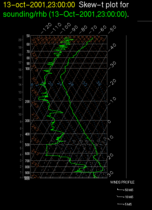
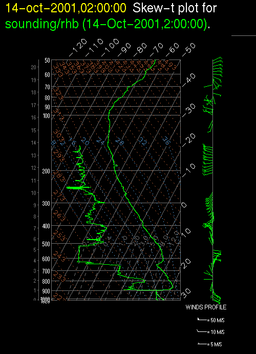
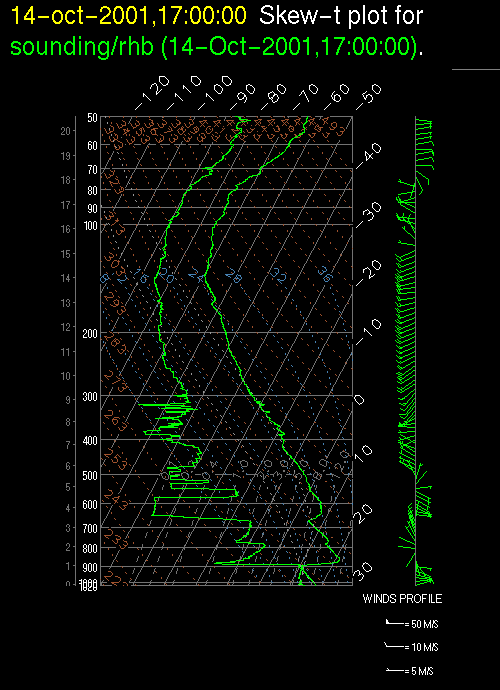
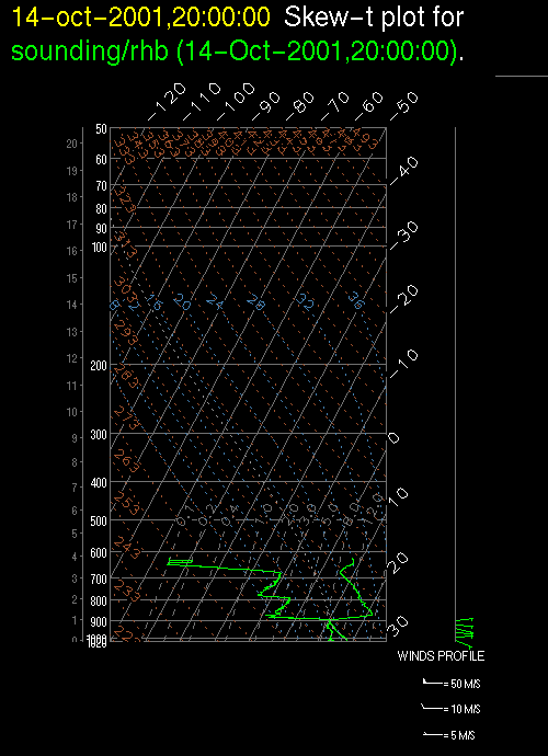
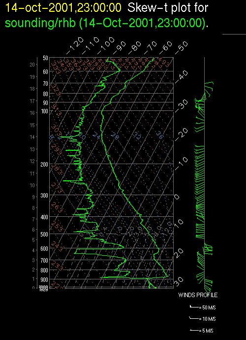
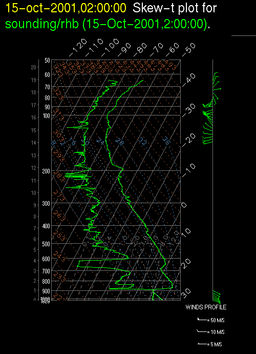
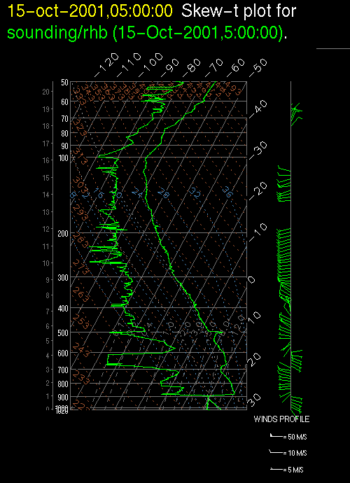
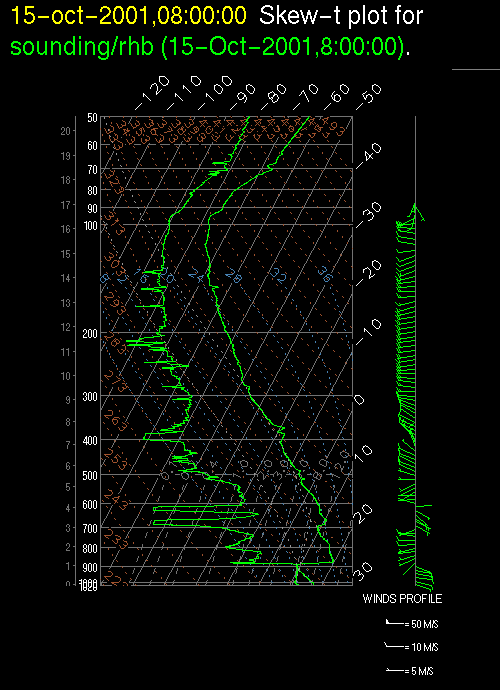
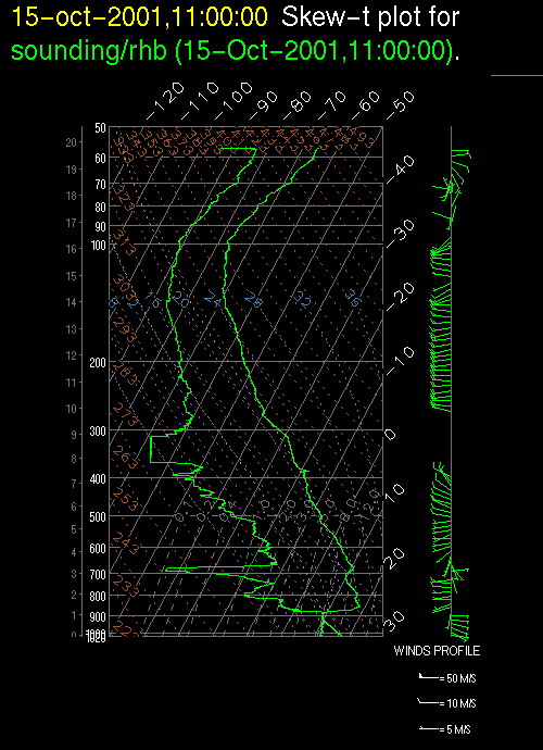
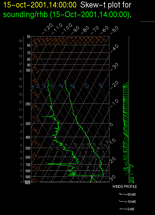
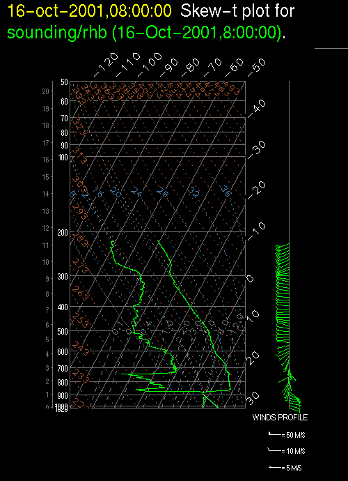
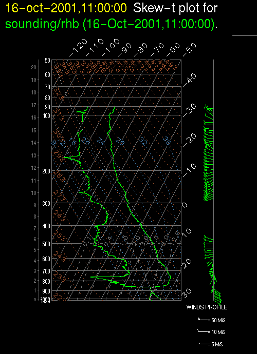
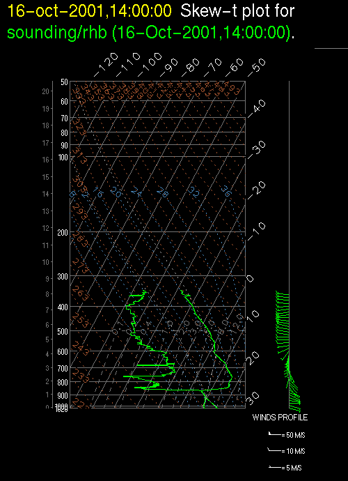
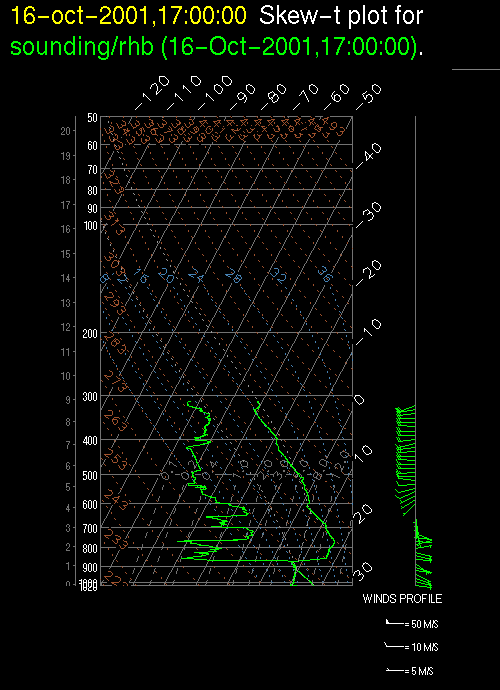
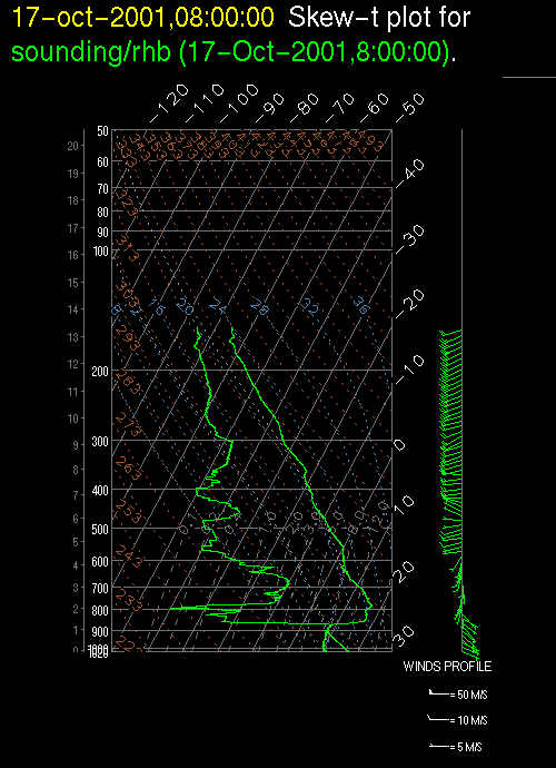
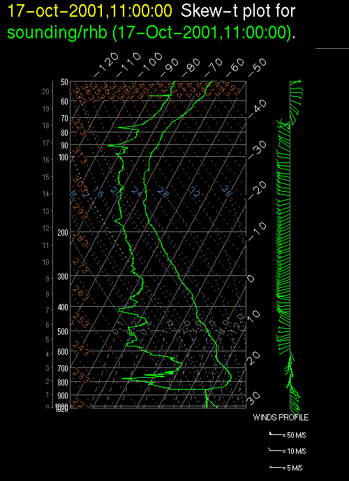
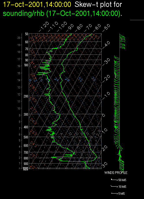
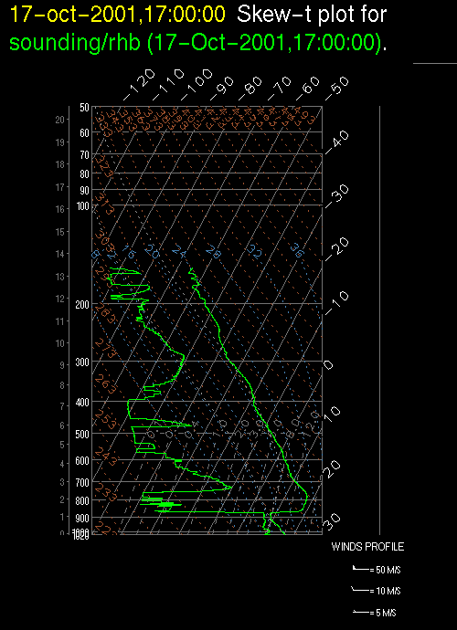
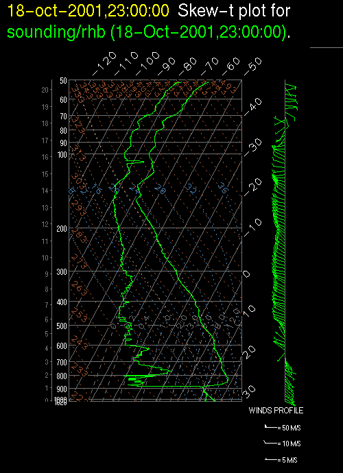
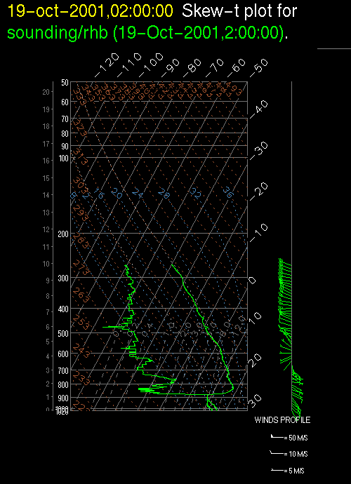
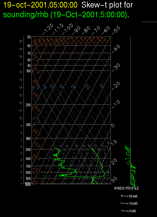
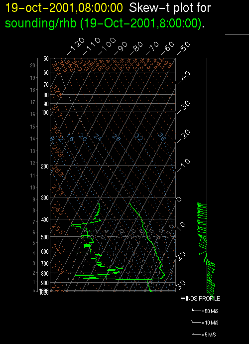
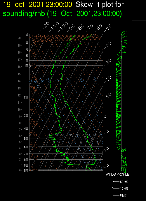
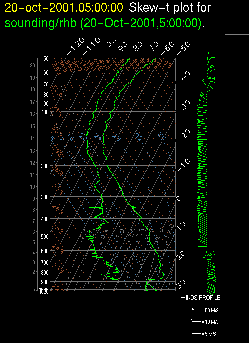
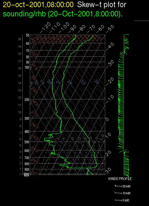
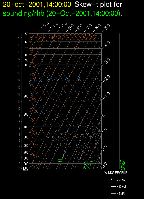
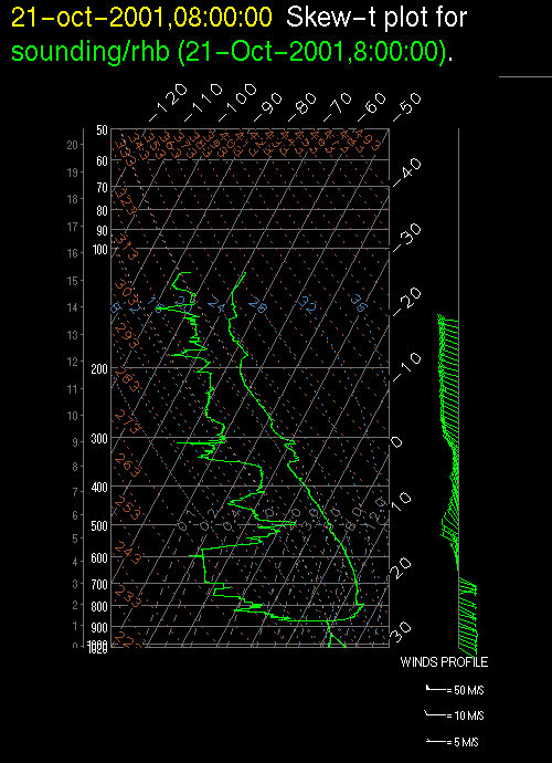
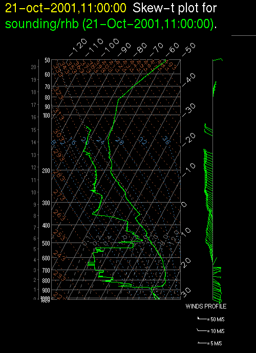
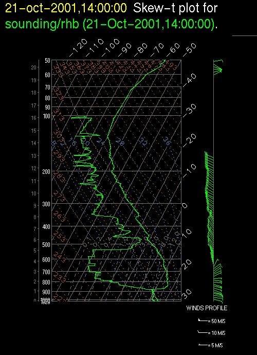
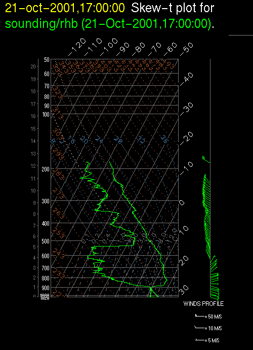
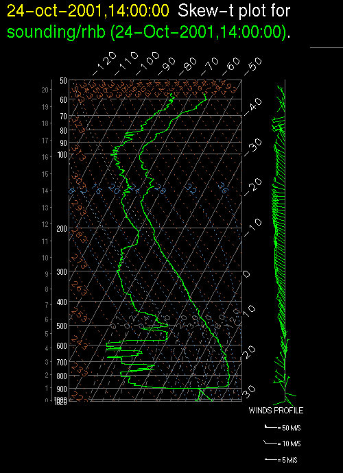
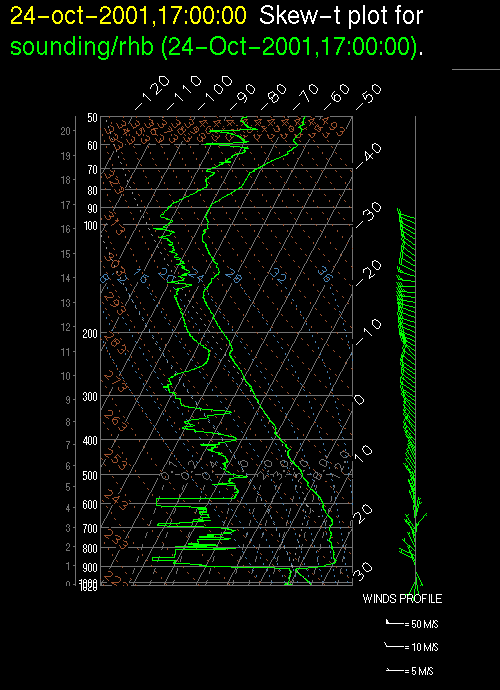
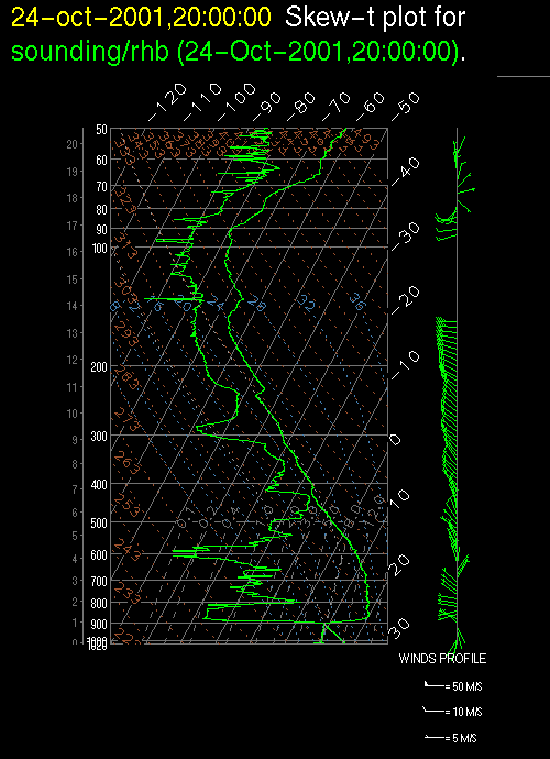
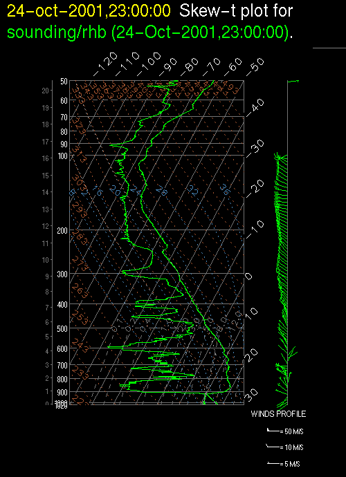
Upper air soundings, also known as rawinsondes or weather balloons were launched every three hours during most of the EPIC Sc cruise. Observed and derived parameters (described in the Data Readme Page) are included in the .dat file for each sounding. The data here are quality controled, as described in the Quality Control Description Page.
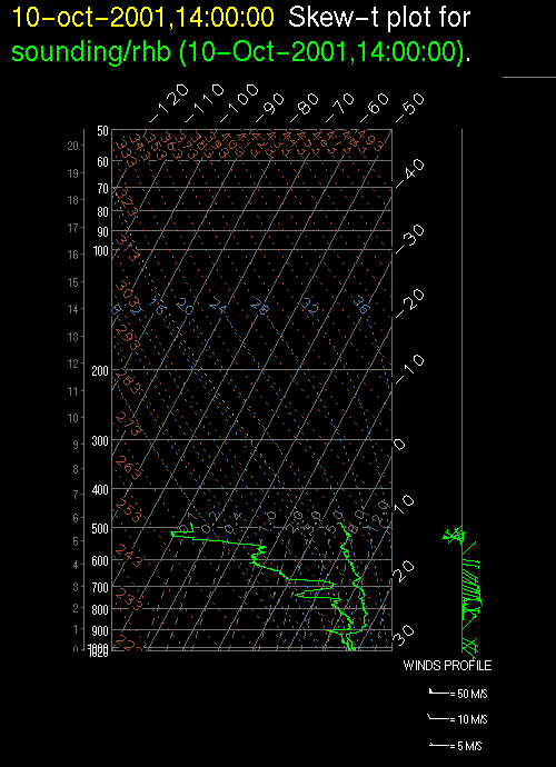
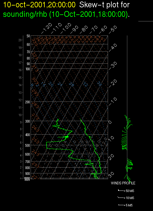
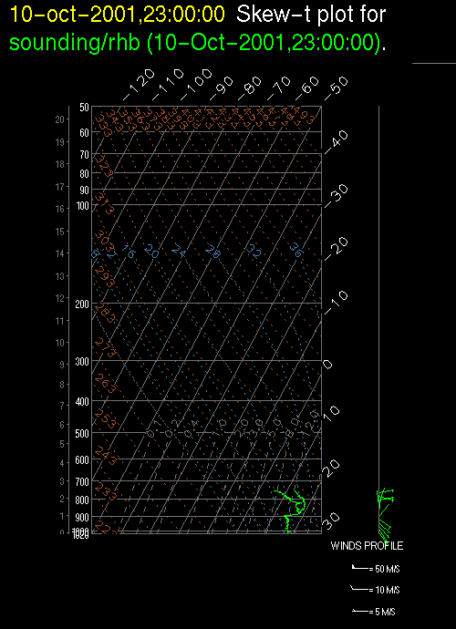
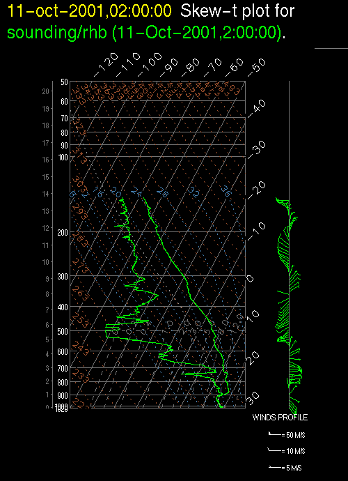
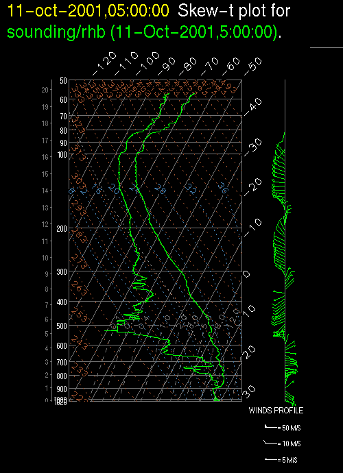
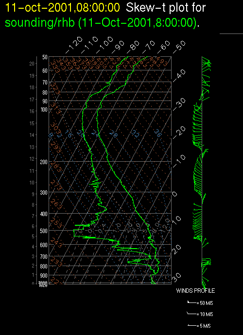
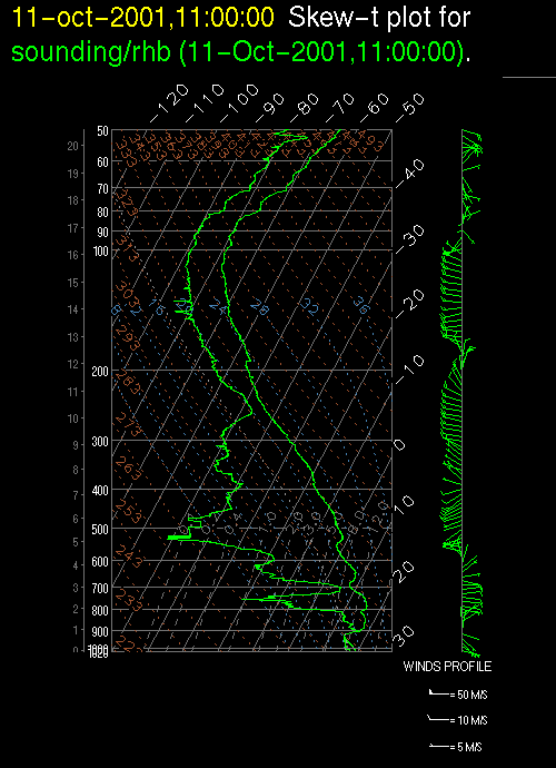
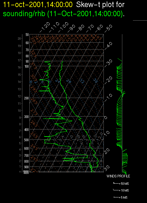
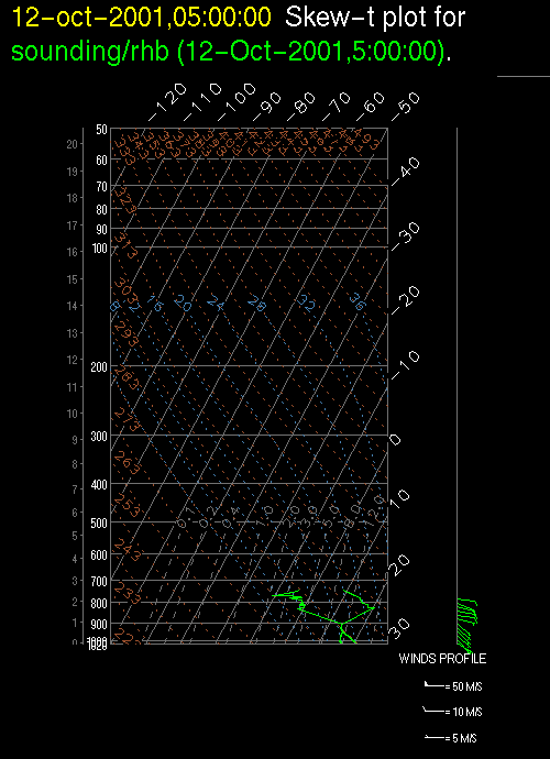
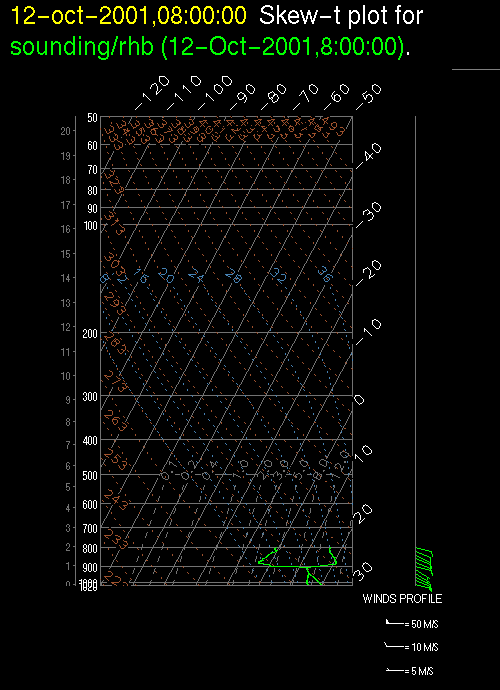
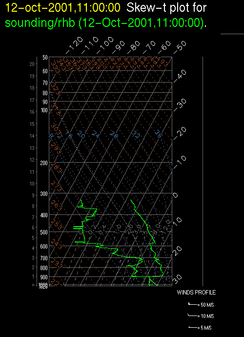
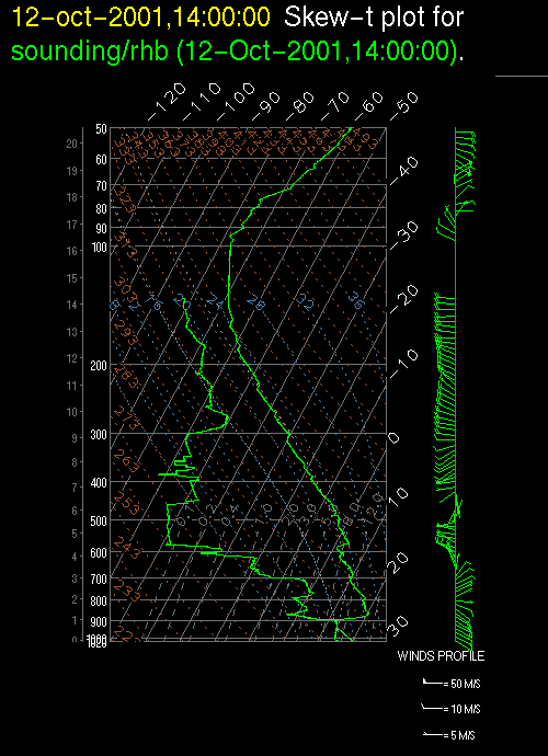
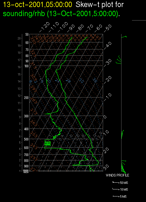
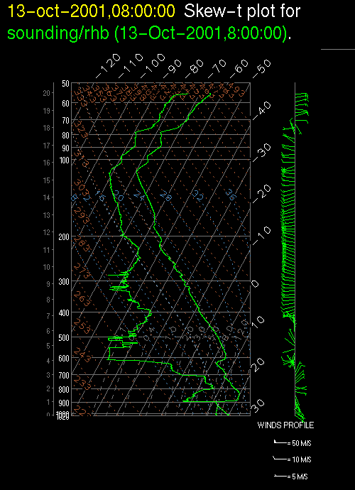
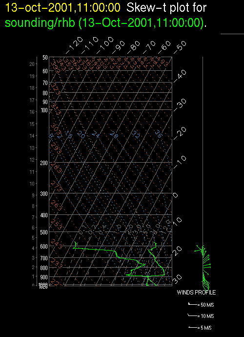
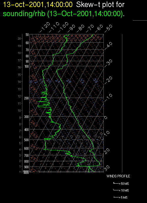
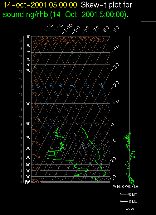
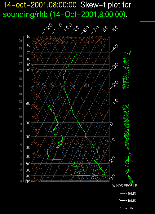
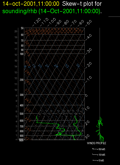
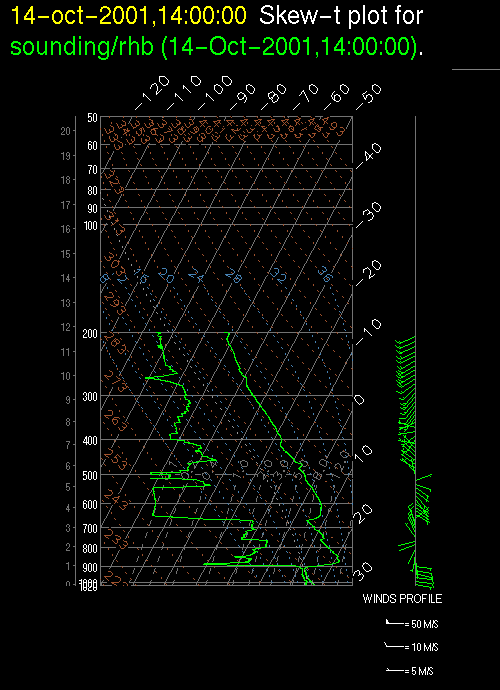
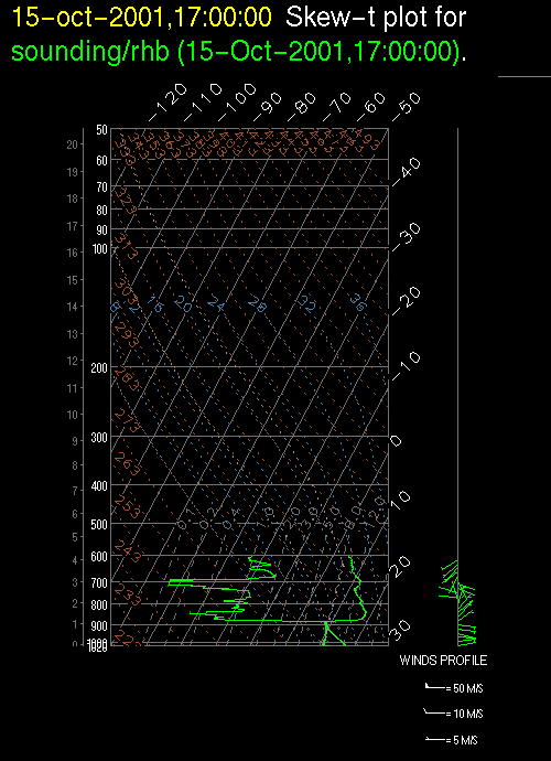
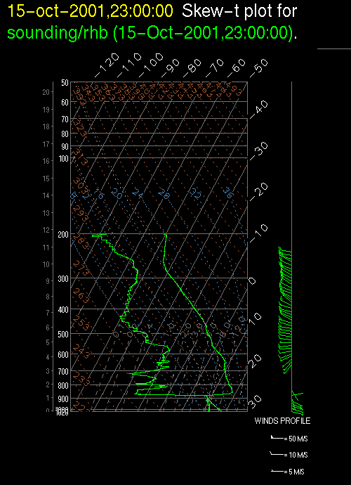
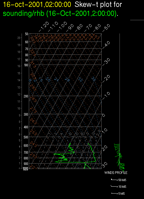
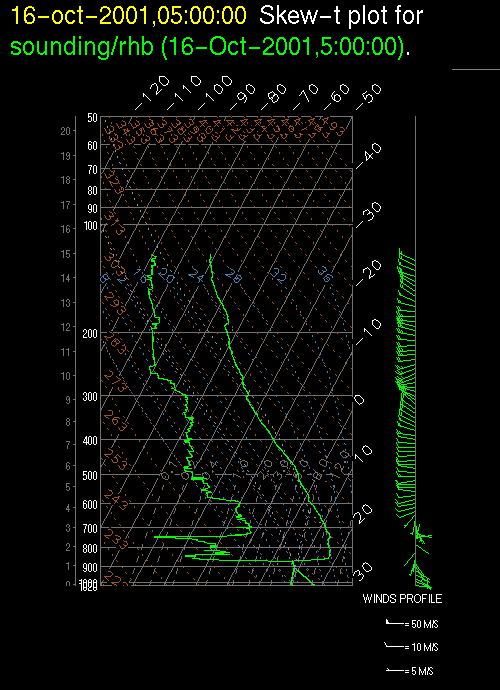
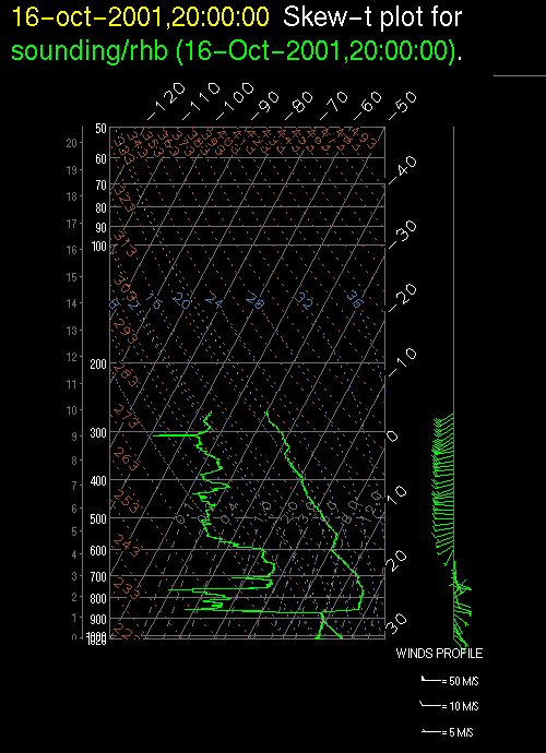
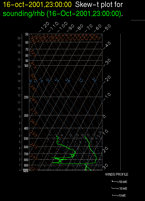
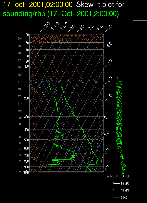
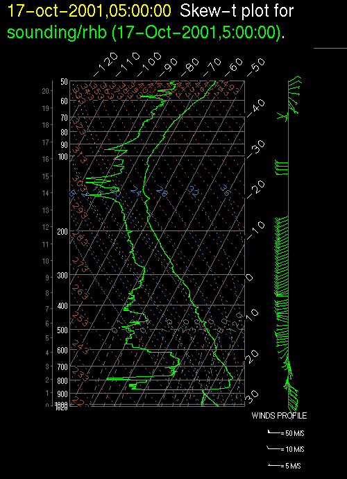
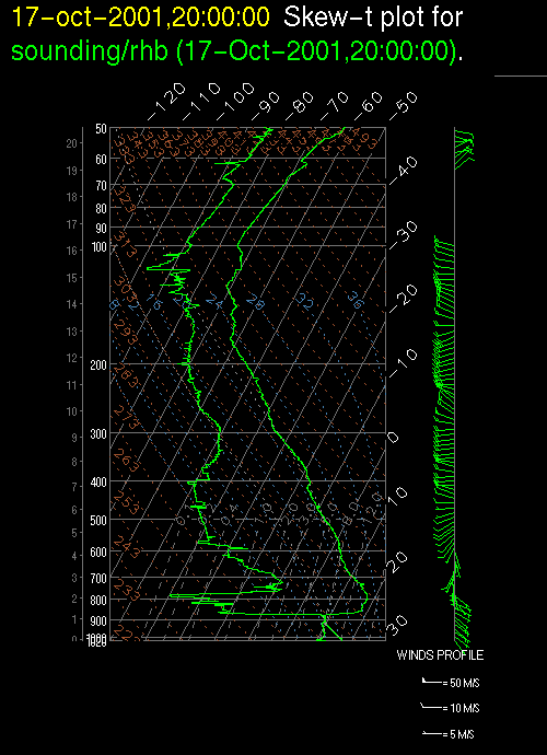
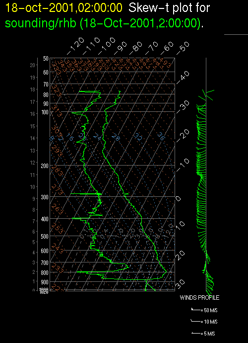
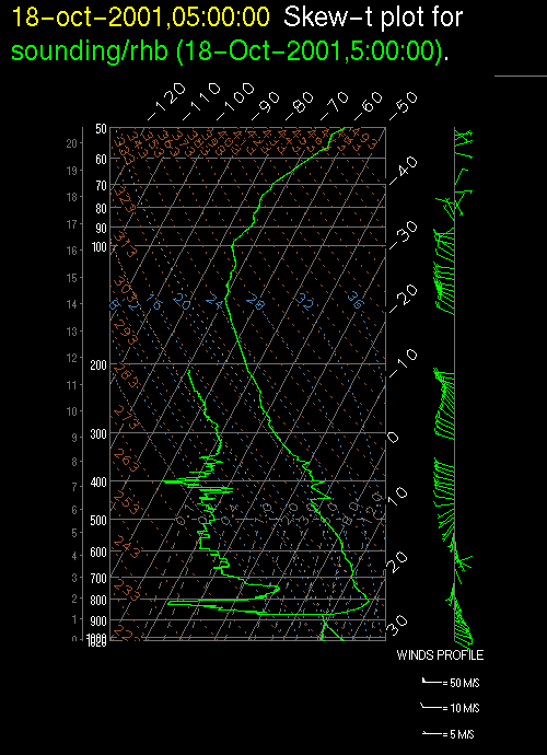
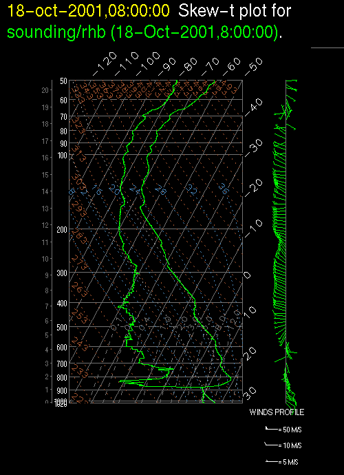
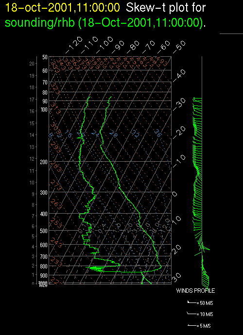
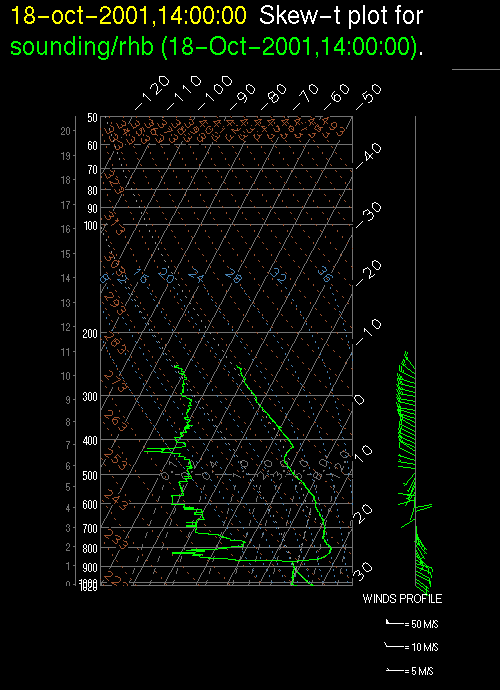
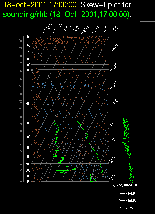
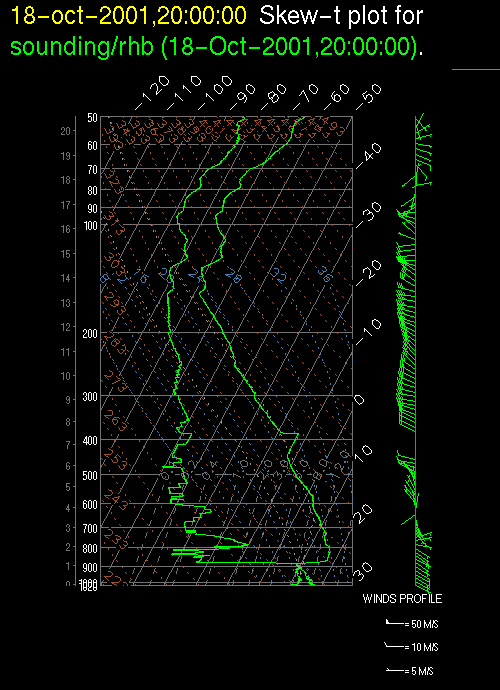
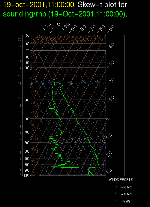
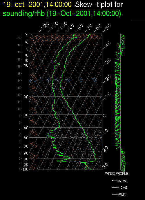
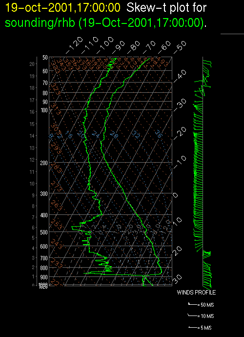
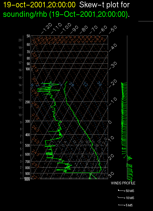
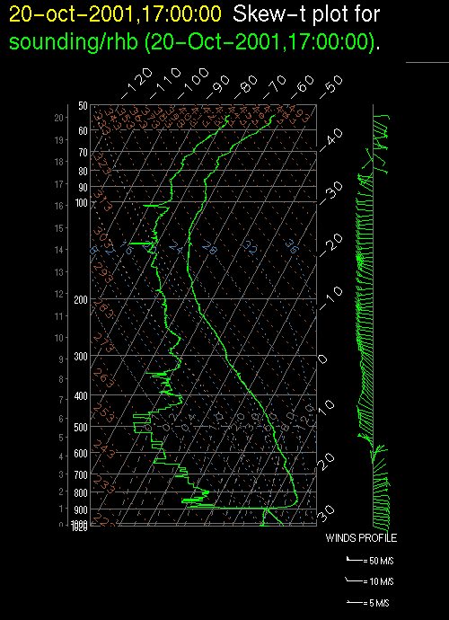
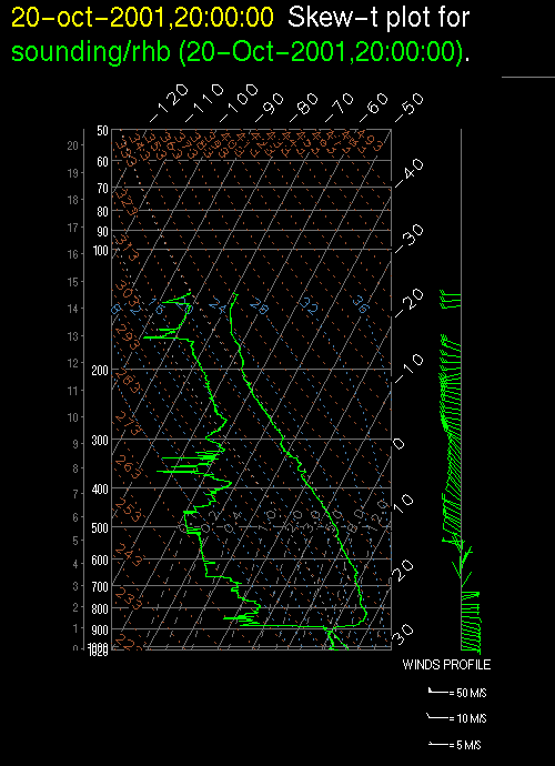
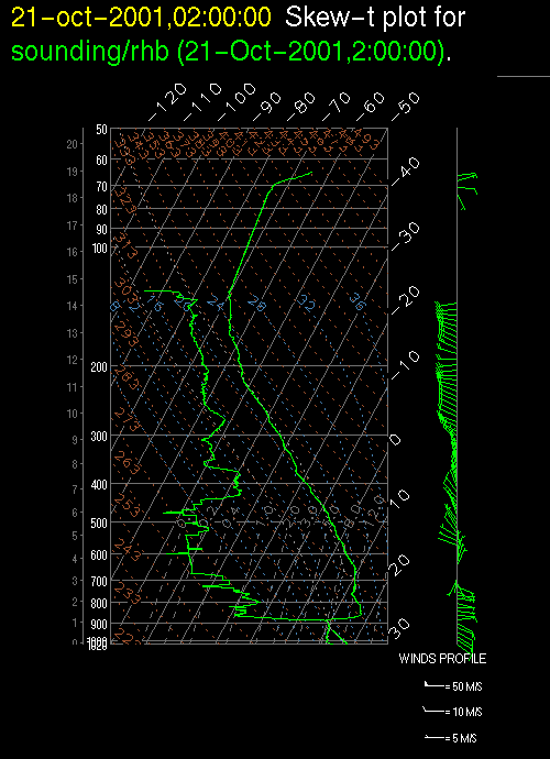
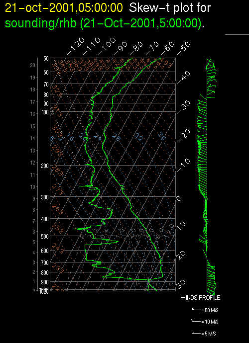
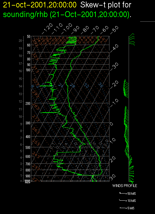
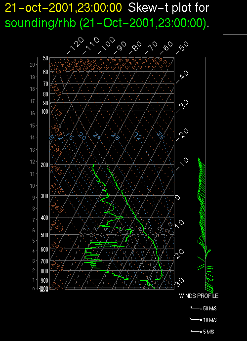
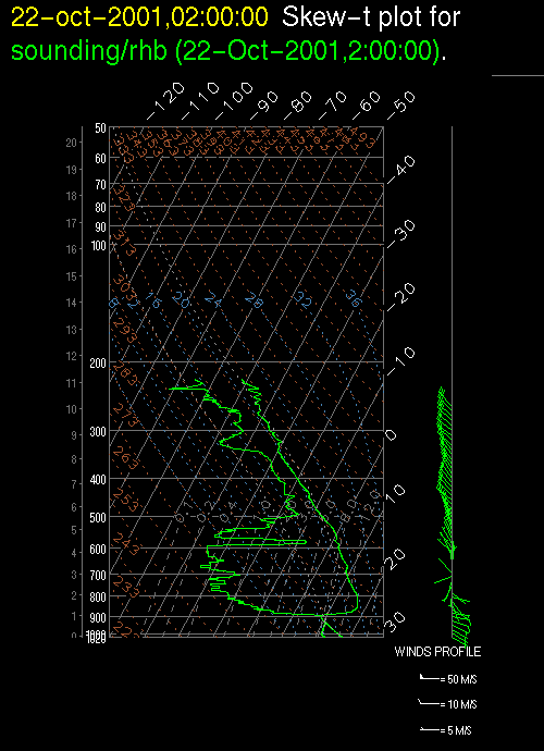
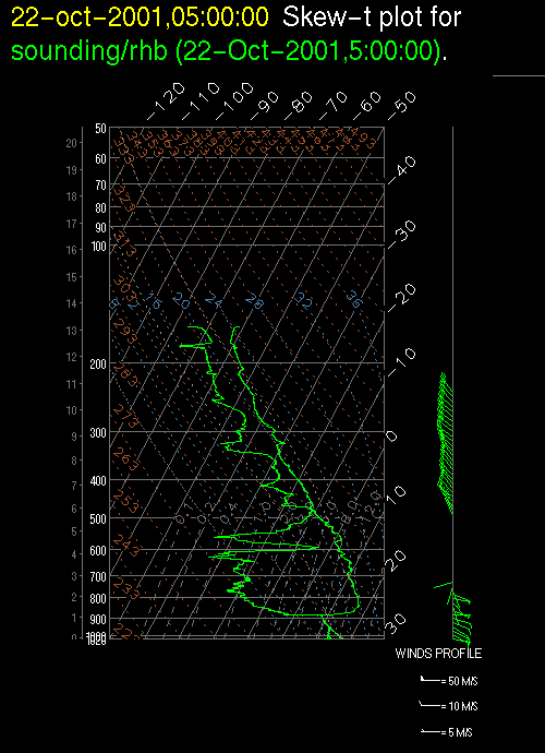
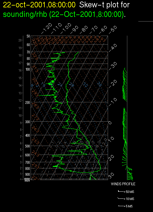
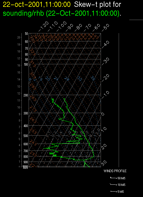
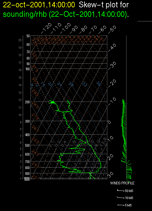
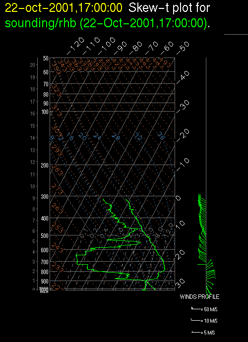
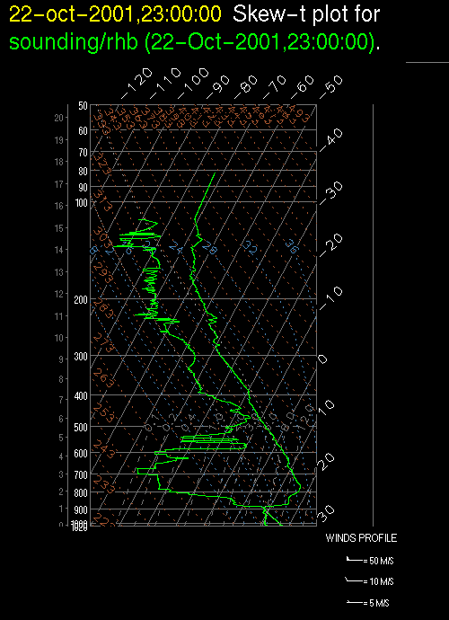
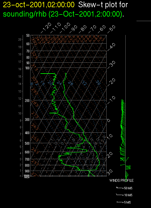
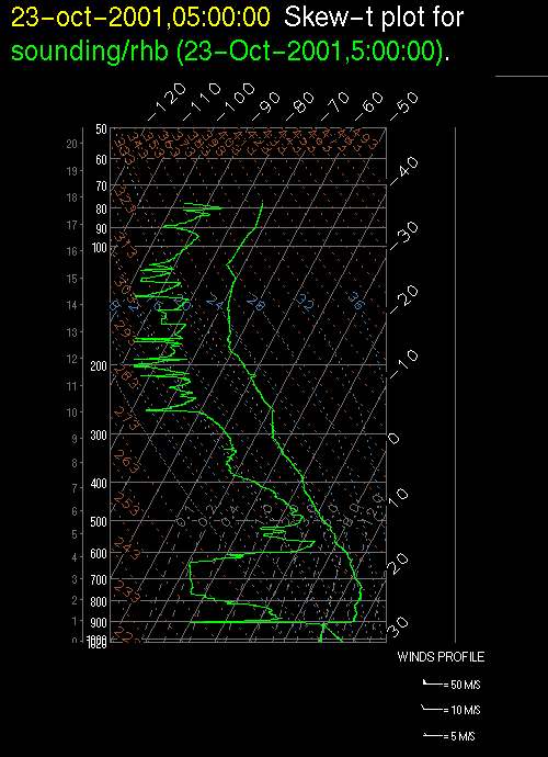
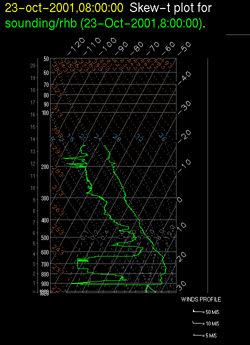
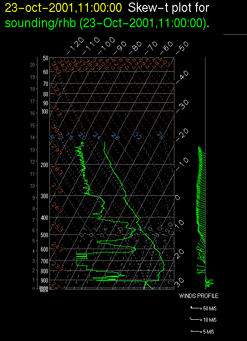
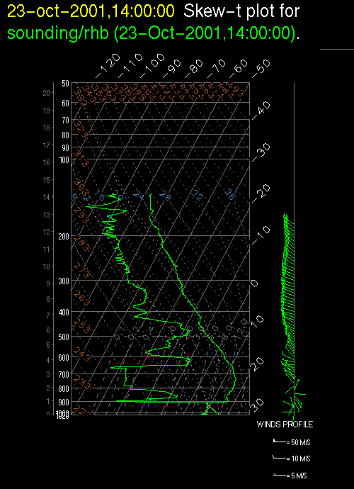
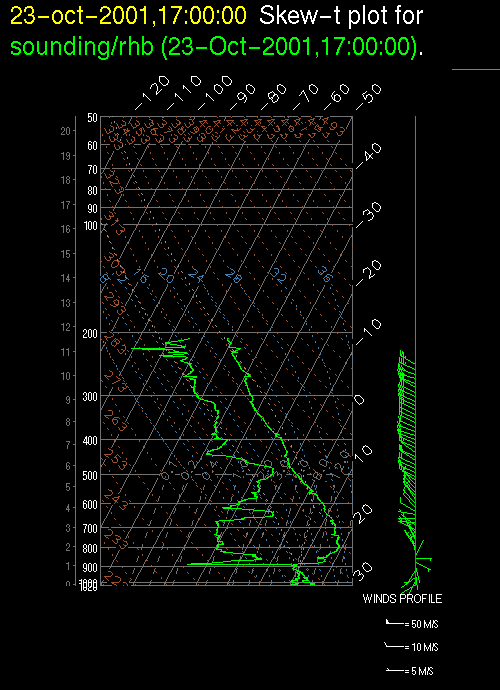
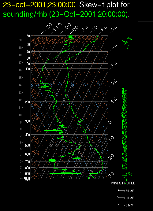
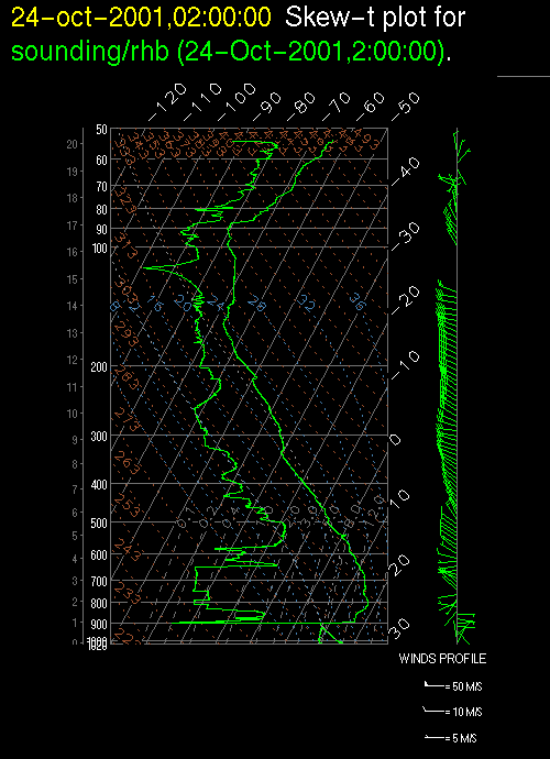
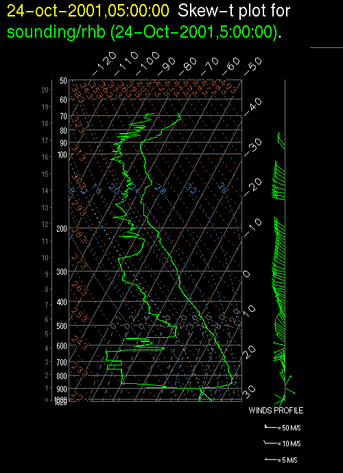
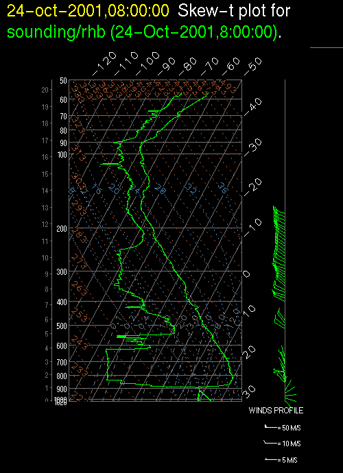
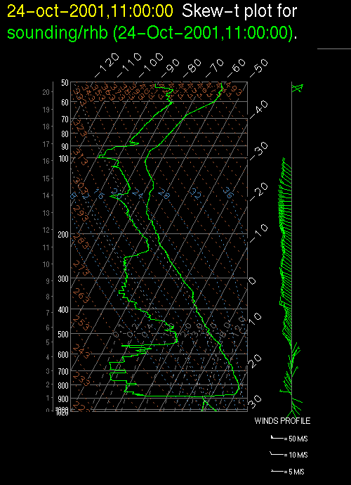
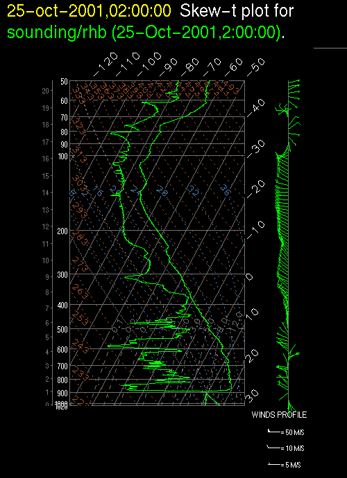
The .gif files are skew-T plots of temperature, dew-point temperature, and wind for each sounding. The far left-hand axis is kilometers, the next left-hand axis is pressure in millibars, and the right-hand and upper axes are temperature in degrees C. Times are in UTC, which is approximately six hours ahead of local time.
To access all of the EPIC Sc sounding data obtained on the RHB in a single file (ASCII or CDF format), please visit the Data Management at JOSS site.