Winter 2002
Global View
500 mb Heights (Polar View, -6d -> +72h)
250 mb Winds/Heights (Polar View, -6d -> +72h)
NCEP
Ensemble Forecast 500 mb heights
The Pacific Ocean and North America
500 mb Heights (Seattle View, -6d -> +72h)
500 mb Heights/Sea-level pressure (Seattle View, -6d -> +72h)
Sea-level pressure and Temperature (Eta model)
Sea-level pressure and 6-hour precipitation (Eta model)
Satellite view of central US, IR latest 12 hours
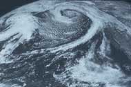
Satellite view of North Pacific and west coast of North America--Enhanced IR latest 12 hours
Satellite view of North Pacific and west coast of North America--Water Vapor latest 12 hours
Satellite
view of North Pacific and west coast of North America--Visible since Midnight
PST
The Pacific Northwest
Washington State Surface Map latest 6 hours
Puget Sound Surface Map latest 6 hours
Quillayute Sounding, Spokane Sounding, and Salem Sounding
MM5 model 12-km domain (3-hour precip and 10-m winds)
MM5 1000-ft temperatures, 10-m winds, and SLP
NWS
Forecast Discussion and explanation
of abbreviations
Seattle
Comparison of recent observations with climatology
Other Weather Data
UW Weather and Climate Homepage