| Mathematics | |
Triangulation and Interpolation of Scattered Data
MATLAB provides routines that aid in the analysis of closest-point problems and geometric analysis.
| Function |
Description |
|
Convex hull. |
|
Delaunay triangulation. |
|
3-D Delaunay tessellation. |
|
Nearest point search of Delaunay triangulation. |
|
True for points inside polygonal region. |
|
Area of polygon. |
rectint |
Area of intersection for two or more rectangles. |
|
Closest triangle search. |
|
Voronoi diagram. |
This section applies the following techniques to the seamount data set supplied with MATLAB:
See also Tessellation and Interpolation of Scattered Data in Higher Dimensions.
Convex Hulls
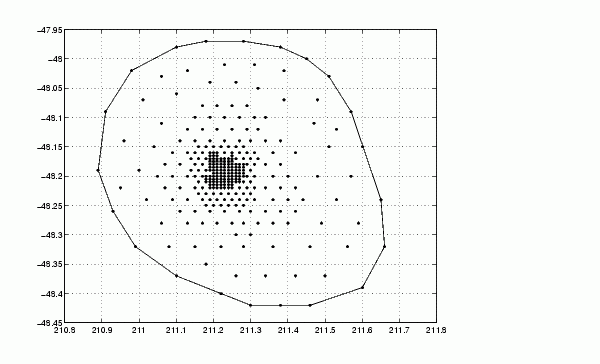
The convhull function returns the indices of the points in a data set that comprise the convex hull for the set. For example, to view the convex hull for the seamount data.
load seamount
plot(x,y,'.','markersize',10)
k = convhull(x,y);
hold on, plot(x(k),y(k)), hold off
grid on
Delaunay Triangulation
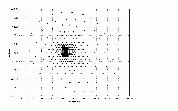
The delaunay function returns a set of triangles such that no data points are contained in any triangle's circumcircle. To try delaunay, load the seamount data set and view the data as a simple scatter plot.
load seamount
plot(x,y,'.','markersize',12)
xlabel('Longitude'), ylabel('Latitude')
grid on
Note For information on seamount, see Parker [2], pp 17-40.
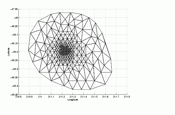
Apply Delaunay triangulation and overplot the resulting triangles on the scatter plot.
tri = delaunay(x,y);
hold on, trimesh(tri,x,y,z), hold off
hidden off; grid on
xlabel('Longitude'); ylabel('Latitude')
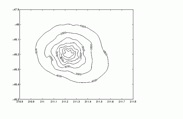
[xi,yi] = meshgrid(210.8:.01:211.8,-48.5:.01:-47.9);
zi = griddata(x,y,z,xi,yi,'cubic');
[c,h] = contour(xi,yi,zi,'c-'); clabel(c,h)
The arguments for meshgrid encompass the largest and smallest x and y values in the original seamount data. To obtain these values, use
min(min(x))
max(max(x))
min(min(y))
max(max(y))
Closest-Point Searches. You can search through the Delaunay triangulation data with two functions:
dsearch finds the point closest to a point you specify.tsearch, given a point (xi,yi), returns an index into the delaunay output that specifies the enclosing triangle for the point.Voronoi Diagrams
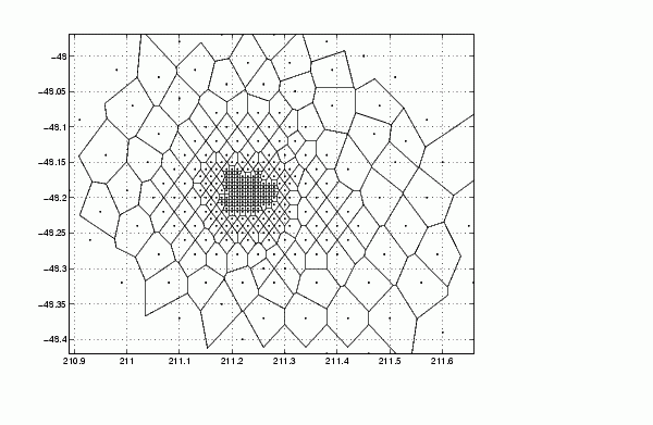
Voronoi diagrams are a closest-point plotting technique related to Delaunay triangulation. Use the voronoi function to produce the Voronoi diagram for the seamount data.
load seamount
voronoi(x,y)
grid on
| | Interpolation and Multidimensional Arrays | Tessellation and Interpolation of Scattered Data in Higher Dimensions | |