Research
Tropcial tropopause layer cirrus clouds
My research focuses on tropical cirrus clouds, especially those in the tropical tropopause layer (TTL).
This work is supported by the NSF PIRE cirrus grant. I have also received support from GSEE (formerly GO-MAP) and ARCS foundation as a ARCS Seattle chapter fellow.
Tropical clouds in GSRMs
Simulated cirrus vary greatly between models

Background
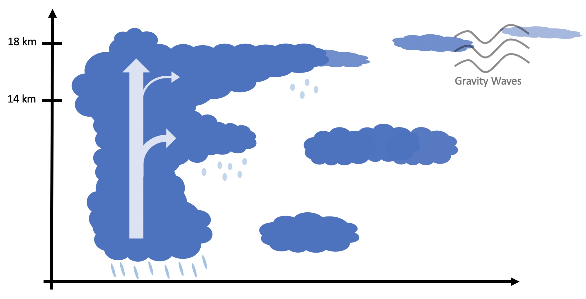
Tropospheric air enters the stratosphere mostly in the tropics. The TTL acts like a gateway to the stratosphere for many atmospheric gases and water vapor. The tropopause has been historically portrayed as a distinct boundary separating air masses in the troposphere and the stratosphere, commonly defined using a sharp increase in lapse rater or, more simply, as the cold point in the temperature profile. However, in the tropical atmosphere, there is a more gradual transition from the well stirred troposphere to the highly stable stratosphere. This region is called the tropical Tropopause Transition Layer (TTL). It occurs in the tropics at elevations of 14km to 18km where there is regular deep convection that brings moisture into the TTL and large-scale ascent due to the Brewer-Dobson Circulation and the uplifting of the Hadley cell.
Current limitations
With satellites, thin cirrus are missed by radars but picked up by lidars; even then, satellites like CALIPSO only pass a certain location twice a day. The data gathered from CALIPSO's lidar are a like a curtain, picking up vertical information along a narrow horizontal path. While the polar regions are well covered, there are large gaps in the tropics due the its polar orbit. Therefore, it is impossible to rigorously study cirrus evolution from such satellites. Geostationary satellites also pose problems for studying properties of cirrus because they do not retrieve any vertical information or thin cirrus. Aircraft data is another method to measure TTL ice processes and vertical velocities; however, the data is sparse and does not correspond to our period/area of interst.
Some results
Using five of the DYAMOND models, I analyzed how the processes in the TTL affect top of atmosphere radiation. Specifically, I'm using the FV3-3.25km, ICON-2.5km, NICAM-3.5km, GEOS-4km, and SAM-4km models. They all have high vertical resolution, so the TTL is well resolved. They also populate the tropics with different types of clouds. For example, ICON has much less deep convective events than FV3, but NICAM has the most cloud ice overall. Despite these differences derived from the microphysics and dynamics schemes, Global Storm Resolving Models (GSRMs) provide unique insight to processes in the TTL involving cirrus.

Specifically, I am focusing on the effects over oceanic regions, specifically three 10° x 10° boxes in the tropics: two over the Tropical Western Pacific (TWP) and one over the Sahel in Western Africa. The first site is directly over the warmest SSTs in the world spurring almost-constant convection. The second site is at the edge of the warm pool where there is less convection but lots of cirrus. These two regions are climatically important because it was been shown that the positive and negative cloud radiative effects (CRE) nearly cancel over the TWP in observations (e.g. Hartmann et al., 2017). The third region over the Sahel offers a great comparison between nearly constant weak oceanic convection and infrequent, strong convection over land. These results are published in a two part sequence (Nugent et al., 2022, Turbeville et al., 2022)
How much does microphysics matter for simulating tropical cirrus clouds?
Microphysics parameterizations account for a large spread in models due to their representation of cirrus clouds
Motivation
From my earlier research using the DYAMOND models, we saw that the models predicted quantities related to cirrus clouds such as ice water content, height, and lifetime vary significantly among the models. Since each model has different microphysics and dynamics used, we perform a microphysics sensitivity study using P3 microphysics in the Simple Cloud Resolving E3SM Atmosphere Model (SCEAM). This is ongoing research which will be present in the summer of 2023.