
In contrast to the ITCZ, which is a manifestation of the rising branch
of the Hadley circulation, the marine stratus region is characterized
by large-scale atmospheric subsidence associated with the descending
branch of the Hadley circulation. Large-scale subsidence, low-level
stratus clouds, sea surface temperature, atmospheric turbulence, and
radiation interact with one another to maintain a persistent, strong
inversion separating the boundary layer from the free atmosphere
(Albrecht 1989; Rogers et al. 1995). The distribution and amount of
drizzle within marine stratus clouds have important implications since
numerical models often assume that potential temperature and total
water are conserved (Wyant 1997). Our ad hoc objectives in the marine
stratus region were to map the nature and areal extent of the marine
stratocumulus drizzle in the vicinity of the ship using C-band radar
and to characterize the associated atmospheric and upper-ocean
environment. These measurements will aid in improving the
representation of marine stratus drizzle in models and open a new
research direction in which sensitive precipitation radars are added
to the tools used to study oceanic stratus.
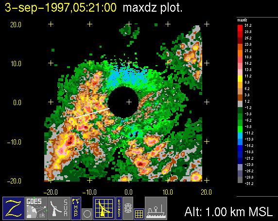
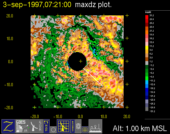
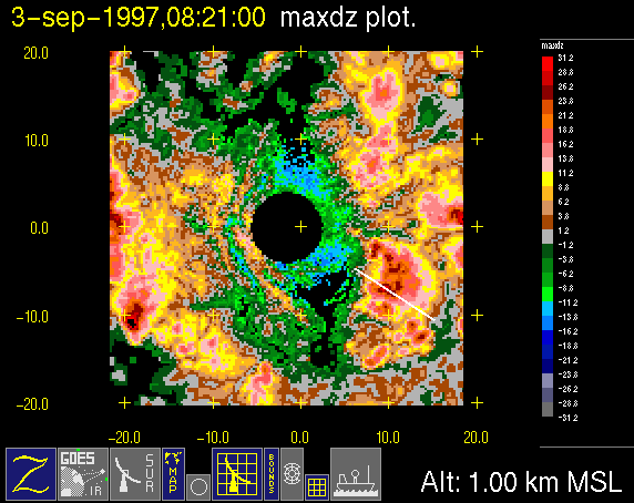
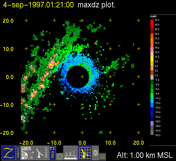
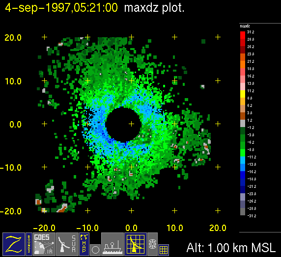
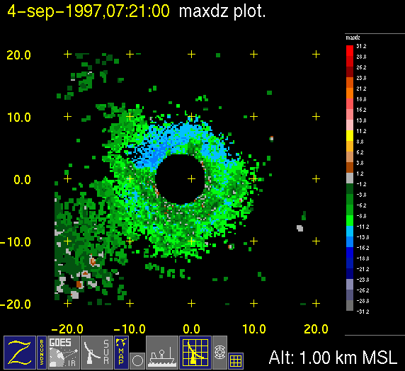
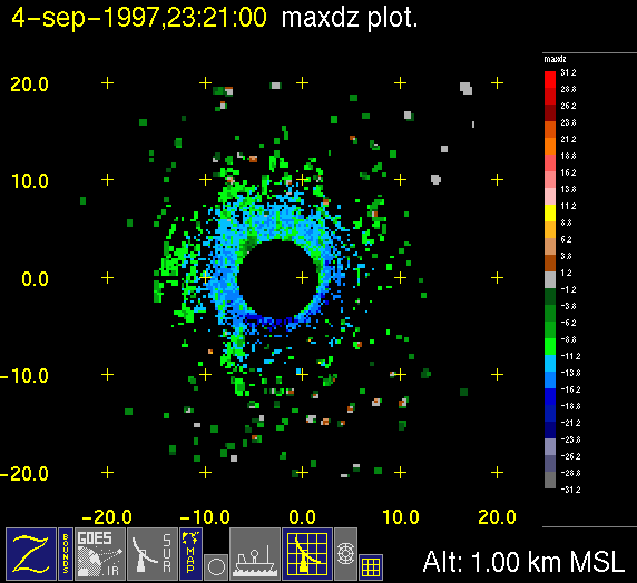
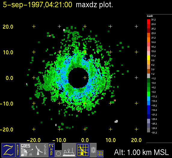
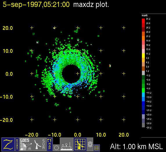
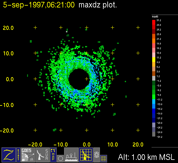
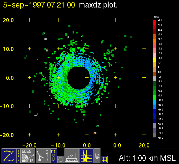
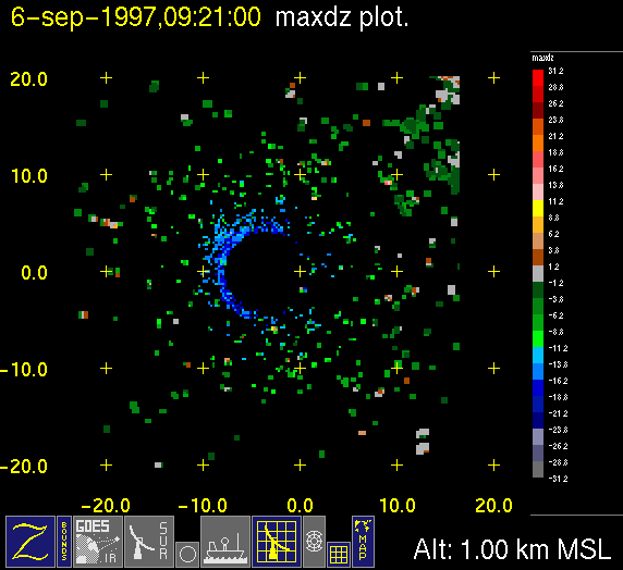
Within the marine stratus region, the radar volume scans were modified from those
used in the ITCZ to obtain high resolution measurements withis a low
cloud deck from 1-2 km in altitude. Surveillance scans were made at 0
and 30 min after the hour and volume scans were made four times per hour.
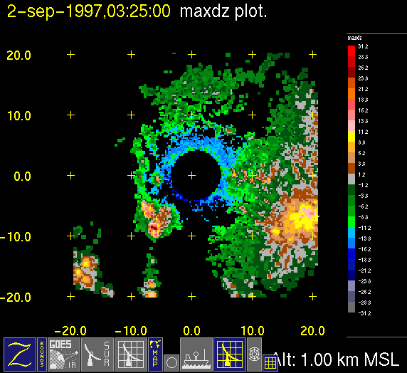
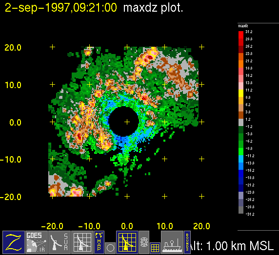
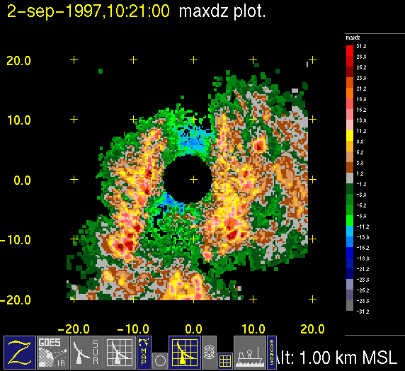
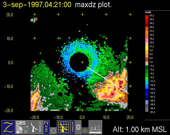
-Large scale context (top left) contains IR data when available and
radar reflectivity data color-coded in 10 dB increments.
-Close up of radar data (bottom left) contains low level horizontal
cross-section of radar reflectivity color-coded in X dB
increments. Red line with small ship on end indicates ship
track. White line indicates where vertical cross-section is taken.
-Vertical cross-section of reflectivity (top right) showing vertical
structure of radar echo.
-Vertical cross-section of radial velocity (bottom right) showing
vertical structure of radial wind pattern within radar echo.
INSTRUCTIONS FOR USE:
1.To access ANIMATED LOOPS of reduced-size radar images for a particular day, click on the date and a separate window will be opened and begin loading the loop. *Note that each day may take up to ten minutes to load (dependent on workstation).
2.To access full-size INDIVIDUAL HOURLY IMAGES for a particular date; follow the link to a CALENDAR of stratocumulus days.
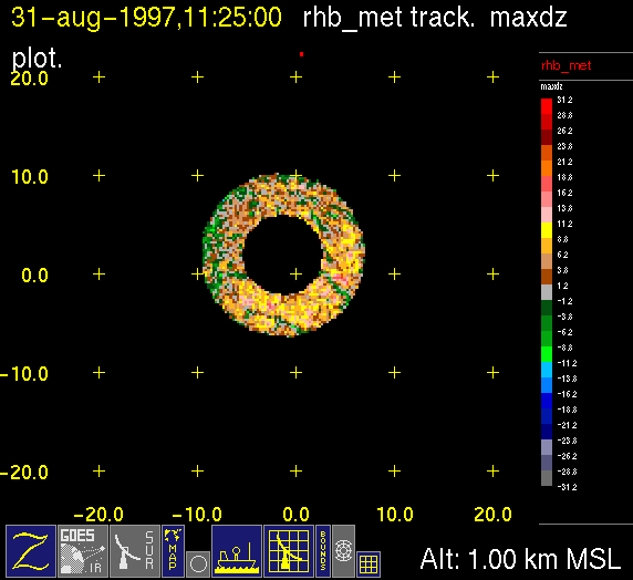
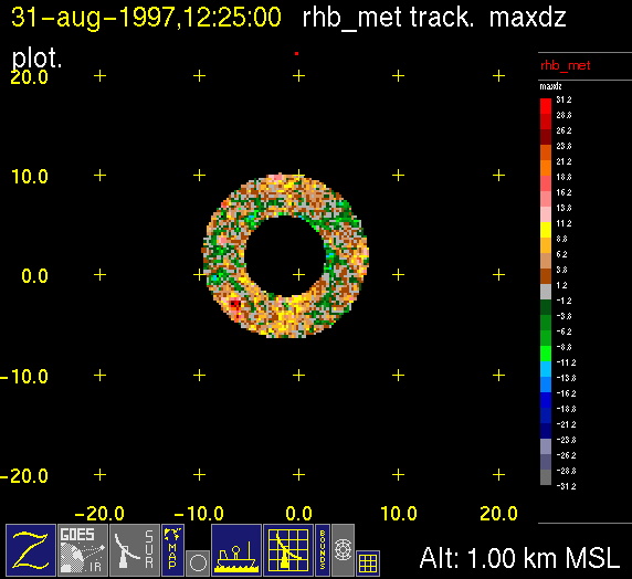
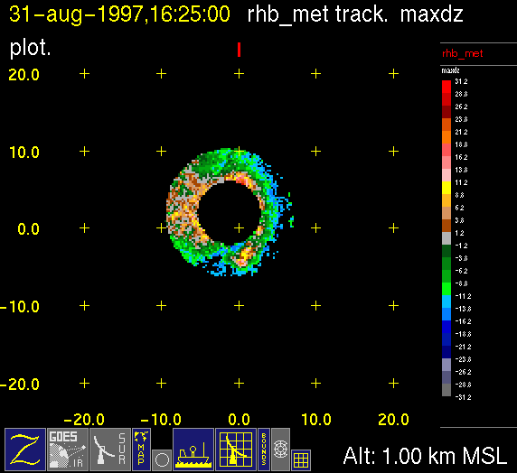
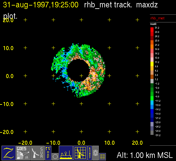
| , August 31, 1997 | |||
|
|
|
|
| 1125 UTC | 1225 UTC | 1625 UTC | 1925 UTC |
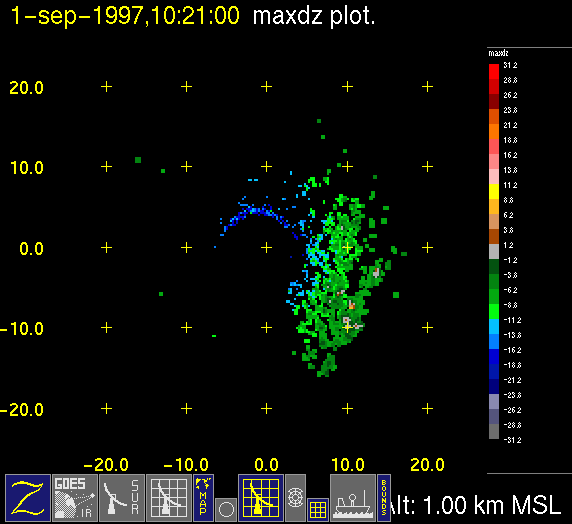
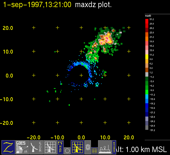
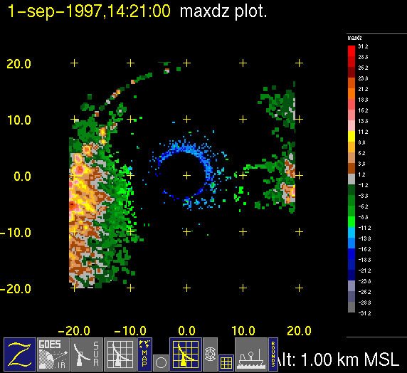
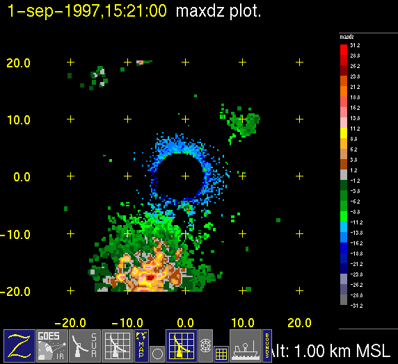
| , September 1, 1997 | |||
|
|
|
|
| 1020 UTC | 1320 UTC | 1420 UTC | 1520 UTC |
| , September 2, 1997 | |||
|
|
|
|
| 0220 UTC | 0320 UTC | 0920 UTC | 1020 UTC |
| , September 3, 1997 | |||
|
|
|
|
| 0420 UTC | 0520 UTC | 0720 UTC | 0820 UTC |
| , September 4, 1997 | |||
|
|
|
|
| 0120 UTC | 0520 UTC | 0720 UTC | 2320 UTC |
| , September 5, 1997 | |||
|
|
|
|
| 0420 UTC | 0520 UTC | 0620 UTC | 0720 UTC |
| , September 6, 1997 | |||
|
|||
| 0920 UTC | NO DATA | ||
