The model availabilty varies with each model. The ETA is the earliest followed by the AVN. The CMC and NOGAPS are the latest. ALSO, MRF is no longer available and the NGM is not being used any more.
Initialization plots and statistics for model run initialized at:
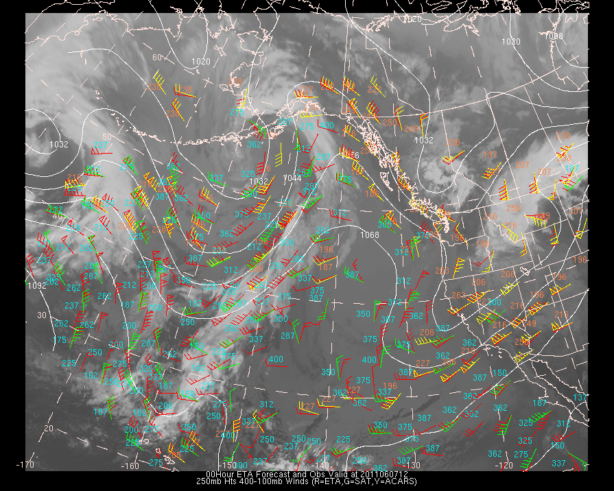
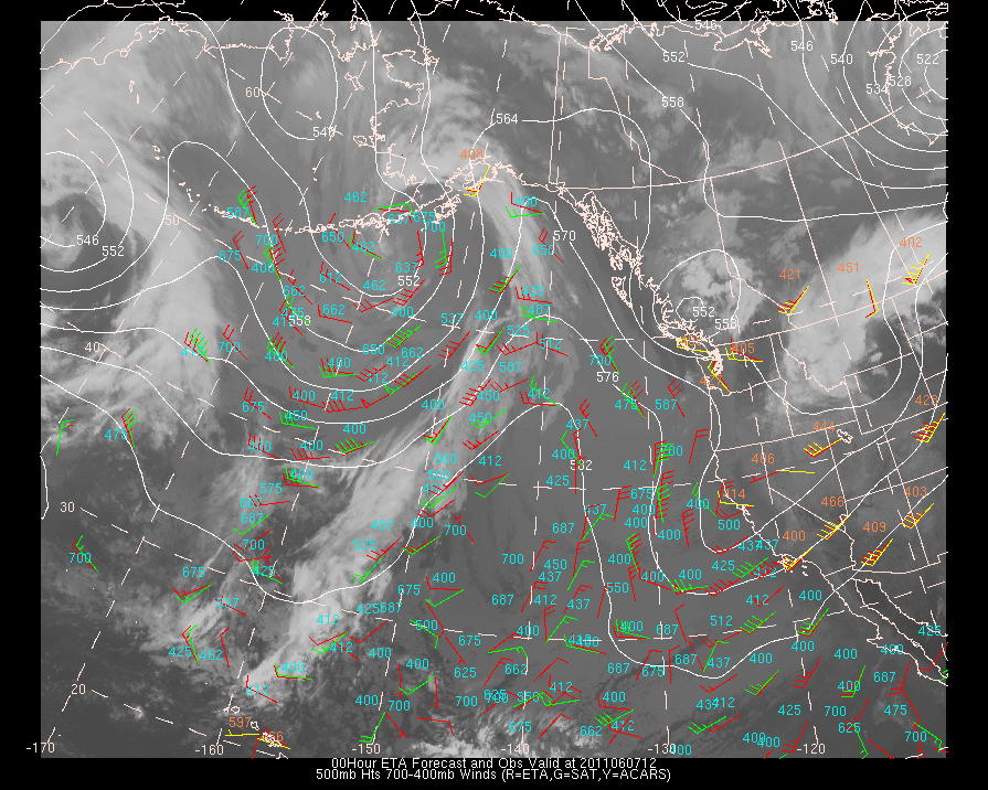
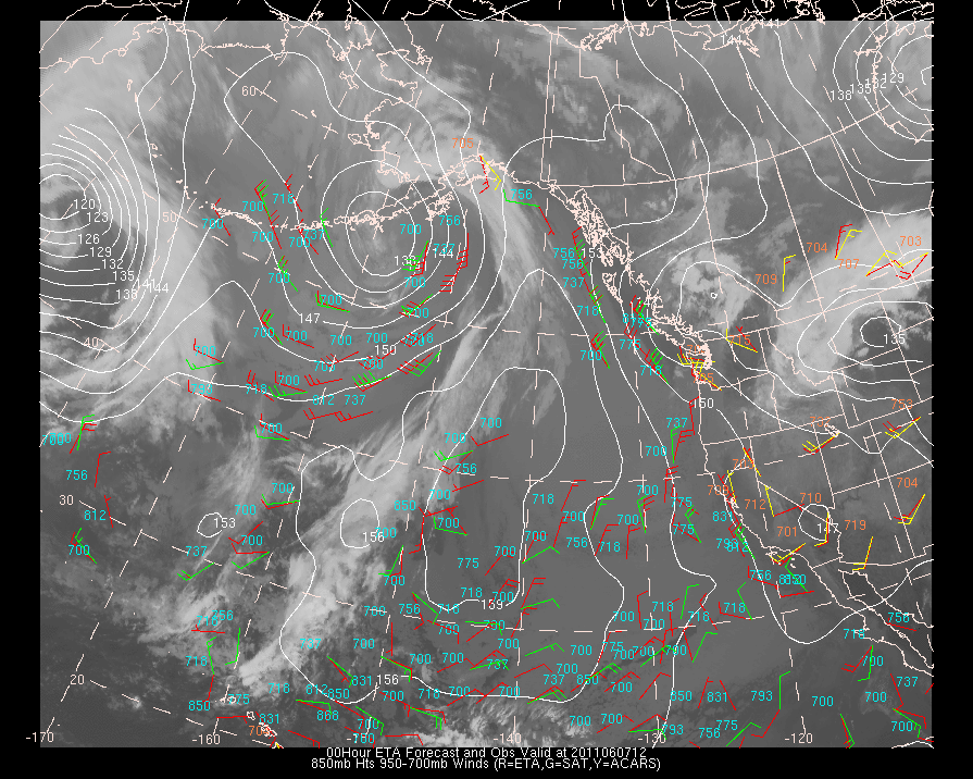
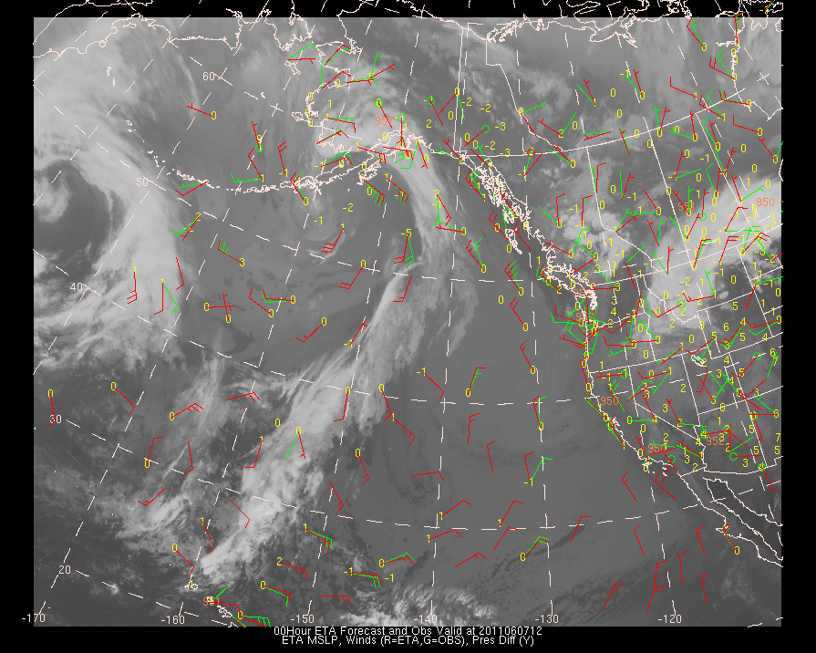
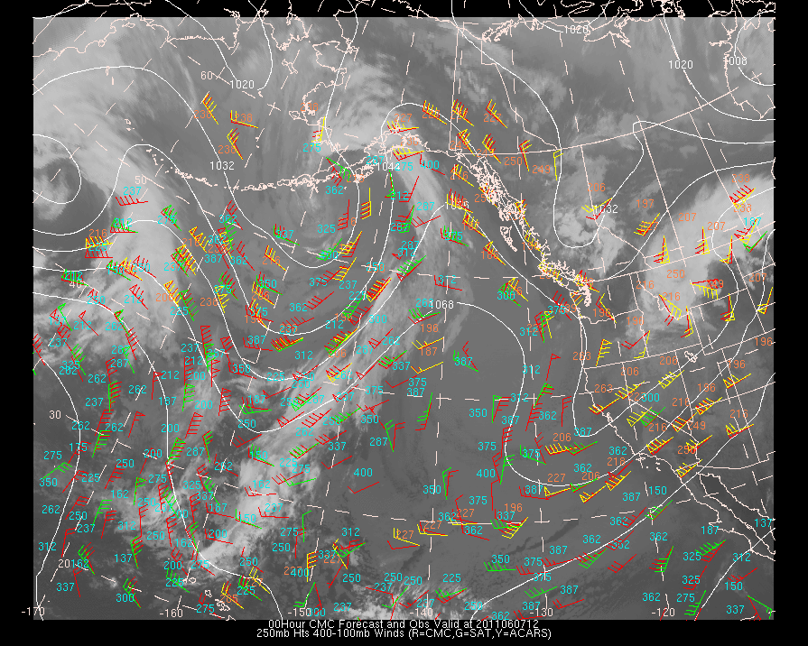
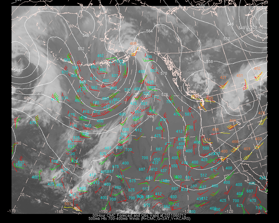
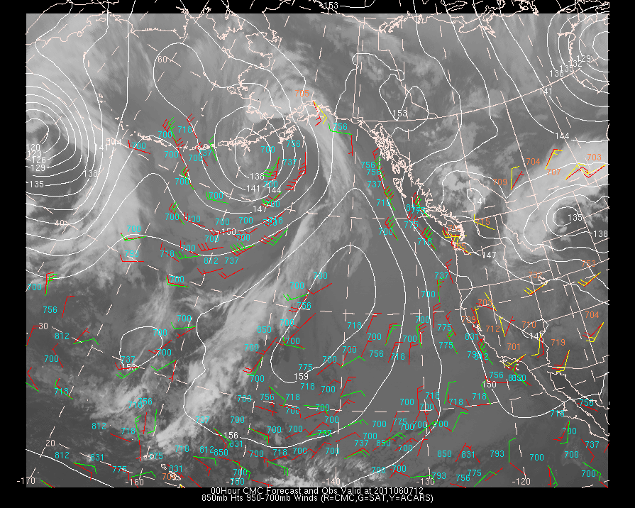
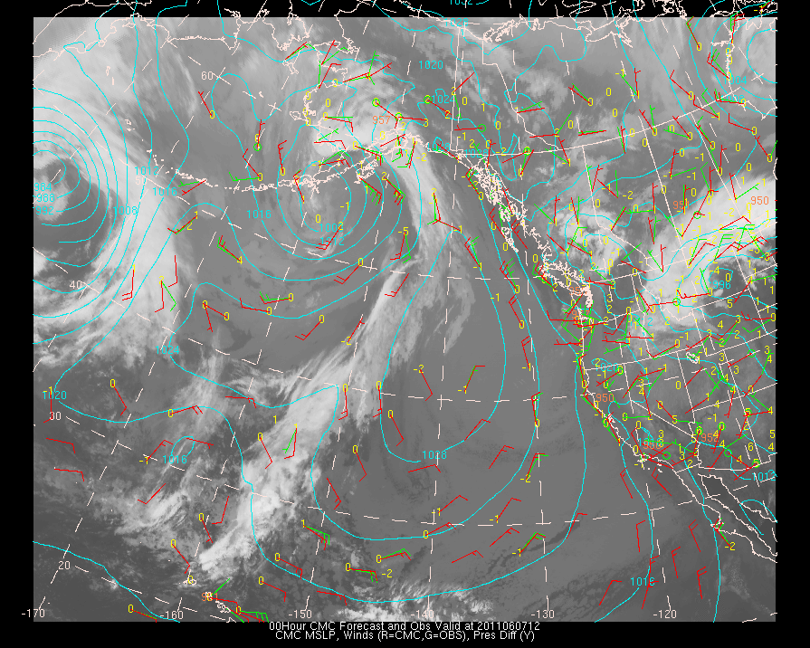
2011060712| MODEL | Upper Level Plots (centered at 250 mb) | Mid-level Plots (centered at 500mb) | Low-Level Plots (centered at 850mb) | Surface Plots |
| ETA | ETA | ETA | ETA | ETA |
| AVN | AVN | AVN | AVN | AVN |
| NOGAPS | NOGAPS | NOGAPS | NOGAPS | NOGAPS |
| CMC | CMC | CMC | CMC | CMC |
Comparisons Between Model and Observations for Specific Observation Platforms for this Model Initialization
Cloud Track/Water Vapor Wind Data ACARS Data Ship/Buoy Data Upper Air (Radiosonde) Data Precipitable Water (GOES)
The scatterometer data from ERS-2 is no longer available. The instrument is no longer functioning
Previous Model Run Initialization Plots (model initialized at):
2011060700Forecast
verification plots and statistics for 6, 12, 24, 36 and 48 hour forecasts:
06-hour Forecast
Verification Plots and Statistics for model initialized at:
Click this
link to see the initialization and forecast verification domains.
About the data used in the verification:
Cloud Track/Water Vapor Satellite
Derived Winds:
These
data are produced at the Cooperative
Institute for Meteorological Satellite Studies (CIMSS)
at the University of Wisconsin-Madison. These winds are calculated by tracking
the motion of finite cloud elements over a short period of time. Please
see their web page for further details about this data set.
Aircraft Communications,
Addressing, and Reporting System (ACARS):
This data set is provided
by the Forecast Systems
Laboratory in Boulder, CO. Several airlines
have equipped their aircraft with meteorological instruments that are capable
of measuring windspeed and direction, and temperature. Some also provide
dew point temperature.
Surface, Ship, and Buoy Observations:
These
data are those which are received from the National
Centers for Environmental Prediction (NCEP) .
Radiosonde Data:
These data, like the
surface data above are also received from the National
Centers for Environmental Prediction (NCEP) .
Precipitable Water (derived
via satellite):
This
data set is also a product received from the Cooperative
Institute for Meteorological Satellite Studies (CIMSS)
group at the University of Wisconsin-Madison.
Scatterometer Winds (derived
via satellite):
This
data set is a product received from the Ocean
Physical Processes Team at NESDIS/NOAA
in Camp Springs, Maryland. The satellite is the ERS-2 satellite maintained
by the European Space Agency
and
the algorithm used to produce the winds is CMOD4.
About the graphics/plotting package:
National Weather Service Forecast Office, Billings, MT
These files are updated as the verification data are received. Please let the author know if a problem arises in product availability by clicking on the link below.
If you have comments or suggestions, email me at mcmurdie@atmos.washington.edu
This page created with Netscape Navigator Gold.